Weitramsdorf elevation
Weitramsdorf (Bavaria, Upper Franconia), Germany elevation is 304 meters and Weitramsdorf elevation in feet is 997 ft above sea level [src 1]. Weitramsdorf is a seat of a fourth-order administrative division (feature code) with elevation that is 46 meters (151 ft) bigger than average city elevation in Germany.
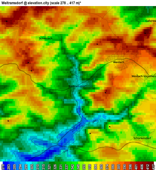
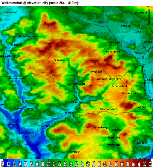
Below is the Elevation map of Weitramsdorf, which displays elevation range with different colors. Scale of the first map is from 278 to 417 m (912 to 1368 ft) with average elevation of 353.1 meters (=1158 ft) [note 1]
These maps also provides idea of topography and contour of this city, they are displayed at different zoom levels. More info about maps, scale and edge coordinates you can find below images.
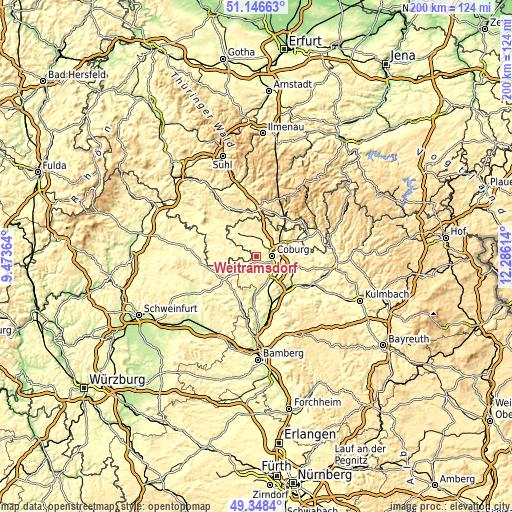
| \ | Map #1 | Map #2 | Topo.Map |
| Scale [m] | 278..417 m | 264..419 m | × |
| Scale [ft] | 912..1368 ft | 866..1375 ft | × |
| Average | 353.1 m = 1158 ft | 332.6 m = 1091 ft | × |
| Width | 6.25 km = 3.9 mi | 12.5 km = 7.8 mi | 199.9 km = 124.2 mi |
| Height | 6.25 km = 3.9 mi | 12.5 km = 7.8 mi | 199.9 km = 124.2 mi |
| ↑Max Latitude | 50.284089° | 50.31216° | 51.14663° |
| Latitude at center | 50.256° | 50.256° | 50.256° |
| ↓Min Latitude | 50.227895° | 50.199773° | 49.3484° |
| ← Min Longitude | 10.835945° | 10.791999° | 9.47364° |
| Longitude center | 10.87989° | 10.87989° | 10.87989° |
| →Max Longitude | 10.923835° | 10.967781° | 12.28614° |
Nearby cities:
Cities around Weitramsdorf sort by population:
• Coburg elevation 304 m
6 km,  86°
86°
• Rödental 340 m
12.3 km,  69°
69°
• Ahorn 336 m
5.7 km,  111°
111°
• Untersiemau 302 m
9.6 km,  135°
135°
• Lautertal 433 m
10.6 km,  35°
35°
• Meeder 326 m
7.5 km,  14°
14°
• Seßlach 279 m
7.9 km,  200°
200°
• Großheirath 284 m
10.2 km,  150°
150°
• Untermerzbach 266 m
14.4 km,  186°
186°
• Niederfüllbach 288 m
8.8 km,  116°
116°
• Pfarrweisach 299 m
15.7 km,  221°
221°
• Hellingen 300 m
14 km,  267°
267°
Multilingual:
 En español:
Weitramsdorf elevación 304 m.
 En France:
Weitramsdorf élévation 304 m.
 Auf Deutsch:
Weitramsdorf höhe über dem Meeresspiegel ist 304 m.

Sources and notes:
- [note 1] Map square and city borders are not equal. Map elevation data is calculated only from area inside that square.
- [src 1] Elevation data from geonames database provided with same terms of usage.
- [src 2] The elevation map of Weitramsdorf is generated using elevation data from NASA's 3 arcsec (90m) resolution SRTM data.
- [src 3] Base (background) map © OpenStreetMap contributors tiles are generated by Geofabrik and OpenTopoMap.
Copyright & License:
This Weitramsdorf Elevation Map is licensed under CC BY-SA. You may reuse any part from this page, if you give a proper credit by linking to this URL:
 More info on terms of use page.