Viernheim elevation
Viernheim (Hesse, Regierungsbezirk Darmstadt), Germany elevation is 103 meters and Viernheim elevation in feet is 338 ft above sea level [src 1]. Viernheim is a populated place (feature code) with elevation that is 155 meters (509 ft) smaller than average city elevation in Germany.
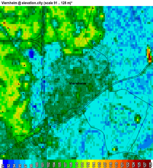
Below is the Elevation map of Viernheim, which displays elevation range with different colors. Scale of the first map is from 91 to 128 m (299 to 420 ft) with average elevation of 101.1 meters (=332 ft) [note 1]
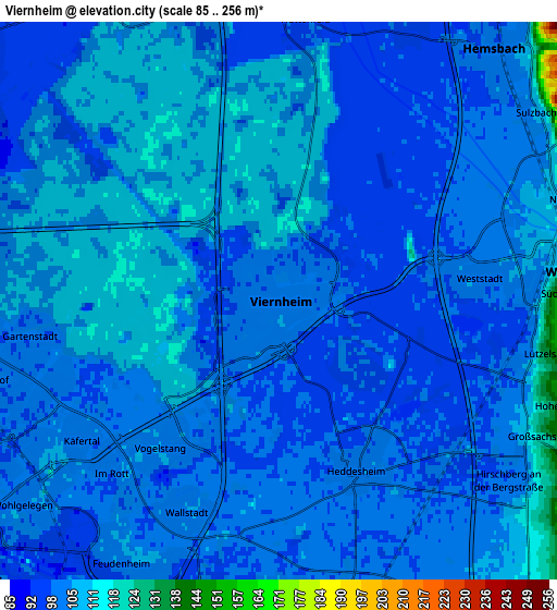
These maps also provides idea of topography and contour of this city, they are displayed at different zoom levels. More info about maps, scale and edge coordinates you can find below images.
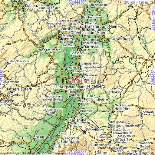
| \ | Map #1 | Map #2 | Topo.Map |
| Scale [m] | 91..128 m | 85..256 m | × |
| Scale [ft] | 299..420 ft | 279..840 ft | × |
| Average | 101.1 m = 332 ft | 102.2 m = 335 ft | × |
| Width | 6.34 km = 3.9 mi | 12.68 km = 7.9 mi | 202.9 km = 126.1 mi |
| Height | 6.34 km = 3.9 mi | 12.68 km = 7.9 mi | 202.9 km = 126.1 mi |
| ↑Max Latitude | 49.568838° | 49.59733° | 50.44436° |
| Latitude at center | 49.54033° | 49.54033° | 49.54033° |
| ↓Min Latitude | 49.511805° | 49.483263° | 48.61926° |
| ← Min Longitude | 8.534255° | 8.490309° | 7.17195° |
| Longitude center | 8.5782° | 8.5782° | 8.5782° |
| →Max Longitude | 8.622145° | 8.666091° | 9.98445° |
Nearby cities:
Cities around Viernheim sort by population:
• Mannheim elevation 100 m
9.8 km,  234°
234°
• Weinheim 118 m
6.5 km,  81°
81°
• Lampertheim 97 m
10 km,  310°
310°
• Schriesheim 118 m
9.6 km,  140°
140°
• Edingen-Neckarhausen 105 m
9.5 km,  167°
167°
• Hemsbach 101 m
7.5 km,  41°
41°
• Heddesheim 102 m
4.3 km,  154°
154°
• Ladenburg 107 m
7.8 km,  163°
163°
• Birkenau 150 m
9.6 km, 75°
• Hirschberg an der Bergstraße 105 m
6.8 km,  123°
123°
• Ilvesheim 100 m
7.4 km,  186°
186°
• Laudenbach 121 m
9.8 km,  33°
33°
Multilingual:
 En español:
Viernheim elevación 103 m.
 En France:
Viernheim élévation 103 m.
 Auf Deutsch:
Viernheim höhe über dem Meeresspiegel ist 103 m.

Sources and notes:
- [note 1] Map square and city borders are not equal. Map elevation data is calculated only from area inside that square.
- [src 1] Elevation data from geonames database provided with same terms of usage.
- [src 2] The elevation map of Viernheim is generated using elevation data from NASA's 3 arcsec (90m) resolution SRTM data.
- [src 3] Base (background) map © OpenStreetMap contributors tiles are generated by Geofabrik and OpenTopoMap.
Copyright & License:
This Viernheim Elevation Map is licensed under CC BY-SA. You may reuse any part from this page, if you give a proper credit by linking to this URL:
 More info on terms of use page.