Wahlstedt elevation
Wahlstedt (Schleswig-Holstein), Germany elevation is 43 meters and Wahlstedt elevation in feet is 141 ft above sea level [src 1]. Wahlstedt is a populated place (feature code) with elevation that is 215 meters (705 ft) smaller than average city elevation in Germany.
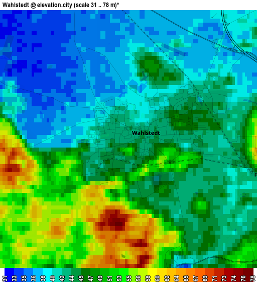
Below is the Elevation map of Wahlstedt, which displays elevation range with different colors. Scale of the first map is from 31 to 78 m (102 to 256 ft) with average elevation of 45.1 meters (=148 ft) [note 1]
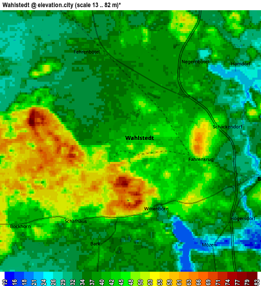
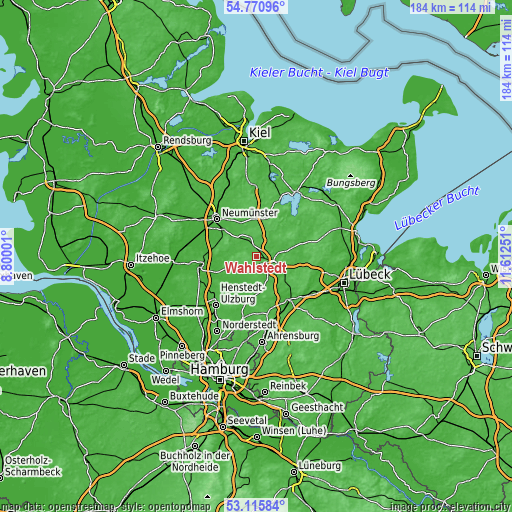
These maps also provides idea of topography and contour of this city, they are displayed at different zoom levels. More info about maps, scale and edge coordinates you can find below images.
| \ | Map #1 | Map #2 | Topo.Map |
| Scale [m] | 31..78 m | 13..82 m | × |
| Scale [ft] | 102..256 ft | 43..269 ft | × |
| Average | 45.1 m = 148 ft | 40.5 m = 133 ft | × |
| Width | 5.75 km = 3.6 mi | 11.5 km = 7.1 mi | 184 km = 114.3 mi |
| Height | 5.75 km = 3.6 mi | 11.5 km = 7.1 mi | 184 km = 114.3 mi |
| ↑Max Latitude | 53.977462° | 54.003299° | 54.77096° |
| Latitude at center | 53.95161° | 53.95161° | 53.95161° |
| ↓Min Latitude | 53.925742° | 53.899857° | 53.11584° |
| ← Min Longitude | 10.162315° | 10.118369° | 8.80001° |
| Longitude center | 10.20626° | 10.20626° | 10.20626° |
| →Max Longitude | 10.250205° | 10.294151° | 11.61251° |
Nearby cities:
Cities around Wahlstedt sort by population:
• Bad Segeberg elevation 40 m
6.3 km,  98°
98°
• Trappenkamp 50 m
9.8 km,  3°
3°
• Bornhöved 42 m
12.9 km,  7°
7°
• Rickling 39 m
7.7 km,  340°
340°
• Seth 32 m
11.8 km,  190°
190°
• Hartenholm 28 m
11.3 km,  238°
238°
• Fahrenkrug 60 m
2.9 km,  93°
93°
• Leezen 29 m
9.9 km,  163°
163°
• Klein Rönnau 24 m
7.4 km,  76°
76°
• Todesfelde 36 m
5.9 km, 194°
• Negernbötel 34 m
4.5 km,  39°
39°
• Bark 37 m
4.8 km,  201°
201°
Multilingual:
 En español:
Wahlstedt elevación 43 m.
 En France:
Wahlstedt élévation 43 m.
 Auf Deutsch:
Wahlstedt höhe über dem Meeresspiegel ist 43 m.

Sources and notes:
- [note 1] Map square and city borders are not equal. Map elevation data is calculated only from area inside that square.
- [src 1] Elevation data from geonames database provided with same terms of usage.
- [src 2] The elevation map of Wahlstedt is generated using elevation data from NASA's 3 arcsec (90m) resolution SRTM data.
- [src 3] Base (background) map © OpenStreetMap contributors tiles are generated by Geofabrik and OpenTopoMap.
Copyright & License:
This Wahlstedt Elevation Map is licensed under CC BY-SA. You may reuse any part from this page, if you give a proper credit by linking to this URL:
 More info on terms of use page.