Bornhöved elevation
Bornhöved (Schleswig-Holstein), Germany elevation is 42 meters and Bornhöved elevation in feet is 138 ft above sea level [src 1]. Bornhöved is a seat of a fourth-order administrative division (feature code) with elevation that is 216 meters (709 ft) smaller than average city elevation in Germany.
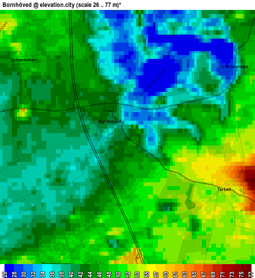
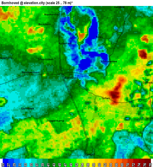
Below is the Elevation map of Bornhöved, which displays elevation range with different colors. Scale of the first map is from 26 to 77 m (85 to 253 ft) with average elevation of 43.3 meters (=142 ft) [note 1]
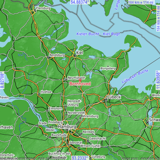
These maps also provides idea of topography and contour of this city, they are displayed at different zoom levels. More info about maps, scale and edge coordinates you can find below images.
| \ | Map #1 | Map #2 | Topo.Map |
| Scale [m] | 26..77 m | 25..78 m | × |
| Scale [ft] | 85..253 ft | 82..256 ft | × |
| Average | 43.3 m = 142 ft | 45.3 m = 149 ft | × |
| Width | 5.73 km = 3.6 mi | 11.47 km = 7.1 mi | 183.5 km = 114 mi |
| Height | 5.73 km = 3.6 mi | 11.47 km = 7.1 mi | 183.5 km = 114 mi |
| ↑Max Latitude | 54.092451° | 54.118216° | 54.88374° |
| Latitude at center | 54.06667° | 54.06667° | 54.06667° |
| ↓Min Latitude | 54.040873° | 54.01506° | 53.2332° |
| ← Min Longitude | 10.189385° | 10.145439° | 8.82708° |
| Longitude center | 10.23333° | 10.23333° | 10.23333° |
| →Max Longitude | 10.277275° | 10.321221° | 11.63958° |
Nearby cities:
Cities around Bornhöved sort by population:
• Trappenkamp elevation 50 m
3.2 km,  201°
201°
• Rickling 39 m
7.1 km,  218°
218°
• Ascheberg 40 m
11.8 km,  38°
38°
• Wankendorf 46 m
5.4 km,  340°
340°
• Seedorf 34 m
12.1 km,  98°
98°
• Busdorf 31 m
10.7 km,  292°
292°
• Bönebüttel 26 m
11 km,  279°
279°
• Groß Kummerfeld 28 m
10 km,  259°
259°
• Klein Rönnau 24 m
12.4 km,  153°
153°
• Stolpe 53 m
7.5 km,  351°
351°
• Ruhwinkel 36 m
3.9 km, 343°
• Negernbötel 34 m
9.3 km,  173°
173°
Multilingual:
 En español:
Bornhöved elevación 42 m.
 En France:
Bornhöved élévation 42 m.
 Auf Deutsch:
Bornhöved höhe über dem Meeresspiegel ist 42 m.

Sources and notes:
- [note 1] Map square and city borders are not equal. Map elevation data is calculated only from area inside that square.
- [src 1] Elevation data from geonames database provided with same terms of usage.
- [src 2] The elevation map of Bornhöved is generated using elevation data from NASA's 3 arcsec (90m) resolution SRTM data.
- [src 3] Base (background) map © OpenStreetMap contributors tiles are generated by Geofabrik and OpenTopoMap.
Copyright & License:
This Bornhöved Elevation Map is licensed under CC BY-SA. You may reuse any part from this page, if you give a proper credit by linking to this URL:
 More info on terms of use page.