Wallmerod elevation
Wallmerod (Rheinland-Pfalz), Germany elevation is 318 meters and Wallmerod elevation in feet is 1043 ft above sea level [src 1]. Wallmerod is a seat of a fourth-order administrative division (feature code) with elevation that is 60 meters (197 ft) bigger than average city elevation in Germany.
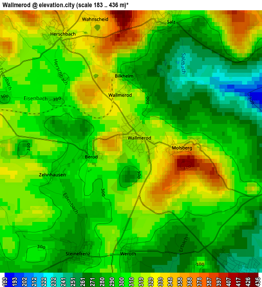
Below is the Elevation map of Wallmerod, which displays elevation range with different colors. Scale of the first map is from 183 to 436 m (600 to 1430 ft) with average elevation of 304 meters (=997 ft) [note 1]
These maps also provides idea of topography and contour of this city, they are displayed at different zoom levels. More info about maps, scale and edge coordinates you can find below images.
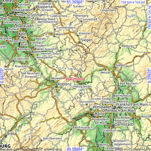
| \ | Map #1 | Topo.Map |
| Scale [m] | 183..436 m | × |
| Scale [ft] | 600..1430 ft | × |
| Average | 304 m = 997 ft | × |
| Width | 6.22 km = 3.9 mi | 199 km = 123.7 mi |
| Height | 6.22 km = 3.9 mi | 199 km = 123.7 mi |
| ↑Max Latitude | 50.511284° | 51.36968° |
| Latitude at center | 50.48333° | 50.48333° |
| ↓Min Latitude | 50.455359° | 49.58004° |
| ← Min Longitude | 7.906055° | 6.54375° |
| Longitude center | 7.95° | 7.95° |
| →Max Longitude | 7.993945° | 9.35625° |
Nearby cities:
Cities around Wallmerod sort by population:
• Hadamar elevation 134 m
7.8 km,  122°
122°
• Hundsangen 263 m
4.4 km,  147°
147°
• Nentershausen 295 m
7.5 km,  189°
189°
• Meudt 346 m
4.3 km,  293°
293°
• Heiligenroth 225 m
7 km,  237°
237°
• Ötzingen 323 m
8.5 km,  282°
282°
• Girod 256 m
4.4 km,  212°
212°
• Ruppach-Goldhausen 301 m
5.1 km,  248°
248°
• Kölbingen 377 m
7.5 km,  350°
350°
• Dreikirchen 254 m
5.6 km,  180°
180°
• Niedererbach 170 m
6.6 km,  164°
164°
• Großholbach 313 m
6 km,  231°
231°
Multilingual:
 En español:
Wallmerod elevación 318 m.
 En France:
Wallmerod élévation 318 m.
 Auf Deutsch:
Wallmerod höhe über dem Meeresspiegel ist 318 m.

Sources and notes:
- [note 1] Map square and city borders are not equal. Map elevation data is calculated only from area inside that square.
- [src 1] Elevation data from geonames database provided with same terms of usage.
- [src 2] The elevation map of Wallmerod is generated using elevation data from NASA's 3 arcsec (90m) resolution SRTM data.
- [src 3] Base (background) map © OpenStreetMap contributors tiles are generated by Geofabrik and OpenTopoMap.
Copyright & License:
This Wallmerod Elevation Map is licensed under CC BY-SA. You may reuse any part from this page, if you give a proper credit by linking to this URL:
 More info on terms of use page.