Weibersbrunn elevation
Weibersbrunn (Bavaria, Regierungsbezirk Unterfranken), Germany elevation is 361 meters and Weibersbrunn elevation in feet is 1184 ft above sea level [src 1]. Weibersbrunn is a seat of a fourth-order administrative division (feature code) with elevation that is 103 meters (338 ft) bigger than average city elevation in Germany.
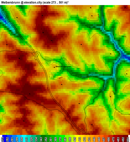
Below is the Elevation map of Weibersbrunn, which displays elevation range with different colors. Scale of the first map is from 273 to 501 m (896 to 1644 ft) with average elevation of 423.8 meters (=1390 ft) [note 1]
These maps also provides idea of topography and contour of this city, they are displayed at different zoom levels. More info about maps, scale and edge coordinates you can find below images.
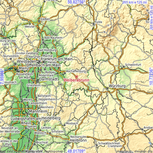
| \ | Map #1 | Topo.Map |
| Scale [m] | 273..501 m | × |
| Scale [ft] | 896..1644 ft | × |
| Average | 423.8 m = 1390 ft | × |
| Width | 6.29 km = 3.9 mi | 201.3 km = 125.1 mi |
| Height | 6.29 km = 3.9 mi | 201.3 km = 125.1 mi |
| ↑Max Latitude | 49.95911° | 50.82756° |
| Latitude at center | 49.93083° | 49.93083° |
| ↓Min Latitude | 49.902534° | 49.01709° |
| ← Min Longitude | 9.322165° | 7.95986° |
| Longitude center | 9.36611° | 9.36611° |
| →Max Longitude | 9.410055° | 10.77236° |
Nearby cities:
Cities around Weibersbrunn sort by population:
• Haibach elevation 279 m
12 km,  288°
288°
• Laufach 200 m
10.7 km,  333°
333°
• Leidersbach 188 m
10.8 km,  252°
252°
• Waldaschaff 220 m
6.7 km,  317°
317°
• Heigenbrücken 294 m
10.8 km,  1°
1°
• Mespelbrunn 278 m
5.6 km, 251°
• Heimbuchenthal 230 m
6.9 km,  227°
227°
• Rothenbuch 385 m
4.3 km,  27°
27°
• Bischbrunn 405 m
11.1 km,  127°
127°
• Altenbuch 254 m
11.6 km,  167°
167°
• Neuhütten 335 m
8.5 km, 25°
• Rechtenbach 345 m
11.7 km,  60°
60°
Multilingual:
 En español:
Weibersbrunn elevación 361 m.
 En France:
Weibersbrunn élévation 361 m.
 Auf Deutsch:
Weibersbrunn höhe über dem Meeresspiegel ist 361 m.

Sources and notes:
- [note 1] Map square and city borders are not equal. Map elevation data is calculated only from area inside that square.
- [src 1] Elevation data from geonames database provided with same terms of usage.
- [src 2] The elevation map of Weibersbrunn is generated using elevation data from NASA's 3 arcsec (90m) resolution SRTM data.
- [src 3] Base (background) map © OpenStreetMap contributors tiles are generated by Geofabrik and OpenTopoMap.
Copyright & License:
This Weibersbrunn Elevation Map is licensed under CC BY-SA. You may reuse any part from this page, if you give a proper credit by linking to this URL:
 More info on terms of use page.