Weisel elevation
Weisel (Rheinland-Pfalz), Germany elevation is 397 meters and Weisel elevation in feet is 1302 ft above sea level [src 1]. Weisel is a seat of a fourth-order administrative division (feature code) with elevation that is 139 meters (456 ft) bigger than average city elevation in Germany.
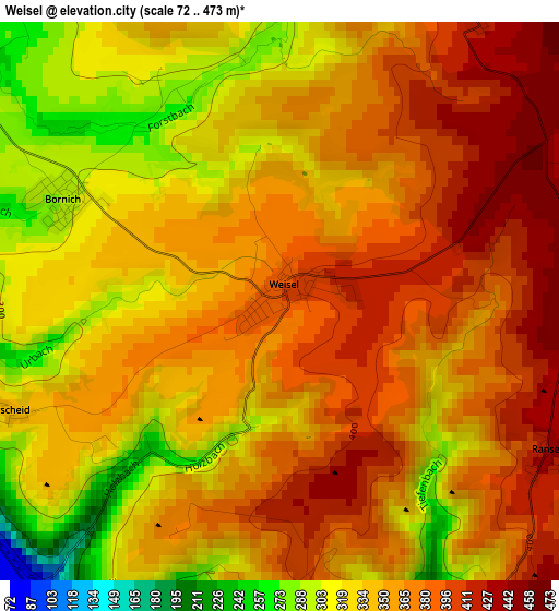
Below is the Elevation map of Weisel, which displays elevation range with different colors. Scale of the first map is from 72 to 473 m (236 to 1552 ft) with average elevation of 354.4 meters (=1163 ft) [note 1]
These maps also provides idea of topography and contour of this city, they are displayed at different zoom levels. More info about maps, scale and edge coordinates you can find below images.
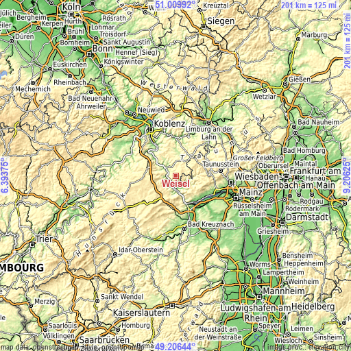
| \ | Map #1 | Topo.Map |
| Scale [m] | 72..473 m | × |
| Scale [ft] | 236..1552 ft | × |
| Average | 354.4 m = 1163 ft | × |
| Width | 6.27 km = 3.9 mi | 200.5 km = 124.6 mi |
| Height | 6.27 km = 3.9 mi | 200.5 km = 124.6 mi |
| ↑Max Latitude | 50.144841° | 51.00992° |
| Latitude at center | 50.11667° | 50.11667° |
| ↓Min Latitude | 50.088483° | 49.20644° |
| ← Min Longitude | 7.756055° | 6.39375° |
| Longitude center | 7.8° | 7.8° |
| →Max Longitude | 7.843945° | 9.20625° |
Nearby cities:
Cities around Weisel sort by population:
• Nastätten elevation 253 m
10.1 km,  24°
24°
• Rheinböllen 396 m
14.8 km,  217°
217°
• Oberwesel 90 m
5.4 km,  259°
259°
• Sankt Goar 208 m
7.5 km,  298°
298°
• Bacharach 86 m
7 km,  198°
198°
• Miehlen 216 m
12.3 km,  10°
10°
• Sankt Goarshausen 162 m
7.7 km,  307°
307°
• Holzhausen an der Haide 393 m
13.8 km,  34°
34°
• Bornich 293 m
2.7 km,  294°
294°
• Dachsenhausen 381 m
16.1 km,  341°
341°
• Trechtingshausen 126 m
12.3 km,  164°
164°
• Kaub 77 m
4.2 km, 221°
Multilingual:
 En español:
Weisel elevación 397 m.
 En France:
Weisel élévation 397 m.


Sources and notes:
- [note 1] Map square and city borders are not equal. Map elevation data is calculated only from area inside that square.
- [src 1] Elevation data from geonames database provided with same terms of usage.
- [src 2] The elevation map of Weisel is generated using elevation data from NASA's 3 arcsec (90m) resolution SRTM data.
- [src 3] Base (background) map © OpenStreetMap contributors tiles are generated by Geofabrik and OpenTopoMap.
Copyright & License:
This Weisel Elevation Map is licensed under CC BY-SA. You may reuse any part from this page, if you give a proper credit by linking to this URL:
 More info on terms of use page.