Worbis elevation
Worbis (Thuringia), Germany elevation is 324 meters and Worbis elevation in feet is 1063 ft above sea level [src 1]. Worbis is a populated place (feature code) with elevation that is 66 meters (217 ft) bigger than average city elevation in Germany.
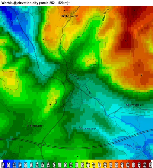
Below is the Elevation map of Worbis, which displays elevation range with different colors. Scale of the first map is from 252 to 520 m (827 to 1706 ft) with average elevation of 366.2 meters (=1201 ft) [note 1]
These maps also provides idea of topography and contour of this city, they are displayed at different zoom levels. More info about maps, scale and edge coordinates you can find below images.
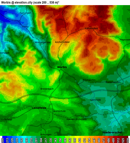
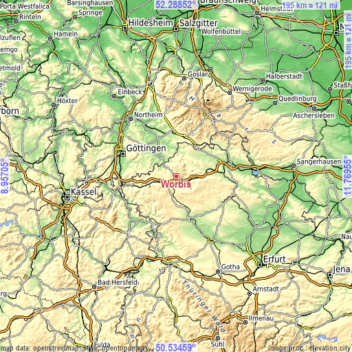
| \ | Map #1 | Map #2 | Topo.Map |
| Scale [m] | 252..520 m | 200..538 m | × |
| Scale [ft] | 827..1706 ft | 656..1765 ft | × |
| Average | 366.2 m = 1201 ft | 359.5 m = 1179 ft | × |
| Width | 6.09 km = 3.8 mi | 12.19 km = 7.6 mi | 195 km = 121.2 mi |
| Height | 6.09 km = 3.8 mi | 12.19 km = 7.6 mi | 195 km = 121.2 mi |
| ↑Max Latitude | 51.447366° | 51.474746° | 52.28852° |
| Latitude at center | 51.41997° | 51.41997° | 51.41997° |
| ↓Min Latitude | 51.392557° | 51.365128° | 50.53459° |
| ← Min Longitude | 10.319355° | 10.275409° | 8.95705° |
| Longitude center | 10.3633° | 10.3633° | 10.3633° |
| →Max Longitude | 10.407245° | 10.451191° | 11.76955° |
Nearby cities:
Cities around Worbis sort by population:
• Leinefelde-Worbis elevation 338 m
4.4 km,  215°
215°
• Niederorschel 278 m
6.8 km,  141°
141°
• Teistungen 198 m
8.5 km,  307°
307°
• Breitenworbis 299 m
4.6 km,  100°
100°
• Bischofferode 299 m
10.2 km,  33°
33°
• Gernrode 289 m
3.4 km,  131°
131°
• Großbodungen 272 m
10.2 km,  52°
52°
• Kirchworbis 315 m
2.5 km,  113°
113°
• Hundeshagen 270 m
5.7 km,  284°
284°
• Berlingerode 226 m
9.6 km,  295°
295°
• Wingerode 301 m
9.2 km,  248°
248°
• Brehme 274 m
8.3 km,  357°
357°
Multilingual:
 En español:
Worbis elevación 324 m.
 En France:
Worbis élévation 324 m.


Sources and notes:
- [note 1] Map square and city borders are not equal. Map elevation data is calculated only from area inside that square.
- [src 1] Elevation data from geonames database provided with same terms of usage.
- [src 2] The elevation map of Worbis is generated using elevation data from NASA's 3 arcsec (90m) resolution SRTM data.
- [src 3] Base (background) map © OpenStreetMap contributors tiles are generated by Geofabrik and OpenTopoMap.
Copyright & License:
This Worbis Elevation Map is licensed under CC BY-SA. You may reuse any part from this page, if you give a proper credit by linking to this URL:
 More info on terms of use page.