Zell elevation
Zell (Baden-Württemberg, Karlsruhe Region), Germany elevation is 130 meters and Zell elevation in feet is 427 ft above sea level [src 1]. Zell is a populated place (feature code) with elevation that is 128 meters (420 ft) smaller than average city elevation in Germany.
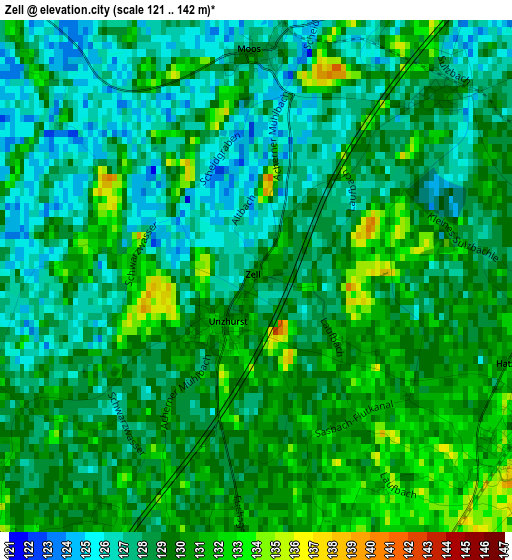
Below is the Elevation map of Zell, which displays elevation range with different colors. Scale of the first map is from 121 to 142 m (397 to 466 ft) with average elevation of 128.7 meters (=422 ft) [note 1]
These maps also provides idea of topography and contour of this city, they are displayed at different zoom levels. More info about maps, scale and edge coordinates you can find below images.
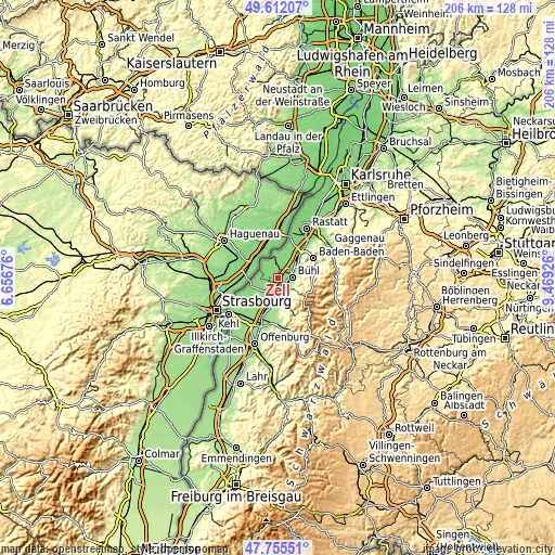
| \ | Map #1 | Map #2 | Topo.Map |
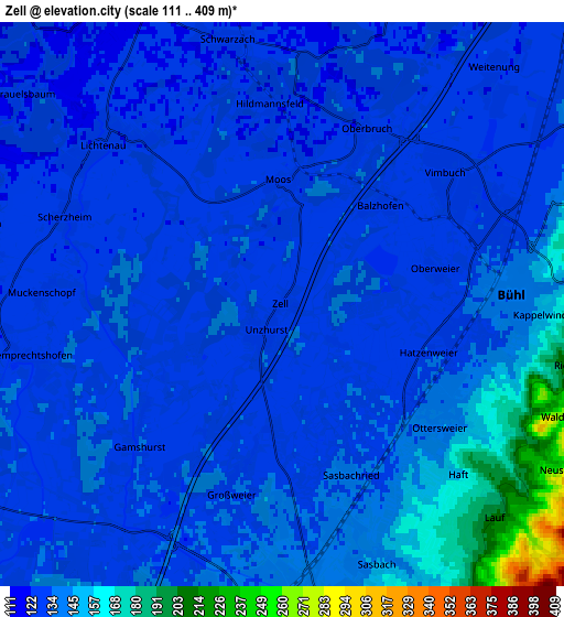
| Scale [m] | 121..142 m | 111..409 m | × |
| Scale [ft] | 397..466 ft | 364..1342 ft | × |
| Average | 128.7 m = 422 ft | 136.6 m = 448 ft | × |
| Width | 6.45 km = 4 mi | 12.9 km = 8 mi | 206.4 km = 128.3 mi |
| Height | 6.45 km = 4 mi | 12.9 km = 8 mi | 206.4 km = 128.3 mi |
| ↑Max Latitude | 48.72135° | 48.750333° | 49.61207° |
| Latitude at center | 48.69235° | 48.69235° | 48.69235° |
| ↓Min Latitude | 48.663333° | 48.6343° | 47.75551° |
| ← Min Longitude | 8.019065° | 7.975119° | 6.65676° |
| Longitude center | 8.06301° | 8.06301° | 8.06301° |
| →Max Longitude | 8.106955° | 8.150901° | 9.46926° |
Nearby cities:
Cities around Zell sort by population:
• Bühl elevation 138 m
5.3 km,  84°
84°
• Achern 145 m
6.9 km,  171°
171°
• Rheinau 131 m
9.7 km,  252°
252°
• Bühlertal 245 m
9.3 km,  94°
94°
• Ottersweier 140 m
4.4 km,  123°
123°
• Sasbach 142 m
6.3 km,  158°
158°
• Lichtenau 128 m
5.7 km,  311°
311°
• Lauf 220 m
7 km,  132°
132°
• Ottenhofen 127 m
6.9 km,  45°
45°
• Sasbachwalden 316 m
9.9 km,  148°
148°
• Greffern 125 m
7.9 km,  327°
327°
• Schwarzach 123 m
6.4 km,  342°
342°
Multilingual:
 En español:
Zell elevación 130 m.
 En France:
Zell élévation 130 m.


Sources and notes:
- [note 1] Map square and city borders are not equal. Map elevation data is calculated only from area inside that square.
- [src 1] Elevation data from geonames database provided with same terms of usage.
- [src 2] The elevation map of Zell is generated using elevation data from NASA's 3 arcsec (90m) resolution SRTM data.
- [src 3] Base (background) map © OpenStreetMap contributors tiles are generated by Geofabrik and OpenTopoMap.
Copyright & License:
This Zell Elevation Map is licensed under CC BY-SA. You may reuse any part from this page, if you give a proper credit by linking to this URL:
 More info on terms of use page.