Zittau elevation
Zittau (Saxony), Germany elevation is 253 meters and Zittau elevation in feet is 830 ft above sea level [src 1]. Zittau is a populated place (feature code) with elevation that is 5 meters (16 ft) smaller than average city elevation in Germany.
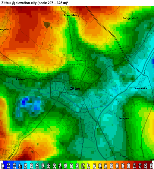
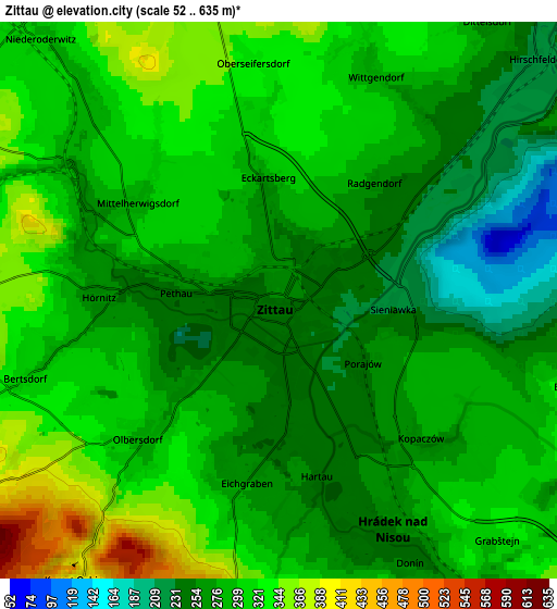
Below is the Elevation map of Zittau, which displays elevation range with different colors. Scale of the first map is from 207 to 328 m (679 to 1076 ft) with average elevation of 262.1 meters (=860 ft) [note 1]
These maps also provides idea of topography and contour of this city, they are displayed at different zoom levels. More info about maps, scale and edge coordinates you can find below images.
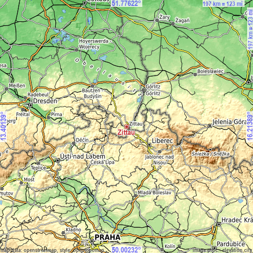
| \ | Map #1 | Map #2 | Topo.Map |
| Scale [m] | 207..328 m | 52..635 m | × |
| Scale [ft] | 679..1076 ft | 171..2083 ft | × |
| Average | 262.1 m = 860 ft | 290.2 m = 952 ft | × |
| Width | 6.16 km = 3.8 mi | 12.33 km = 7.7 mi | 197.2 km = 122.5 mi |
| Height | 6.16 km = 3.8 mi | 12.33 km = 7.7 mi | 197.2 km = 122.5 mi |
| ↑Max Latitude | 50.925428° | 50.95312° | 51.77622° |
| Latitude at center | 50.89772° | 50.89772° | 50.89772° |
| ↓Min Latitude | 50.869995° | 50.842254° | 50.00232° |
| ← Min Longitude | 14.763695° | 14.719749° | 13.40139° |
| Longitude center | 14.80764° | 14.80764° | 14.80764° |
| →Max Longitude | 14.851585° | 14.895531° | 16.21389° |
Nearby cities:
Cities around Zittau sort by population:
• Großschönau elevation 322 m
8.7 km,  271°
271°
• Olbersdorf 280 m
3.8 km,  223°
223°
• Eibau 358 m
13.9 km,  312°
312°
• Mittelherwigsdorf 296 m
3.6 km, 306°
• Leutersdorf 367 m
12.5 km,  297°
297°
• Hirschfelde 224 m
7.5 km,  46°
46°
• Bertsdorf-Hörnitz 299 m
5.1 km,  255°
255°
• Kurort Jonsdorf 429 m
8.2 km,  237°
237°
• Hainewalde 291 m
7.4 km,  280°
280°
• Kurort Oybin 415 m
7.8 km, 216°
• Großhennersdorf 307 m
9.9 km,  351°
351°
• Schlegel 284 m
10.1 km,  28°
28°
Multilingual:
 En español:
Zittau elevación 253 m.
 En France:
Zittau élévation 253 m.


Sources and notes:
- [note 1] Map square and city borders are not equal. Map elevation data is calculated only from area inside that square.
- [src 1] Elevation data from geonames database provided with same terms of usage.
- [src 2] The elevation map of Zittau is generated using elevation data from NASA's 3 arcsec (90m) resolution SRTM data.
- [src 3] Base (background) map © OpenStreetMap contributors tiles are generated by Geofabrik and OpenTopoMap.
Copyright & License:
This Zittau Elevation Map is licensed under CC BY-SA. You may reuse any part from this page, if you give a proper credit by linking to this URL:
 More info on terms of use page.