Beroun elevation
Beroun (Central Bohemia, Okres Beroun), Czech Republic elevation is 228 meters and Beroun elevation in feet is 748 ft above sea level [src 1]. Beroun is a populated place (feature code) with elevation that is 117 meters (384 ft) smaller than average city elevation in Czech Republic.
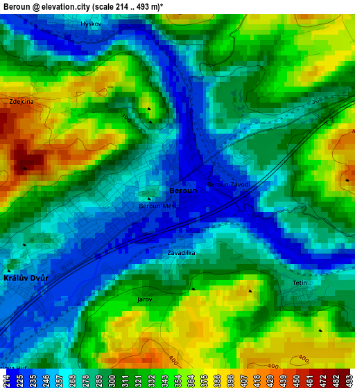
Below is the Elevation map of Beroun, which displays elevation range with different colors. Scale of the first map is from 214 to 493 m (702 to 1617 ft) with average elevation of 306.8 meters (=1007 ft) [note 1]
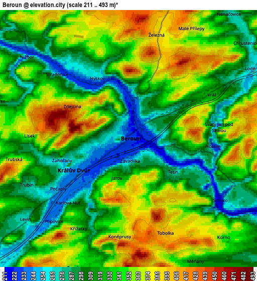
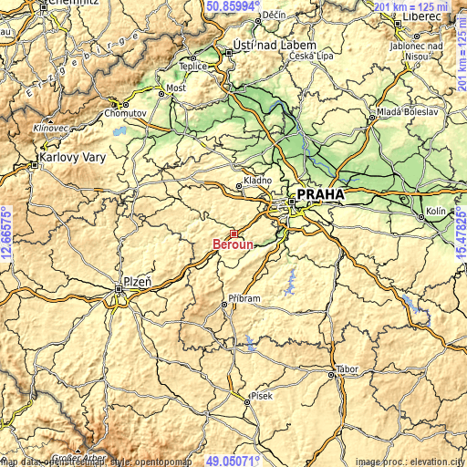
These maps also provides idea of topography and contour of this city, they are displayed at different zoom levels. More info about maps, scale and edge coordinates you can find below images.
| \ | Map #1 | Map #2 | Topo.Map |
| Scale [m] | 214..493 m | 211..493 m | × |
| Scale [ft] | 702..1617 ft | 692..1617 ft | × |
| Average | 306.8 m = 1007 ft | 333.2 m = 1093 ft | × |
| Width | 6.29 km = 3.9 mi | 12.57 km = 7.8 mi | 201.2 km = 125 mi |
| Height | 6.29 km = 3.9 mi | 12.57 km = 7.8 mi | 201.2 km = 125 mi |
| ↑Max Latitude | 49.99208° | 50.020324° | 50.85994° |
| Latitude at center | 49.96382° | 49.96382° | 49.96382° |
| ↓Min Latitude | 49.935543° | 49.907249° | 49.05071° |
| ← Min Longitude | 14.028055° | 13.984109° | 12.66575° |
| Longitude center | 14.072° | 14.072° | 14.072° |
| →Max Longitude | 14.115945° | 14.159891° | 15.47825° |
Nearby cities:
Cities around Beroun sort by population:
• Králův Dvůr elevation 245 m
3.1 km,  239°
239°
• Zdice 263 m
8.9 km,  229°
229°
• Unhošť 389 m
14.1 km,  17°
17°
• Rudná 382 m
14 km,  55°
55°
• Řevnice 221 m
13 km,  115°
115°
• Dobřichovice 205 m
15.1 km,  105°
105°
• Loděnice 260 m
7 km, 60°
• Chyňava 397 m
7.1 km,  1°
1°
• Nižbor 236 m
6.4 km,  308°
308°
• Hýskov 261 m
3.4 km,  332°
332°
• Hudlice 412 m
7.3 km,  267°
267°
• Lochovice 302 m
13.9 km,  207°
207°
Multilingual:
 En español:
Beroun elevación 228 m.
 En France:
Beroun élévation 228 m.


Sources and notes:
- [note 1] Map square and city borders are not equal. Map elevation data is calculated only from area inside that square.
- [src 1] Elevation data from geonames database provided with same terms of usage.
- [src 2] The elevation map of Beroun is generated using elevation data from NASA's 3 arcsec (90m) resolution SRTM data.
- [src 3] Base (background) map © OpenStreetMap contributors tiles are generated by Geofabrik and OpenTopoMap.
Copyright & License:
This Beroun Elevation Map is licensed under CC BY-SA. You may reuse any part from this page, if you give a proper credit by linking to this URL:
 More info on terms of use page.