Řevnice elevation
Řevnice (Central Bohemia, Okres Praha-západ), Czech Republic elevation is 221 meters and Řevnice elevation in feet is 725 ft above sea level [src 1]. Řevnice is a populated place (feature code) with elevation that is 124 meters (407 ft) smaller than average city elevation in Czech Republic.
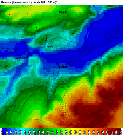
Below is the Elevation map of Řevnice, which displays elevation range with different colors. Scale of the first map is from 201 to 533 m (659 to 1749 ft) with average elevation of 323.2 meters (=1060 ft) [note 1]
These maps also provides idea of topography and contour of this city, they are displayed at different zoom levels. More info about maps, scale and edge coordinates you can find below images.
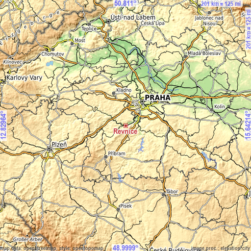
| \ | Map #1 | Topo.Map |
| Scale [m] | 201..533 m | × |
| Scale [ft] | 659..1749 ft | × |
| Average | 323.2 m = 1060 ft | × |
| Width | 6.29 km = 3.9 mi | 201.4 km = 125.1 mi |
| Height | 6.29 km = 3.9 mi | 201.4 km = 125.1 mi |
| ↑Max Latitude | 49.94224° | 50.811° |
| Latitude at center | 49.91395° | 49.91395° |
| ↓Min Latitude | 49.885644° | 48.9999° |
| ← Min Longitude | 14.191945° | 12.82964° |
| Longitude center | 14.23589° | 14.23589° |
| →Max Longitude | 14.279835° | 15.64214° |
Nearby cities:
Cities around Řevnice sort by population:
• Beroun elevation 228 m
13 km,  295°
295°
• Černošice 215 m
7.9 km,  49°
49°
• Mníšek pod Brdy 384 m
5.6 km,  160°
160°
• Rudná 382 m
13.5 km,  359°
359°
• Dobřichovice 205 m
3.2 km,  61°
61°
• Vrané nad Vltavou 232 m
10.4 km,  76°
76°
• Loděnice 260 m
10.6 km,  328°
328°
• Všenory 237 m
5.1 km,  71°
71°
• Hradištko 284 m
13.4 km,  112°
112°
• Davle 211 m
12 km,  101°
101°
• Zvole 369 m
13.2 km, 79°
• Třebotov 355 m
7.6 km,  31°
31°
Multilingual:
 En español:
Řevnice elevación 221 m.
 En France:
Řevnice élévation 221 m.


Sources and notes:
- [note 1] Map square and city borders are not equal. Map elevation data is calculated only from area inside that square.
- [src 1] Elevation data from geonames database provided with same terms of usage.
- [src 2] The elevation map of Řevnice is generated using elevation data from NASA's 3 arcsec (90m) resolution SRTM data.
- [src 3] Base (background) map © OpenStreetMap contributors tiles are generated by Geofabrik and OpenTopoMap.
Copyright & License:
This Řevnice Elevation Map is licensed under CC BY-SA. You may reuse any part from this page, if you give a proper credit by linking to this URL:
 More info on terms of use page.