Bystřice pod Hostýnem elevation
Bystřice pod Hostýnem (Zlín, Okres Kroměříž), Czech Republic elevation is 320 meters and Bystřice pod Hostýnem elevation in feet is 1050 ft above sea level [src 1]. Bystřice pod Hostýnem is a populated place (feature code) with elevation that is 25 meters (82 ft) smaller than average city elevation in Czech Republic.
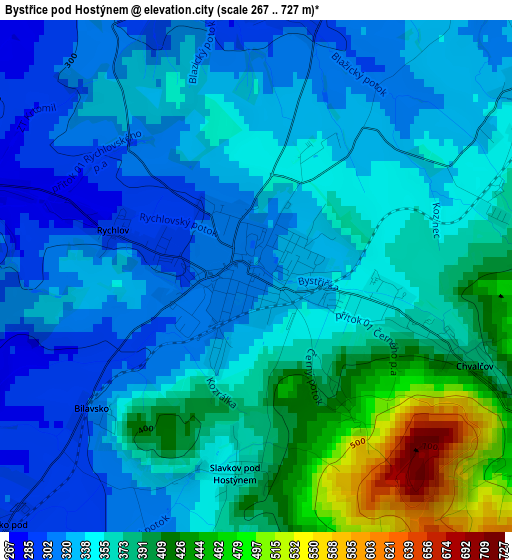
Below is the Elevation map of Bystřice pod Hostýnem, which displays elevation range with different colors. Scale of the first map is from 267 to 727 m (876 to 2385 ft) with average elevation of 356.8 meters (=1171 ft) [note 1]
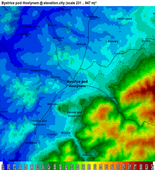
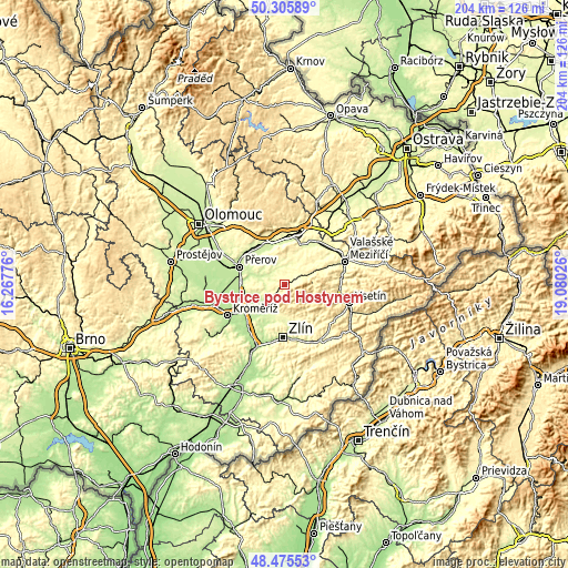
These maps also provides idea of topography and contour of this city, they are displayed at different zoom levels. More info about maps, scale and edge coordinates you can find below images.
| \ | Map #1 | Map #2 | Topo.Map |
| Scale [m] | 267..727 m | 231..847 m | × |
| Scale [ft] | 876..2385 ft | 758..2779 ft | × |
| Average | 356.8 m = 1171 ft | 376.1 m = 1234 ft | × |
| Width | 6.36 km = 4 mi | 12.72 km = 7.9 mi | 203.5 km = 126.4 mi |
| Height | 6.36 km = 4 mi | 12.72 km = 7.9 mi | 203.5 km = 126.4 mi |
| ↑Max Latitude | 49.427831° | 49.456405° | 50.30589° |
| Latitude at center | 49.39924° | 49.39924° | 49.39924° |
| ↓Min Latitude | 49.370633° | 49.342009° | 48.47553° |
| ← Min Longitude | 17.630065° | 17.586119° | 16.26776° |
| Longitude center | 17.67401° | 17.67401° | 17.67401° |
| →Max Longitude | 17.717955° | 17.761901° | 19.08026° |
Nearby cities:
Cities around Bystřice pod Hostýnem sort by population:
• Holešov elevation 231 m
10.1 km,  223°
223°
• Lipník nad Bečvou 248 m
15.6 km,  335°
335°
• Fryšták 269 m
12.7 km,  176°
176°
• Kelč 349 m
13.5 km,  49°
49°
• Hošťálková 378 m
15 km,  109°
109°
• Lukov 310 m
12.8 km,  161°
161°
• Chvalčov 378 m
2.9 km, 112°
• Horní Moštěnice 206 m
15.6 km,  275°
275°
• Dřevohostice 242 m
6.6 km,  296°
296°
• Prusinovice 264 m
6.7 km,  250°
250°
• Radslavice 224 m
14.4 km,  307°
307°
• Osek nad Bečvou 225 m
16.3 km,  319°
319°
Multilingual:
 En español:
Bystřice pod Hostýnem elevación 320 m.
 En France:
Bystřice pod Hostýnem élévation 320 m.
 Auf Deutsch:
Bystřice pod Hostýnem höhe über dem Meeresspiegel ist 320 m.
 На русском:
Bystřice pod Hostýnem высота над уровнем моря 320 м
Sources and notes:
- [note 1] Map square and city borders are not equal. Map elevation data is calculated only from area inside that square.
- [src 1] Elevation data from geonames database provided with same terms of usage.
- [src 2] The elevation map of Bystřice pod Hostýnem is generated using elevation data from NASA's 3 arcsec (90m) resolution SRTM data.
- [src 3] Base (background) map © OpenStreetMap contributors tiles are generated by Geofabrik and OpenTopoMap.
Copyright & License:
This Bystřice pod Hostýnem Elevation Map is licensed under CC BY-SA. You may reuse any part from this page, if you give a proper credit by linking to this URL:
 More info on terms of use page.