Fryšták elevation
Fryšták (Zlín, Okres Zlín), Czech Republic elevation is 269 meters and Fryšták elevation in feet is 883 ft above sea level [src 1]. Fryšták is a populated place (feature code) with elevation that is 76 meters (249 ft) smaller than average city elevation in Czech Republic.
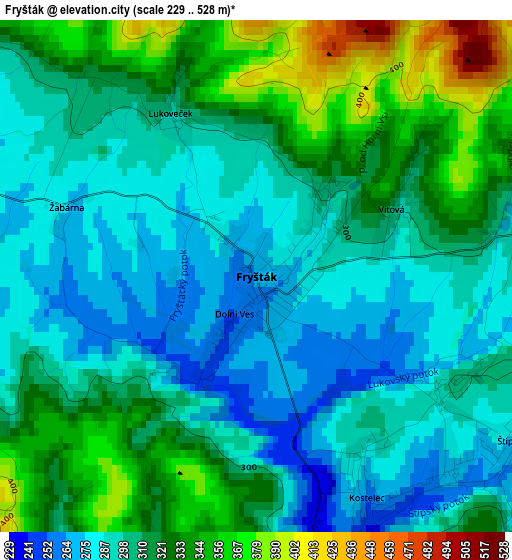
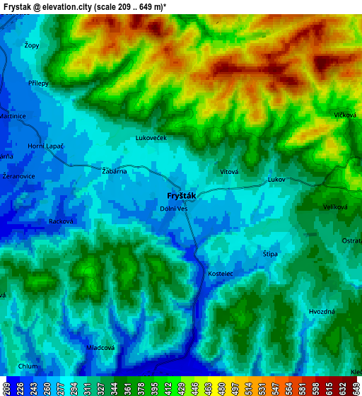
Below is the Elevation map of Fryšták, which displays elevation range with different colors. Scale of the first map is from 229 to 528 m (751 to 1732 ft) with average elevation of 309.6 meters (=1016 ft) [note 1]
These maps also provides idea of topography and contour of this city, they are displayed at different zoom levels. More info about maps, scale and edge coordinates you can find below images.
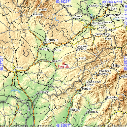
| \ | Map #1 | Map #2 | Topo.Map |
| Scale [m] | 229..528 m | 209..649 m | × |
| Scale [ft] | 751..1732 ft | 686..2129 ft | × |
| Average | 309.6 m = 1016 ft | 344.5 m = 1130 ft | × |
| Width | 6.37 km = 4 mi | 12.75 km = 7.9 mi | 204 km = 126.8 mi |
| Height | 6.37 km = 4 mi | 12.75 km = 7.9 mi | 204 km = 126.8 mi |
| ↑Max Latitude | 49.313857° | 49.342497° | 50.19397° |
| Latitude at center | 49.2852° | 49.2852° | 49.2852° |
| ↓Min Latitude | 49.256526° | 49.227836° | 48.35937° |
| ← Min Longitude | 17.639515° | 17.595569° | 16.27721° |
| Longitude center | 17.68346° | 17.68346° | 17.68346° |
| →Max Longitude | 17.727405° | 17.771351° | 19.08971° |
Nearby cities:
Cities around Fryšták sort by population:
• Zlín elevation 229 m
6.6 km,  188°
188°
• Otrokovice 196 m
13.4 km,  231°
231°
• Holešov 231 m
9.3 km,  305°
305°
• Bystřice pod Hostýnem 320 m
12.7 km,  356°
356°
• Slušovice 275 m
9.5 km,  115°
115°
• Lukov 310 m
3.4 km,  80°
80°
• Chvalčov 378 m
11.7 km,  9°
9°
• Tečovice 209 m
10 km,  224°
224°
• Prusinovice 264 m
12.5 km,  326°
326°
• Březnice 296 m
11.1 km, 187°
• Trnava 345 m
11.6 km, 84°
• Hvozdná 287 m
6.4 km,  129°
129°
Multilingual:
 En español:
Fryšták elevación 269 m.
 En France:
Fryšták élévation 269 m.


Sources and notes:
- [note 1] Map square and city borders are not equal. Map elevation data is calculated only from area inside that square.
- [src 1] Elevation data from geonames database provided with same terms of usage.
- [src 2] The elevation map of Fryšták is generated using elevation data from NASA's 3 arcsec (90m) resolution SRTM data.
- [src 3] Base (background) map © OpenStreetMap contributors tiles are generated by Geofabrik and OpenTopoMap.
Copyright & License:
This Fryšták Elevation Map is licensed under CC BY-SA. You may reuse any part from this page, if you give a proper credit by linking to this URL:
 More info on terms of use page.