Hartmanice elevation
Hartmanice (Plzeňský kraj, Okres Klatovy), Czech Republic elevation is 718 meters and Hartmanice elevation in feet is 2356 ft above sea level [src 1]. Hartmanice is a populated place (feature code) with elevation that is 373 meters (1224 ft) bigger than average city elevation in Czech Republic.
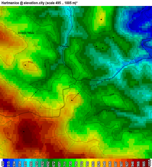
Below is the Elevation map of Hartmanice, which displays elevation range with different colors. Scale of the first map is from 495 to 1005 m (1624 to 3297 ft) with average elevation of 731.7 meters (=2401 ft) [note 1]
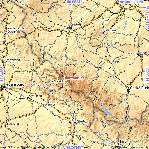
These maps also provides idea of topography and contour of this city, they are displayed at different zoom levels. More info about maps, scale and edge coordinates you can find below images.
| \ | Map #1 | Topo.Map |
| Scale [m] | 495..1005 m | × |
| Scale [ft] | 1624..3297 ft | × |
| Average | 731.7 m = 2401 ft | × |
| Width | 6.39 km = 4 mi | 204.5 km = 127.1 mi |
| Height | 6.39 km = 4 mi | 204.5 km = 127.1 mi |
| ↑Max Latitude | 49.198204° | 50.0804° |
| Latitude at center | 49.16948° | 49.16948° |
| ↓Min Latitude | 49.140739° | 48.24149° |
| ← Min Longitude | 13.410605° | 12.0483° |
| Longitude center | 13.45455° | 13.45455° |
| →Max Longitude | 13.498495° | 14.8608° |
Nearby cities:
Cities around Hartmanice sort by population:
• Sušice elevation 477 m
8.3 km,  34°
34°
• Horažďovice 433 m
24.5 km,  46°
46°
• Železná Ruda 777 m
16.3 km,  257°
257°
• Plánice 559 m
24.5 km,  2°
2°
• Zdíkov 731 m
20 km,  118°
118°
• Kašperské Hory 733 m
8 km,  111°
111°
• Kolinec 536 m
14.4 km,  355°
355°
• Vacov 731 m
20.3 km,  100°
100°
• Strážov 483 m
21.2 km,  314°
314°
• Hrádek 488 m
10.7 km,  17°
17°
• Stachy 746 m
17.2 km, 116°
• Borová Lada 901 m
25 km,  143°
143°
Multilingual:
 En español:
Hartmanice elevación 718 m.
 En France:
Hartmanice élévation 718 m.
 Auf Deutsch:
Hartmanice höhe über dem Meeresspiegel ist 718 m.

Sources and notes:
- [note 1] Map square and city borders are not equal. Map elevation data is calculated only from area inside that square.
- [src 1] Elevation data from geonames database provided with same terms of usage.
- [src 2] The elevation map of Hartmanice is generated using elevation data from NASA's 3 arcsec (90m) resolution SRTM data.
- [src 3] Base (background) map © OpenStreetMap contributors tiles are generated by Geofabrik and OpenTopoMap.
Copyright & License:
This Hartmanice Elevation Map is licensed under CC BY-SA. You may reuse any part from this page, if you give a proper credit by linking to this URL:
 More info on terms of use page.