Kadaň elevation
Kadaň (Ústecký kraj, Okres Chomutov), Czech Republic elevation is 302 meters and Kadaň elevation in feet is 991 ft above sea level [src 1]. Kadaň is a populated place (feature code) with elevation that is 43 meters (141 ft) smaller than average city elevation in Czech Republic.
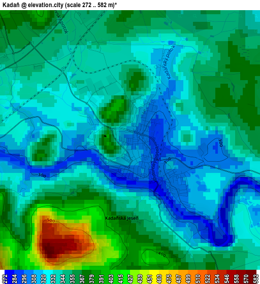
Below is the Elevation map of Kadaň, which displays elevation range with different colors. Scale of the first map is from 272 to 582 m (892 to 1909 ft) with average elevation of 347.5 meters (=1140 ft) [note 1]
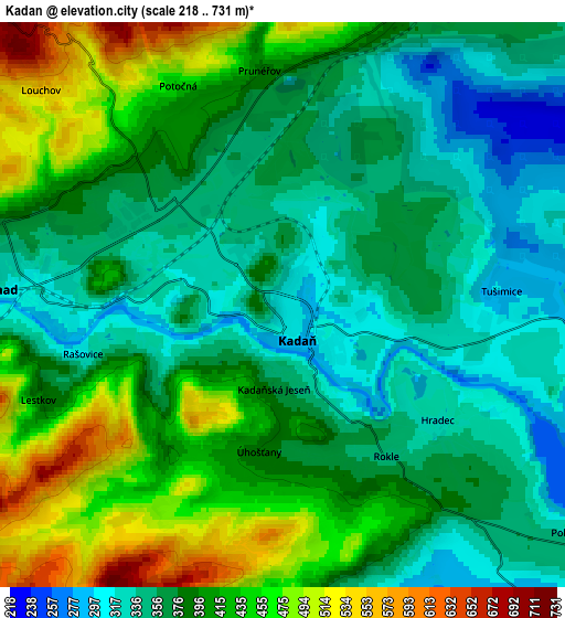
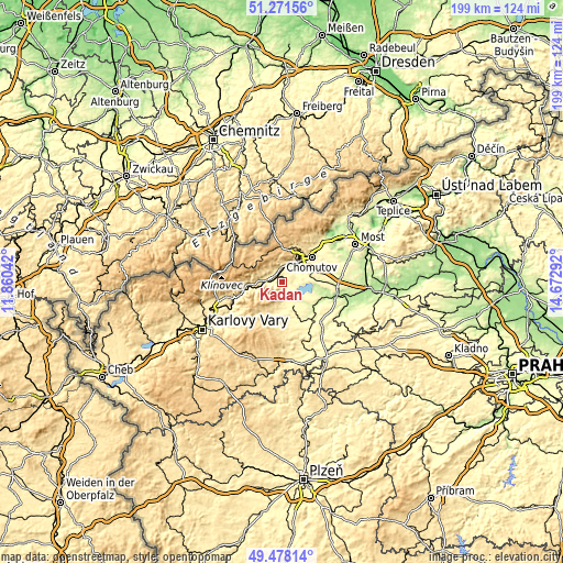
These maps also provides idea of topography and contour of this city, they are displayed at different zoom levels. More info about maps, scale and edge coordinates you can find below images.
| \ | Map #1 | Map #2 | Topo.Map |
| Scale [m] | 272..582 m | 218..731 m | × |
| Scale [ft] | 892..1909 ft | 715..2398 ft | × |
| Average | 347.5 m = 1140 ft | 391.1 m = 1283 ft | × |
| Width | 6.23 km = 3.9 mi | 12.46 km = 7.7 mi | 199.4 km = 123.9 mi |
| Height | 6.23 km = 3.9 mi | 12.46 km = 7.7 mi | 199.4 km = 123.9 mi |
| ↑Max Latitude | 50.411343° | 50.43934° | 51.27156° |
| Latitude at center | 50.38333° | 50.38333° | 50.38333° |
| ↓Min Latitude | 50.3553° | 50.327254° | 49.47814° |
| ← Min Longitude | 13.222725° | 13.178779° | 11.86042° |
| Longitude center | 13.26667° | 13.26667° | 13.26667° |
| →Max Longitude | 13.310615° | 13.354561° | 14.67292° |
Nearby cities:
Cities around Kadaň sort by population:
• Chomutov elevation 341 m
13.7 km,  51°
51°
• Jirkov 306 m
18.2 km,  44°
44°
• Žatec 243 m
20.8 km,  107°
107°
• Klášterec nad Ohří 318 m
5.9 km,  275°
275°
• Podbořany 328 m
20 km,  148°
148°
• Krásná Lípa 604 m
12.9 km,  29°
29°
• Vejprty 724 m
20.6 km,  306°
306°
• Kovářská 815 m
16.3 km,  292°
292°
• Březno 279 m
11.1 km,  79°
79°
• Radonice 327 m
9.6 km,  172°
172°
• Údlice 290 m
14.9 km,  64°
64°
• Perštejn 362 m
11.1 km,  269°
269°
Multilingual:
 En español:
Kadaň elevación 302 m.
 En France:
Kadaň élévation 302 m.


Sources and notes:
- [note 1] Map square and city borders are not equal. Map elevation data is calculated only from area inside that square.
- [src 1] Elevation data from geonames database provided with same terms of usage.
- [src 2] The elevation map of Kadaň is generated using elevation data from NASA's 3 arcsec (90m) resolution SRTM data.
- [src 3] Base (background) map © OpenStreetMap contributors tiles are generated by Geofabrik and OpenTopoMap.
Copyright & License:
This Kadaň Elevation Map is licensed under CC BY-SA. You may reuse any part from this page, if you give a proper credit by linking to this URL:
 More info on terms of use page.