Údlice elevation
Údlice (Ústecký kraj, Okres Chomutov), Czech Republic elevation is 290 meters and Údlice elevation in feet is 951 ft above sea level [src 1]. Údlice is a populated place (feature code) with elevation that is 55 meters (180 ft) smaller than average city elevation in Czech Republic.
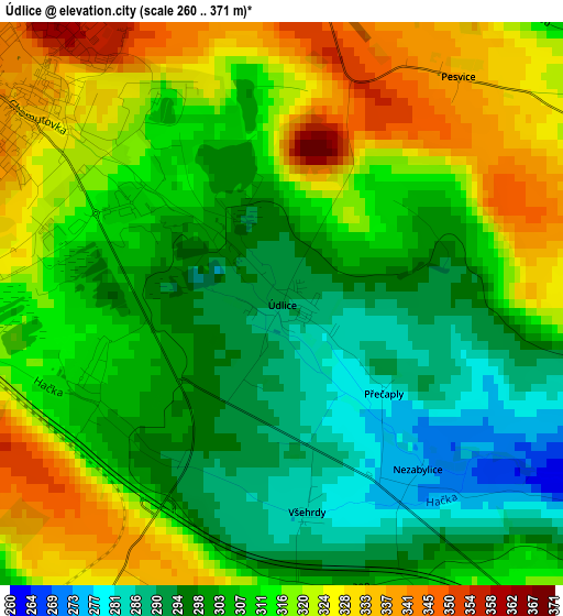
Below is the Elevation map of Údlice, which displays elevation range with different colors. Scale of the first map is from 260 to 371 m (853 to 1217 ft) with average elevation of 310.1 meters (=1017 ft) [note 1]
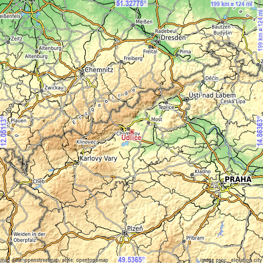
These maps also provides idea of topography and contour of this city, they are displayed at different zoom levels. More info about maps, scale and edge coordinates you can find below images.
| \ | Map #1 | Topo.Map |
| Scale [m] | 260..371 m | × |
| Scale [ft] | 853..1217 ft | × |
| Average | 310.1 m = 1017 ft | × |
| Width | 6.22 km = 3.9 mi | 199.2 km = 123.8 mi |
| Height | 6.22 km = 3.9 mi | 199.2 km = 123.8 mi |
| ↑Max Latitude | 50.46858° | 51.32775° |
| Latitude at center | 50.4406° | 50.4406° |
| ↓Min Latitude | 50.412604° | 49.5365° |
| ← Min Longitude | 13.413435° | 12.05113° |
| Longitude center | 13.45738° | 13.45738° |
| →Max Longitude | 13.501325° | 14.86363° |
Nearby cities:
Cities around Údlice sort by population:
• Most elevation 282 m
14.4 km,  61°
61°
• Chomutov 341 m
3.6 km,  308°
308°
• Jirkov 306 m
6.6 km,  354°
354°
• Žatec 243 m
14.1 km,  153°
153°
• Kadaň 302 m
14.9 km,  244°
244°
• Postoloprty 193 m
19.6 km,  117°
117°
• Krásná Lípa 604 m
8.5 km,  304°
304°
• Obrnice 222 m
18.3 km,  66°
66°
• Bečov 256 m
18.5 km,  86°
86°
• Horní Jiřetín 269 m
16 km,  23°
23°
• Březno 279 m
5 km,  210°
210°
• Radonice 327 m
20 km,  217°
217°
Multilingual:
 En español:
Údlice elevación 290 m.
 En France:
Údlice élévation 290 m.


Sources and notes:
- [note 1] Map square and city borders are not equal. Map elevation data is calculated only from area inside that square.
- [src 1] Elevation data from geonames database provided with same terms of usage.
- [src 2] The elevation map of Údlice is generated using elevation data from NASA's 3 arcsec (90m) resolution SRTM data.
- [src 3] Base (background) map © OpenStreetMap contributors tiles are generated by Geofabrik and OpenTopoMap.
Copyright & License:
This Údlice Elevation Map is licensed under CC BY-SA. You may reuse any part from this page, if you give a proper credit by linking to this URL:
 More info on terms of use page.