Karlovy Vary elevation
Karlovy Vary (Karlovarský kraj, Okres Karlovy Vary), Czech Republic elevation is 374 meters and Karlovy Vary elevation in feet is 1227 ft above sea level [src 1]. Karlovy Vary is a seat of a first-order administrative division (feature code) with elevation that is 29 meters (95 ft) bigger than average city elevation in Czech Republic.
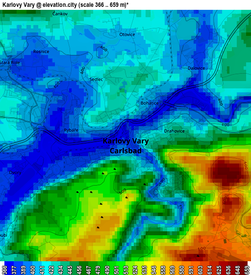
Below is the Elevation map of Karlovy Vary, which displays elevation range with different colors. Scale of the first map is from 366 to 659 m (1201 to 2162 ft) with average elevation of 446.1 meters (=1464 ft) [note 1]
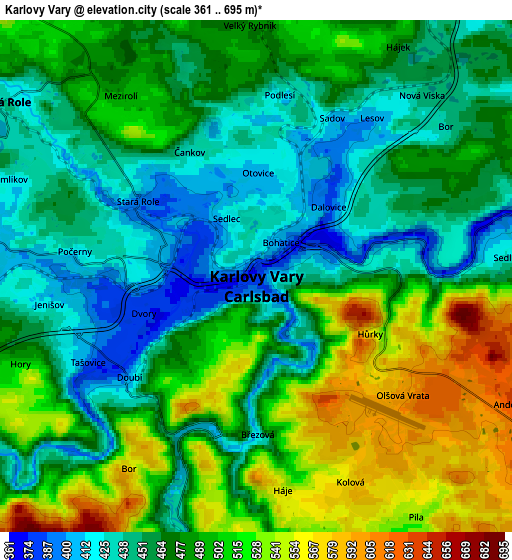
These maps also provides idea of topography and contour of this city, they are displayed at different zoom levels. More info about maps, scale and edge coordinates you can find below images.
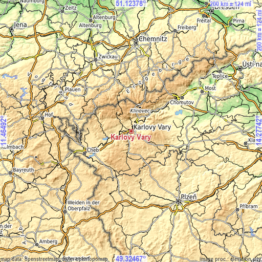
| \ | Map #1 | Map #2 | Topo.Map |
| Scale [m] | 366..659 m | 361..695 m | × |
| Scale [ft] | 1201..2162 ft | 1184..2280 ft | × |
| Average | 446.1 m = 1464 ft | 481.1 m = 1578 ft | × |
| Width | 6.25 km = 3.9 mi | 12.5 km = 7.8 mi | 200 km = 124.3 mi |
| Height | 6.25 km = 3.9 mi | 12.5 km = 7.8 mi | 200 km = 124.3 mi |
| ↑Max Latitude | 50.260812° | 50.288898° | 51.12378° |
| Latitude at center | 50.23271° | 50.23271° | 50.23271° |
| ↓Min Latitude | 50.204591° | 50.176456° | 49.32467° |
| ← Min Longitude | 12.827225° | 12.783279° | 11.46492° |
| Longitude center | 12.87117° | 12.87117° | 12.87117° |
| →Max Longitude | 12.915115° | 12.959061° | 14.27742° |
Nearby cities:
Cities around Karlovy Vary sort by population:
• Ostrov elevation 403 m
9.5 km,  30°
30°
• Chodov 414 m
9 km,  275°
275°
• Nejdek 557 m
14.2 km,  314°
314°
• Horní Slavkov 567 m
11.4 km,  203°
203°
• Nová Role 439 m
7.5 km,  304°
304°
• Loket 415 m
9.8 km,  238°
238°
• Nové Sedlo 428 m
9.9 km,  252°
252°
• Dalovice 383 m
2.4 km,  46°
46°
• Hroznětín 452 m
8.5 km,  0°
0°
• Vintířov 455 m
10.9 km,  270°
270°
• Merklín 516 m
10.6 km,  357°
357°
• Sadov 406 m
4.2 km, 25°
Multilingual:
 En español:
Karlovy Vary elevación 374 m.
 En France:
Karlovy Vary élévation 374 m.
 Auf Deutsch:
Karlsbad höhe über dem Meeresspiegel ist 374 m.

Sources and notes:
- [note 1] Map square and city borders are not equal. Map elevation data is calculated only from area inside that square.
- [src 1] Elevation data from geonames database provided with same terms of usage.
- [src 2] The elevation map of Karlovy Vary is generated using elevation data from NASA's 3 arcsec (90m) resolution SRTM data.
- [src 3] Base (background) map © OpenStreetMap contributors tiles are generated by Geofabrik and OpenTopoMap.
Copyright & License:
This Karlovy Vary Elevation Map is licensed under CC BY-SA. You may reuse any part from this page, if you give a proper credit by linking to this URL:
 More info on terms of use page.