Ostrov elevation
Ostrov (Karlovarský kraj, Okres Karlovy Vary), Czech Republic elevation is 403 meters and Ostrov elevation in feet is 1322 ft above sea level [src 1]. Ostrov is a populated place (feature code) with elevation that is 58 meters (190 ft) bigger than average city elevation in Czech Republic.
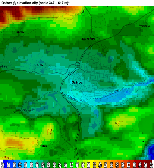
Below is the Elevation map of Ostrov, which displays elevation range with different colors. Scale of the first map is from 347 to 617 m (1138 to 2024 ft) with average elevation of 446.9 meters (=1466 ft) [note 1]
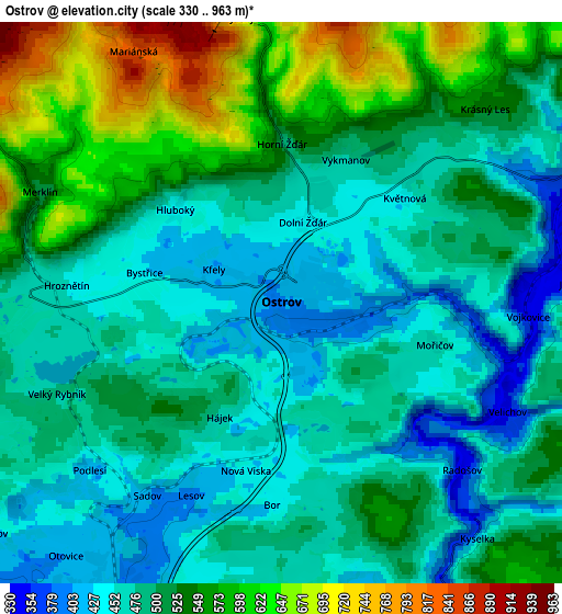
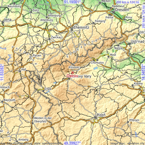
These maps also provides idea of topography and contour of this city, they are displayed at different zoom levels. More info about maps, scale and edge coordinates you can find below images.
| \ | Map #1 | Map #2 | Topo.Map |
| Scale [m] | 347..617 m | 330..963 m | × |
| Scale [ft] | 1138..2024 ft | 1083..3159 ft | × |
| Average | 446.9 m = 1466 ft | 506.4 m = 1661 ft | × |
| Width | 6.24 km = 3.9 mi | 12.48 km = 7.8 mi | 199.7 km = 124.1 mi |
| Height | 6.24 km = 3.9 mi | 12.48 km = 7.8 mi | 199.7 km = 124.1 mi |
| ↑Max Latitude | 50.333979° | 50.362022° | 51.19561° |
| Latitude at center | 50.30592° | 50.30592° | 50.30592° |
| ↓Min Latitude | 50.277844° | 50.249752° | 49.39927° |
| ← Min Longitude | 12.895125° | 12.851179° | 11.53282° |
| Longitude center | 12.93907° | 12.93907° | 12.93907° |
| →Max Longitude | 12.983015° | 13.026961° | 14.34532° |
Nearby cities:
Cities around Ostrov sort by population:
• Karlovy Vary elevation 374 m
9.5 km,  210°
210°
• Chodov 414 m
15.6 km,  242°
242°
• Nejdek 557 m
15 km,  277°
277°
• Nová Role 439 m
11.7 km,  250°
250°
• Jáchymov 596 m
5.9 km,  356°
356°
• Dalovice 383 m
7.2 km, 205°
• Hroznětín 452 m
4.8 km,  274°
274°
• Kovářská 815 m
16.8 km,  28°
28°
• Abertamy 891 m
11.1 km,  309°
309°
• Merklín 516 m
5.9 km,  294°
294°
• Perštejn 362 m
14.8 km,  55°
55°
• Sadov 406 m
5.2 km, 214°
Multilingual:
 En español:
Ostrov elevación 403 m.
 En France:
Ostrov élévation 403 m.
 Auf Deutsch:
Schlackenwerth höhe über dem Meeresspiegel ist 403 m.

Sources and notes:
- [note 1] Map square and city borders are not equal. Map elevation data is calculated only from area inside that square.
- [src 1] Elevation data from geonames database provided with same terms of usage.
- [src 2] The elevation map of Ostrov is generated using elevation data from NASA's 3 arcsec (90m) resolution SRTM data.
- [src 3] Base (background) map © OpenStreetMap contributors tiles are generated by Geofabrik and OpenTopoMap.
Copyright & License:
This Ostrov Elevation Map is licensed under CC BY-SA. You may reuse any part from this page, if you give a proper credit by linking to this URL:
 More info on terms of use page.