Chodov elevation
Chodov (Karlovarský kraj, Okres Sokolov), Czech Republic elevation is 414 meters and Chodov elevation in feet is 1358 ft above sea level [src 1]. Chodov is a populated place (feature code) with elevation that is 69 meters (226 ft) bigger than average city elevation in Czech Republic.
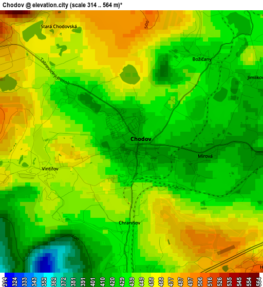
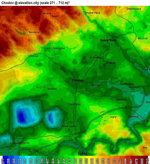
Below is the Elevation map of Chodov, which displays elevation range with different colors. Scale of the first map is from 314 to 564 m (1030 to 1850 ft) with average elevation of 443.2 meters (=1454 ft) [note 1]
These maps also provides idea of topography and contour of this city, they are displayed at different zoom levels. More info about maps, scale and edge coordinates you can find below images.
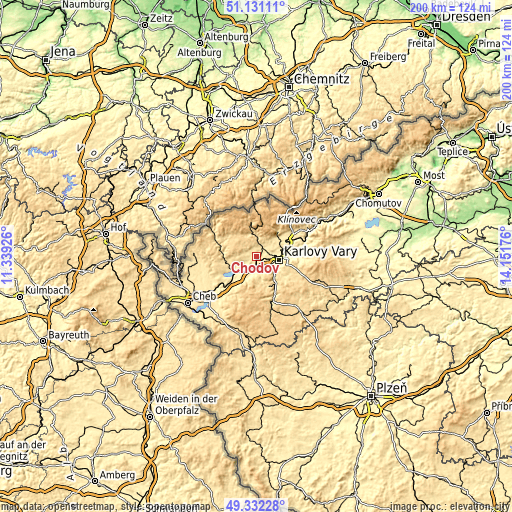
| \ | Map #1 | Map #2 | Topo.Map |
| Scale [m] | 314..564 m | 271..712 m | × |
| Scale [ft] | 1030..1850 ft | 889..2336 ft | × |
| Average | 443.2 m = 1454 ft | 478.8 m = 1571 ft | × |
| Width | 6.25 km = 3.9 mi | 12.5 km = 7.8 mi | 200 km = 124.3 mi |
| Height | 6.25 km = 3.9 mi | 12.5 km = 7.8 mi | 200 km = 124.3 mi |
| ↑Max Latitude | 50.268278° | 50.296359° | 51.13111° |
| Latitude at center | 50.24018° | 50.24018° | 50.24018° |
| ↓Min Latitude | 50.212066° | 50.183935° | 49.33228° |
| ← Min Longitude | 12.701565° | 12.657619° | 11.33926° |
| Longitude center | 12.74551° | 12.74551° | 12.74551° |
| →Max Longitude | 12.789455° | 12.833401° | 14.15176° |
Nearby cities:
Cities around Chodov sort by population:
• Karlovy Vary elevation 374 m
9 km,  95°
95°
• Sokolov 402 m
10 km,  228°
228°
• Nejdek 557 m
9.2 km,  352°
352°
• Nová Role 439 m
4.4 km,  38°
38°
• Loket 415 m
6.1 km,  174°
174°
• Nové Sedlo 428 m
3.8 km,  188°
188°
• Dalovice 383 m
10.7 km,  85°
85°
• Svatava 406 m
10.1 km,  238°
238°
• Dolní Rychnov 426 m
11 km,  220°
220°
• Lomnice 432 m
8.6 km,  248°
248°
• Vintířov 455 m
2.1 km, 250°
• Sadov 406 m
11.2 km,  74°
74°
Multilingual:
 En español:
Chodov elevación 414 m.
 En France:
Chodov élévation 414 m.


Sources and notes:
- [note 1] Map square and city borders are not equal. Map elevation data is calculated only from area inside that square.
- [src 1] Elevation data from geonames database provided with same terms of usage.
- [src 2] The elevation map of Chodov is generated using elevation data from NASA's 3 arcsec (90m) resolution SRTM data.
- [src 3] Base (background) map © OpenStreetMap contributors tiles are generated by Geofabrik and OpenTopoMap.
Copyright & License:
This Chodov Elevation Map is licensed under CC BY-SA. You may reuse any part from this page, if you give a proper credit by linking to this URL:
 More info on terms of use page.