Klášter elevation
Klášter (Karlovarský kraj, Okres Cheb), Czech Republic elevation is 660 meters and Klášter elevation in feet is 2165 ft above sea level [src 1]. Klášter is a populated place (feature code) with elevation that is 315 meters (1033 ft) bigger than average city elevation in Czech Republic.
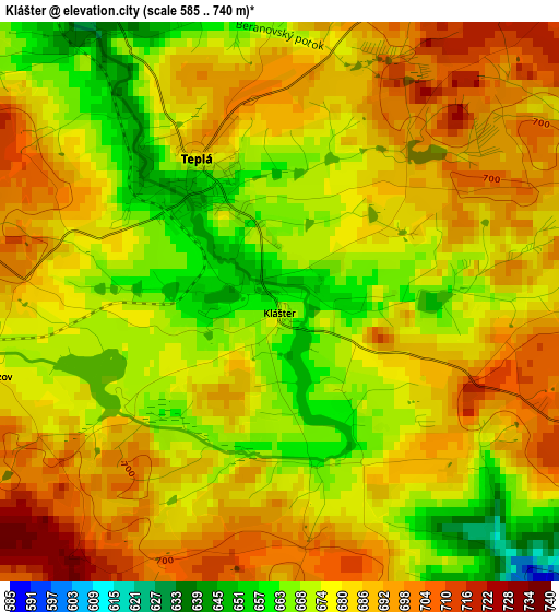
Below is the Elevation map of Klášter, which displays elevation range with different colors. Scale of the first map is from 585 to 740 m (1919 to 2428 ft) with average elevation of 681.7 meters (=2237 ft) [note 1]
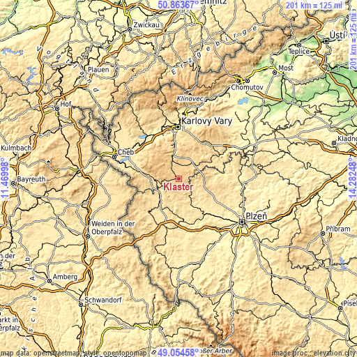
These maps also provides idea of topography and contour of this city, they are displayed at different zoom levels. More info about maps, scale and edge coordinates you can find below images.
| \ | Map #1 | Topo.Map |
| Scale [m] | 585..740 m | × |
| Scale [ft] | 1919..2428 ft | × |
| Average | 681.7 m = 2237 ft | × |
| Width | 6.29 km = 3.9 mi | 201.2 km = 125 mi |
| Height | 6.29 km = 3.9 mi | 201.1 km = 125 mi |
| ↑Max Latitude | 49.995878° | 50.86367° |
| Latitude at center | 49.96762° | 49.96762° |
| ↓Min Latitude | 49.939345° | 49.05458° |
| ← Min Longitude | 12.832285° | 11.46998° |
| Longitude center | 12.87623° | 12.87623° |
| →Max Longitude | 12.920175° | 14.28248° |
Nearby cities:
Cities around Klášter sort by population:
• Mariánské Lázně elevation 592 m
12.5 km,  268°
268°
• Horní Slavkov 567 m
19.6 km,  345°
345°
• Planá 514 m
14.6 km,  220°
220°
• Toužim 615 m
12.9 km,  36°
36°
• Město 659 m
1.6 km,  328°
328°
• Velká Hleďsebe 558 m
14.9 km, 267°
• Bochov 676 m
23.7 km,  31°
31°
• Chodová Planá 525 m
13.3 km,  231°
231°
• Lázně Kynžvart 675 m
18.6 km,  284°
284°
• Dolní Žandov 537 m
23.9 km, 283°
• Černošín 498 m
16.9 km,  178°
178°
• Bezdružice 592 m
9.5 km,  134°
134°
Multilingual:
 En español:
Klášter elevación 660 m.
 En France:
Klášter élévation 660 m.


Sources and notes:
- [note 1] Map square and city borders are not equal. Map elevation data is calculated only from area inside that square.
- [src 1] Elevation data from geonames database provided with same terms of usage.
- [src 2] The elevation map of Klášter is generated using elevation data from NASA's 3 arcsec (90m) resolution SRTM data.
- [src 3] Base (background) map © OpenStreetMap contributors tiles are generated by Geofabrik and OpenTopoMap.
Copyright & License:
This Klášter Elevation Map is licensed under CC BY-SA. You may reuse any part from this page, if you give a proper credit by linking to this URL:
 More info on terms of use page.