Koryčany elevation
Koryčany (Zlín, Okres Kroměříž), Czech Republic elevation is 284 meters and Koryčany elevation in feet is 932 ft above sea level [src 1]. Koryčany is a populated place (feature code) with elevation that is 61 meters (200 ft) smaller than average city elevation in Czech Republic.
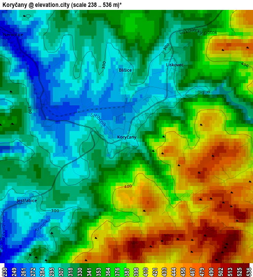
Below is the Elevation map of Koryčany, which displays elevation range with different colors. Scale of the first map is from 238 to 536 m (781 to 1759 ft) with average elevation of 352.4 meters (=1156 ft) [note 1]
These maps also provides idea of topography and contour of this city, they are displayed at different zoom levels. More info about maps, scale and edge coordinates you can find below images.
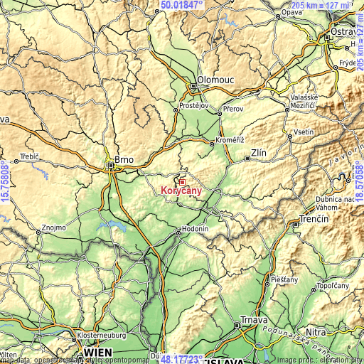
| \ | Map #1 | Topo.Map |
| Scale [m] | 238..536 m | × |
| Scale [ft] | 781..1759 ft | × |
| Average | 352.4 m = 1156 ft | × |
| Width | 6.4 km = 4 mi | 204.7 km = 127.2 mi |
| Height | 6.4 km = 4 mi | 204.7 km = 127.2 mi |
| ↑Max Latitude | 49.135151° | 50.01847° |
| Latitude at center | 49.10639° | 49.10639° |
| ↓Min Latitude | 49.077613° | 48.17723° |
| ← Min Longitude | 17.120385° | 15.75808° |
| Longitude center | 17.16433° | 17.16433° |
| →Max Longitude | 17.208275° | 18.57058° |
Nearby cities:
Cities around Koryčany sort by population:
• Kyjov elevation 191 m
11.1 km,  195°
195°
• Bučovice 219 m
12.7 km,  291°
291°
• Vracov 195 m
15 km,  166°
166°
• Ždánice 223 m
10.9 km,  246°
246°
• Buchlovice 250 m
12.9 km,  100°
100°
• Boršice 209 m
14.4 km,  109°
109°
• Polešovice 227 m
15.2 km,  122°
122°
• Nesovice 239 m
7.8 km,  309°
309°
• Tupesy 214 m
15.2 km, 99°
• Vlkoš 193 m
13 km,  180°
180°
• Žeravice 268 m
10.7 km,  150°
150°
• Domanín 229 m
14.6 km,  142°
142°
Multilingual:
 En español:
Koryčany elevación 284 m.
 En France:
Koryčany élévation 284 m.
 Auf Deutsch:
Koryčany höhe über dem Meeresspiegel ist 284 m.

Sources and notes:
- [note 1] Map square and city borders are not equal. Map elevation data is calculated only from area inside that square.
- [src 1] Elevation data from geonames database provided with same terms of usage.
- [src 2] The elevation map of Koryčany is generated using elevation data from NASA's 3 arcsec (90m) resolution SRTM data.
- [src 3] Base (background) map © OpenStreetMap contributors tiles are generated by Geofabrik and OpenTopoMap.
Copyright & License:
This Koryčany Elevation Map is licensed under CC BY-SA. You may reuse any part from this page, if you give a proper credit by linking to this URL:
 More info on terms of use page.