Lanškroun elevation
Lanškroun (Pardubický, Okres Ústí nad Orlicí), Czech Republic elevation is 383 meters and Lanškroun elevation in feet is 1257 ft above sea level [src 1]. Lanškroun is a populated place (feature code) with elevation that is 38 meters (125 ft) bigger than average city elevation in Czech Republic.
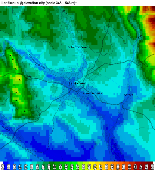
Below is the Elevation map of Lanškroun, which displays elevation range with different colors. Scale of the first map is from 348 to 546 m (1142 to 1791 ft) with average elevation of 390.9 meters (=1282 ft) [note 1]
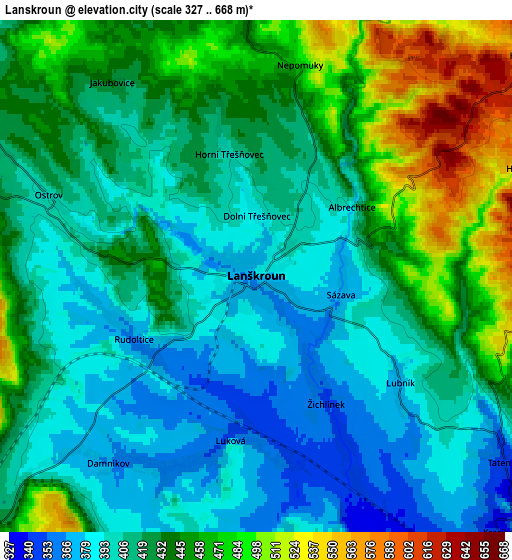
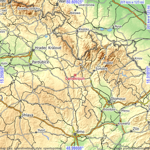
These maps also provides idea of topography and contour of this city, they are displayed at different zoom levels. More info about maps, scale and edge coordinates you can find below images.
| \ | Map #1 | Map #2 | Topo.Map |
| Scale [m] | 348..546 m | 327..668 m | × |
| Scale [ft] | 1142..1791 ft | 1073..2192 ft | × |
| Average | 390.9 m = 1282 ft | 427 m = 1401 ft | × |
| Width | 6.29 km = 3.9 mi | 12.59 km = 7.8 mi | 201.4 km = 125.1 mi |
| Height | 6.29 km = 3.9 mi | 12.59 km = 7.8 mi | 201.4 km = 125.1 mi |
| ↑Max Latitude | 49.940461° | 49.968735° | 50.80925° |
| Latitude at center | 49.91217° | 49.91217° | 49.91217° |
| ↓Min Latitude | 49.883863° | 49.855539° | 48.99808° |
| ← Min Longitude | 16.567955° | 16.524009° | 15.20565° |
| Longitude center | 16.6119° | 16.6119° | 16.6119° |
| →Max Longitude | 16.655845° | 16.699791° | 18.01815° |
Nearby cities:
Cities around Lanškroun sort by population:
• Česká Třebová elevation 370 m
12 km,  265°
265°
• Letohrad 373 m
15.9 km,  329°
329°
• Červená Voda 526 m
17 km,  33°
33°
• Jablonné nad Orlicí 428 m
13.1 km,  356°
356°
• Dolní Dobrouč 364 m
12.1 km,  317°
317°
• Štíty 442 m
12.3 km,  63°
63°
• Dolní Čermná 397 m
8.2 km,  335°
335°
• Dlouhá Třebová 341 m
13.9 km,  283°
283°
• Kunčina 374 m
13.1 km,  175°
175°
• Opatov 436 m
12.4 km,  218°
218°
• Bystřec 500 m
11.1 km,  2°
2°
• Horní Čermná 431 m
6.5 km, 357°
Multilingual:
 En español:
Lanškroun elevación 383 m.
 En France:
Lanškroun élévation 383 m.
 Auf Deutsch:
Landskron/Schönhengstgau höhe über dem Meeresspiegel ist 383 m.

Sources and notes:
- [note 1] Map square and city borders are not equal. Map elevation data is calculated only from area inside that square.
- [src 1] Elevation data from geonames database provided with same terms of usage.
- [src 2] The elevation map of Lanškroun is generated using elevation data from NASA's 3 arcsec (90m) resolution SRTM data.
- [src 3] Base (background) map © OpenStreetMap contributors tiles are generated by Geofabrik and OpenTopoMap.
Copyright & License:
This Lanškroun Elevation Map is licensed under CC BY-SA. You may reuse any part from this page, if you give a proper credit by linking to this URL:
 More info on terms of use page.