Nedvědice elevation
Nedvědice (South Moravian, Okres Brno-venkov), Czech Republic elevation is 328 meters and Nedvědice elevation in feet is 1076 ft above sea level [src 1]. Nedvědice is a populated place (feature code) with elevation that is 17 meters (56 ft) smaller than average city elevation in Czech Republic.
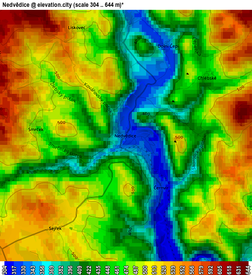
Below is the Elevation map of Nedvědice, which displays elevation range with different colors. Scale of the first map is from 304 to 644 m (997 to 2113 ft) with average elevation of 470.5 meters (=1544 ft) [note 1]
These maps also provides idea of topography and contour of this city, they are displayed at different zoom levels. More info about maps, scale and edge coordinates you can find below images.
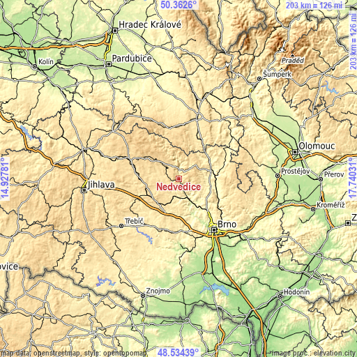
| \ | Map #1 | Topo.Map |
| Scale [m] | 304..644 m | × |
| Scale [ft] | 997..2113 ft | × |
| Average | 470.5 m = 1544 ft | × |
| Width | 6.35 km = 3.9 mi | 203.3 km = 126.3 mi |
| Height | 6.35 km = 3.9 mi | 203.3 km = 126.3 mi |
| ↑Max Latitude | 49.485577° | 50.3626° |
| Latitude at center | 49.45702° | 49.45702° |
| ↓Min Latitude | 49.428446° | 48.53439° |
| ← Min Longitude | 16.290115° | 14.92781° |
| Longitude center | 16.33406° | 16.33406° |
| →Max Longitude | 16.378005° | 17.74031° |
Nearby cities:
Cities around Nedvědice sort by population:
• Bystřice nad Pernštejnem elevation 534 m
9 km,  324°
324°
• Tišnov 272 m
13.7 km,  151°
151°
• Kunštát 443 m
14.3 km,  67°
67°
• Černá Hora 326 m
18.5 km,  105°
105°
• Křižanov 525 m
17.9 km,  244°
244°
• Lysice 362 m
14.7 km,  92°
92°
• Olešnice 550 m
12.8 km,  29°
29°
• Předklášteří 261 m
12.6 km,  156°
156°
• Lomnice 373 m
8.2 km,  135°
135°
• Drásov 280 m
17.4 km, 143°
• Drnovice 352 m
15.1 km,  84°
84°
• Dolní Loućky 280 m
10.8 km,  170°
170°
Multilingual:
 En español:
Nedvědice elevación 328 m.
 En France:
Nedvědice élévation 328 m.
 Auf Deutsch:
Nedvědice höhe über dem Meeresspiegel ist 328 m.

Sources and notes:
- [note 1] Map square and city borders are not equal. Map elevation data is calculated only from area inside that square.
- [src 1] Elevation data from geonames database provided with same terms of usage.
- [src 2] The elevation map of Nedvědice is generated using elevation data from NASA's 3 arcsec (90m) resolution SRTM data.
- [src 3] Base (background) map © OpenStreetMap contributors tiles are generated by Geofabrik and OpenTopoMap.
Copyright & License:
This Nedvědice Elevation Map is licensed under CC BY-SA. You may reuse any part from this page, if you give a proper credit by linking to this URL:
 More info on terms of use page.