Kunštát elevation
Kunštát (South Moravian, Okres Blansko), Czech Republic elevation is 443 meters and Kunštát elevation in feet is 1453 ft above sea level [src 1]. Kunštát is a populated place (feature code) with elevation that is 98 meters (322 ft) bigger than average city elevation in Czech Republic.
Below is the Elevation map of Kunštát, which displays elevation range with different colors. Scale of the first map is from 366 to 679 m (1201 to 2228 ft) with average elevation of 494 meters (=1621 ft) [note 1]
These maps also provides idea of topography and contour of this city, they are displayed at different zoom levels. More info about maps, scale and edge coordinates you can find below images.
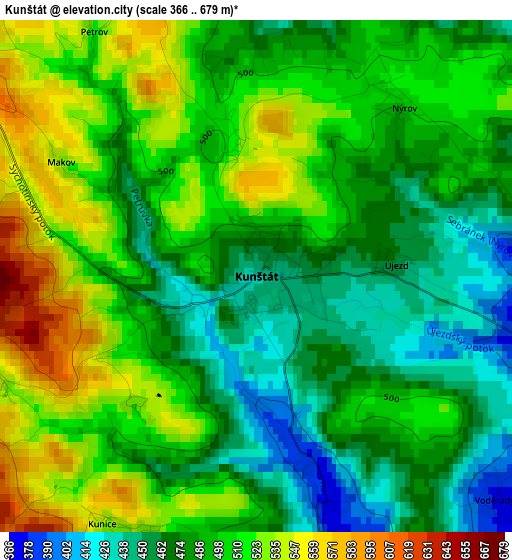
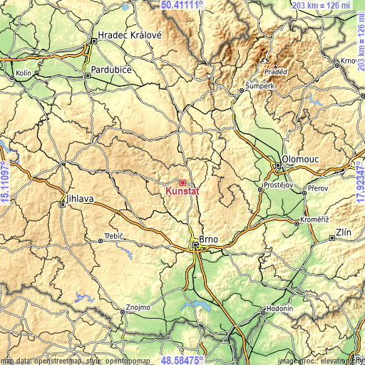
| \ | Map #1 | Topo.Map |
| Scale [m] | 366..679 m | × |
| Scale [ft] | 1201..2228 ft | × |
| Average | 494 m = 1621 ft | × |
| Width | 6.35 km = 3.9 mi | 203.1 km = 126.2 mi |
| Height | 6.35 km = 3.9 mi | 203.1 km = 126.2 mi |
| ↑Max Latitude | 49.534978° | 50.41111° |
| Latitude at center | 49.50645° | 49.50645° |
| ↓Min Latitude | 49.477905° | 48.58475° |
| ← Min Longitude | 16.473275° | 15.11097° |
| Longitude center | 16.51722° | 16.51722° |
| →Max Longitude | 16.561165° | 17.92347° |
Nearby cities:
Cities around Kunštát sort by population:
• Boskovice elevation 386 m
10.5 km,  101°
101°
• Letovice 330 m
6.1 km,  41°
41°
• Rájec-Jestřebí 295 m
13.8 km,  140°
140°
• Černá Hora 326 m
11.3 km,  155°
155°
• Lysice 362 m
6.3 km,  166°
166°
• Olešnice 550 m
8.9 km,  309°
309°
• Svitávka 315 m
5.9 km, 95°
• Brněnec 377 m
13.4 km,  1°
1°
• Lomnice 373 m
13.6 km,  213°
213°
• Bořitov 307 m
10.5 km,  149°
149°
• Doubravice nad Svitavou 313 m
11.2 km,  133°
133°
• Drnovice 352 m
4.5 km, 156°
Multilingual:
 En español:
Kunštát elevación 443 m.
 En France:
Kunštát élévation 443 m.


Sources and notes:
- [note 1] Map square and city borders are not equal. Map elevation data is calculated only from area inside that square.
- [src 1] Elevation data from geonames database provided with same terms of usage.
- [src 2] The elevation map of Kunštát is generated using elevation data from NASA's 3 arcsec (90m) resolution SRTM data.
- [src 3] Base (background) map © OpenStreetMap contributors tiles are generated by Geofabrik and OpenTopoMap.
Copyright & License:
This Kunštát Elevation Map is licensed under CC BY-SA. You may reuse any part from this page, if you give a proper credit by linking to this URL:
 More info on terms of use page.