Brněnec elevation
Brněnec (Pardubický, Okres Svitavy), Czech Republic elevation is 377 meters and Brněnec elevation in feet is 1237 ft above sea level [src 1]. Brněnec is a populated place (feature code) with elevation that is 32 meters (105 ft) bigger than average city elevation in Czech Republic.
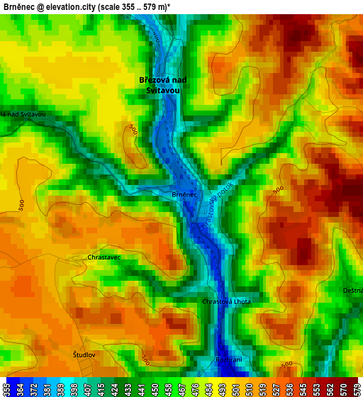
Below is the Elevation map of Brněnec, which displays elevation range with different colors. Scale of the first map is from 355 to 579 m (1165 to 1900 ft) with average elevation of 481.1 meters (=1578 ft) [note 1]
These maps also provides idea of topography and contour of this city, they are displayed at different zoom levels. More info about maps, scale and edge coordinates you can find below images.
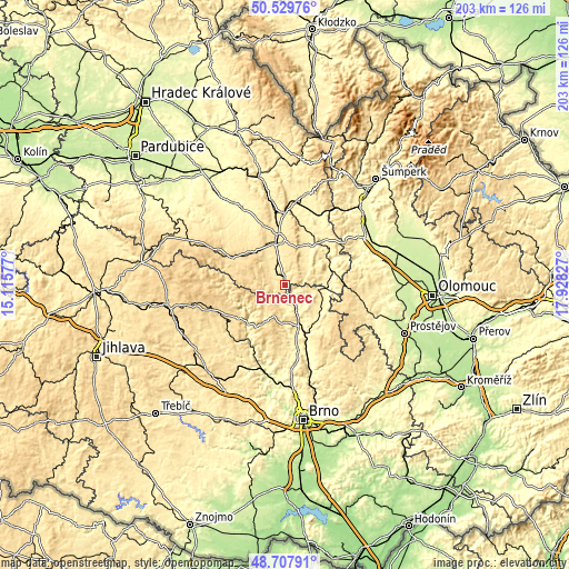
| \ | Map #1 | Topo.Map |
| Scale [m] | 355..579 m | × |
| Scale [ft] | 1165..1900 ft | × |
| Average | 481.1 m = 1578 ft | × |
| Width | 6.33 km = 3.9 mi | 202.6 km = 125.9 mi |
| Height | 6.33 km = 3.9 mi | 202.6 km = 125.9 mi |
| ↑Max Latitude | 49.655808° | 50.52976° |
| Latitude at center | 49.62735° | 49.62735° |
| ↓Min Latitude | 49.598876° | 48.70791° |
| ← Min Longitude | 16.478075° | 15.11577° |
| Longitude center | 16.52202° | 16.52202° |
| →Max Longitude | 16.565965° | 17.92827° |
Nearby cities:
Cities around Brněnec sort by population:
• Svitavy elevation 442 m
14.8 km,  344°
344°
• Letovice 330 m
9.7 km,  157°
157°
• Velké Opatovice 379 m
11.5 km,  98°
98°
• Jevíčko 363 m
13.6 km,  87°
87°
• Kunštát 443 m
13.4 km,  181°
181°
• Olešnice 550 m
10.6 km,  222°
222°
• Svitávka 315 m
15 km, 158°
• Bystré 619 m
12.6 km,  270°
270°
• Hradec nad Svitavou 423 m
9.8 km, 342°
• Březová nad Svitavou 382 m
1.9 km,  351°
351°
• Radiměř 444 m
9.8 km,  323°
323°
• Jedlová 599 m
16 km,  283°
283°
Multilingual:
 En español:
Brněnec elevación 377 m.
 En France:
Brněnec élévation 377 m.


Sources and notes:
- [note 1] Map square and city borders are not equal. Map elevation data is calculated only from area inside that square.
- [src 1] Elevation data from geonames database provided with same terms of usage.
- [src 2] The elevation map of Brněnec is generated using elevation data from NASA's 3 arcsec (90m) resolution SRTM data.
- [src 3] Base (background) map © OpenStreetMap contributors tiles are generated by Geofabrik and OpenTopoMap.
Copyright & License:
This Brněnec Elevation Map is licensed under CC BY-SA. You may reuse any part from this page, if you give a proper credit by linking to this URL:
 More info on terms of use page.