Příbram elevation
Příbram (Central Bohemia, Okres Příbram), Czech Republic elevation is 510 meters and Příbram elevation in feet is 1673 ft above sea level [src 1]. Příbram is a populated place (feature code) with elevation that is 165 meters (541 ft) bigger than average city elevation in Czech Republic.
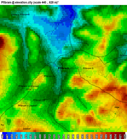
Below is the Elevation map of Příbram, which displays elevation range with different colors. Scale of the first map is from 440 to 628 m (1444 to 2060 ft) with average elevation of 524.2 meters (=1720 ft) [note 1]
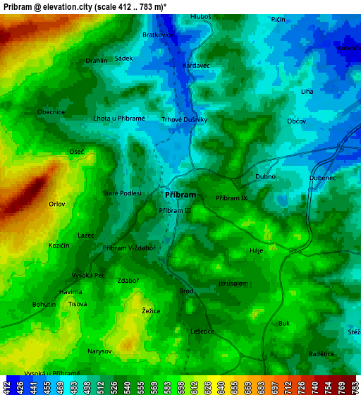
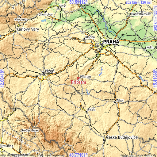
These maps also provides idea of topography and contour of this city, they are displayed at different zoom levels. More info about maps, scale and edge coordinates you can find below images.
| \ | Map #1 | Map #2 | Topo.Map |
| Scale [m] | 440..628 m | 412..783 m | × |
| Scale [ft] | 1444..2060 ft | 1352..2569 ft | × |
| Average | 524.2 m = 1720 ft | 540.8 m = 1774 ft | × |
| Width | 6.32 km = 3.9 mi | 12.64 km = 7.9 mi | 202.3 km = 125.7 mi |
| Height | 6.32 km = 3.9 mi | 12.64 km = 7.9 mi | 202.3 km = 125.7 mi |
| ↑Max Latitude | 49.718301° | 49.746705° | 50.59112° |
| Latitude at center | 49.68988° | 49.68988° | 49.68988° |
| ↓Min Latitude | 49.661442° | 49.632988° | 48.77161° |
| ← Min Longitude | 13.966485° | 13.922539° | 12.60418° |
| Longitude center | 14.01043° | 14.01043° | 14.01043° |
| →Max Longitude | 14.054375° | 14.098321° | 15.41668° |
Nearby cities:
Cities around Příbram sort by population:
• Dobříš elevation 382 m
15.2 km,  47°
47°
• Hořovice 377 m
18 km,  334°
334°
• Rožmitál pod Třemšínem 524 m
14.4 km,  227°
227°
• Březnice 468 m
15.3 km,  196°
196°
• Komárov 395 m
17 km,  319°
319°
• Jince 391 m
11 km,  347°
347°
• Milín 550 m
6.9 km,  158°
158°
• Bohutín 554 m
6.1 km, 231°
• Hostomice 367 m
15.3 km,  9°
9°
• Zaječov 456 m
15.4 km,  307°
307°
• Obecnice 523 m
5.4 km,  302°
302°
• Stará Huť 353 m
16.9 km, 52°
Multilingual:
 En español:
Příbram elevación 510 m.
 En France:
Příbram élévation 510 m.


Sources and notes:
- [note 1] Map square and city borders are not equal. Map elevation data is calculated only from area inside that square.
- [src 1] Elevation data from geonames database provided with same terms of usage.
- [src 2] The elevation map of Příbram is generated using elevation data from NASA's 3 arcsec (90m) resolution SRTM data.
- [src 3] Base (background) map © OpenStreetMap contributors tiles are generated by Geofabrik and OpenTopoMap.
Copyright & License:
This Příbram Elevation Map is licensed under CC BY-SA. You may reuse any part from this page, if you give a proper credit by linking to this URL:
 More info on terms of use page.