Protivín elevation
Protivín (Jihočeský kraj, Okres Písek), Czech Republic elevation is 388 meters and Protivín elevation in feet is 1273 ft above sea level [src 1]. Protivín is a populated place (feature code) with elevation that is 43 meters (141 ft) bigger than average city elevation in Czech Republic.
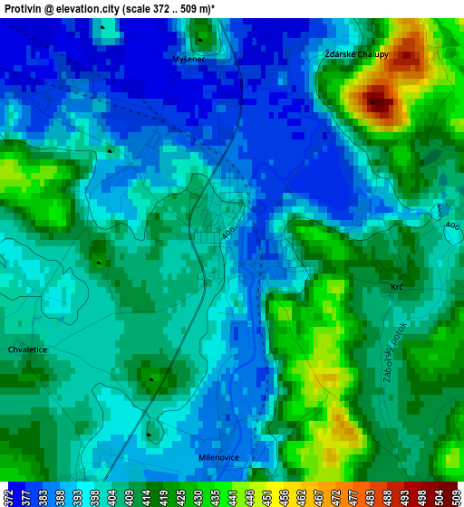
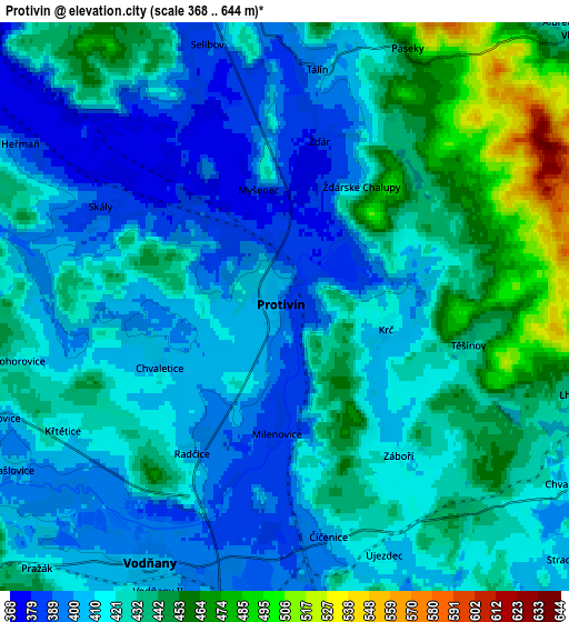
Below is the Elevation map of Protivín, which displays elevation range with different colors. Scale of the first map is from 372 to 509 m (1220 to 1670 ft) with average elevation of 404.6 meters (=1327 ft) [note 1]
These maps also provides idea of topography and contour of this city, they are displayed at different zoom levels. More info about maps, scale and edge coordinates you can find below images.
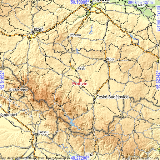
| \ | Map #1 | Map #2 | Topo.Map |
| Scale [m] | 372..509 m | 368..644 m | × |
| Scale [ft] | 1220..1670 ft | 1207..2113 ft | × |
| Average | 404.6 m = 1327 ft | 422.4 m = 1386 ft | × |
| Width | 6.39 km = 4 mi | 12.77 km = 7.9 mi | 204.3 km = 126.9 mi |
| Height | 6.39 km = 4 mi | 12.77 km = 7.9 mi | 204.3 km = 126.9 mi |
| ↑Max Latitude | 49.228197° | 49.256887° | 50.10985° |
| Latitude at center | 49.19949° | 49.19949° | 49.19949° |
| ↓Min Latitude | 49.170767° | 49.142027° | 48.27206° |
| ← Min Longitude | 14.173225° | 14.129279° | 12.81092° |
| Longitude center | 14.21717° | 14.21717° | 14.21717° |
| →Max Longitude | 14.261115° | 14.305061° | 15.62342° |
Nearby cities:
Cities around Protivín sort by population:
• Písek elevation 374 m
13.2 km,  337°
337°
• Týn nad Vltavou 368 m
15 km,  79°
79°
• Vodňany 405 m
6.5 km,  208°
208°
• Bechyně 407 m
21.1 km,  59°
59°
• Hluboká nad Vltavou 398 m
22.8 km,  136°
136°
• Zliv 391 m
18.4 km, 143°
• Netolice 434 m
16.8 km,  185°
185°
• Vlachovo Březí 552 m
23 km,  235°
235°
• Bavorov 441 m
13.3 km,  229°
229°
• Dřiteň 435 m
11.3 km,  123°
123°
• Bernartice 462 m
22.3 km,  32°
32°
• Strunkovice nad Blanicí 461 m
17.4 km,  222°
222°
Multilingual:
 En español:
Protivín elevación 388 m.
 En France:
Protivín élévation 388 m.
 Auf Deutsch:
Protivín höhe über dem Meeresspiegel ist 388 m.

Sources and notes:
- [note 1] Map square and city borders are not equal. Map elevation data is calculated only from area inside that square.
- [src 1] Elevation data from geonames database provided with same terms of usage.
- [src 2] The elevation map of Protivín is generated using elevation data from NASA's 3 arcsec (90m) resolution SRTM data.
- [src 3] Base (background) map © OpenStreetMap contributors tiles are generated by Geofabrik and OpenTopoMap.
Copyright & License:
This Protivín Elevation Map is licensed under CC BY-SA. You may reuse any part from this page, if you give a proper credit by linking to this URL:
 More info on terms of use page.