Vodňany elevation
Vodňany (Jihočeský kraj, Okres Strakonice), Czech Republic elevation is 405 meters and Vodňany elevation in feet is 1329 ft above sea level [src 1]. Vodňany is a populated place (feature code) with elevation that is 60 meters (197 ft) bigger than average city elevation in Czech Republic.
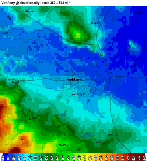
Below is the Elevation map of Vodňany, which displays elevation range with different colors. Scale of the first map is from 382 to 543 m (1253 to 1781 ft) with average elevation of 414.3 meters (=1359 ft) [note 1]
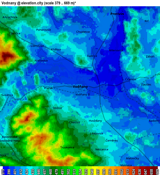
These maps also provides idea of topography and contour of this city, they are displayed at different zoom levels. More info about maps, scale and edge coordinates you can find below images.
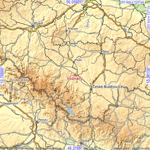
| \ | Map #1 | Map #2 | Topo.Map |
| Scale [m] | 382..543 m | 379..669 m | × |
| Scale [ft] | 1253..1781 ft | 1243..2195 ft | × |
| Average | 414.3 m = 1359 ft | 437.1 m = 1434 ft | × |
| Width | 6.39 km = 4 mi | 12.78 km = 7.9 mi | 204.6 km = 127.1 mi |
| Height | 6.39 km = 4 mi | 12.78 km = 7.9 mi | 204.5 km = 127.1 mi |
| ↑Max Latitude | 49.176627° | 49.205347° | 50.05921° |
| Latitude at center | 49.14789° | 49.14789° | 49.14789° |
| ↓Min Latitude | 49.119137° | 49.090367° | 48.2195° |
| ← Min Longitude | 14.131185° | 14.087239° | 12.76888° |
| Longitude center | 14.17513° | 14.17513° | 14.17513° |
| →Max Longitude | 14.219075° | 14.263021° | 15.58138° |
Nearby cities:
Cities around Vodňany sort by population:
• Písek elevation 374 m
18 km,  353°
353°
• Prachatice 578 m
19.8 km,  220°
220°
• Týn nad Vltavou 368 m
19.7 km,  64°
64°
• Protivín 388 m
6.5 km,  28°
28°
• Zliv 391 m
16.6 km,  123°
123°
• Netolice 434 m
11.1 km,  171°
171°
• Lhenice 557 m
17.1 km,  186°
186°
• Vlachovo Březí 552 m
17.4 km,  244°
244°
• Bavorov 441 m
7.6 km,  247°
247°
• Dřiteň 435 m
12.4 km,  92°
92°
• Husinec 514 m
17.2 km,  232°
232°
• Strunkovice nad Blanicí 461 m
11.3 km, 230°
Multilingual:
 En español:
Vodňany elevación 405 m.
 En France:
Vodňany élévation 405 m.


Sources and notes:
- [note 1] Map square and city borders are not equal. Map elevation data is calculated only from area inside that square.
- [src 1] Elevation data from geonames database provided with same terms of usage.
- [src 2] The elevation map of Vodňany is generated using elevation data from NASA's 3 arcsec (90m) resolution SRTM data.
- [src 3] Base (background) map © OpenStreetMap contributors tiles are generated by Geofabrik and OpenTopoMap.
Copyright & License:
This Vodňany Elevation Map is licensed under CC BY-SA. You may reuse any part from this page, if you give a proper credit by linking to this URL:
 More info on terms of use page.