Roztoky elevation
Roztoky (Central Bohemia, Okres Praha-západ), Czech Republic elevation is 189 meters and Roztoky elevation in feet is 620 ft above sea level [src 1]. Roztoky is a populated place (feature code) with elevation that is 156 meters (512 ft) smaller than average city elevation in Czech Republic.
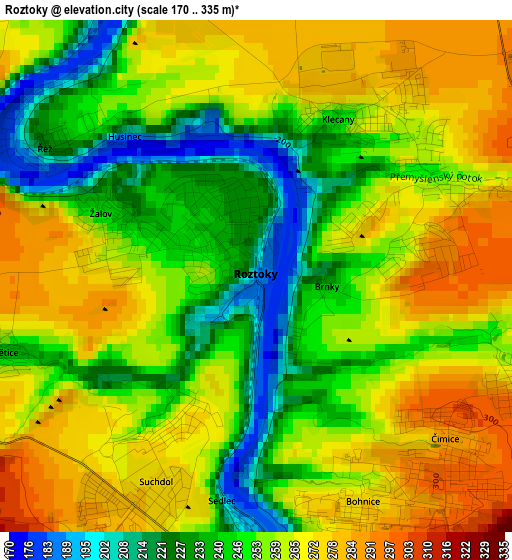
Below is the Elevation map of Roztoky, which displays elevation range with different colors. Scale of the first map is from 170 to 335 m (558 to 1099 ft) with average elevation of 256 meters (=840 ft) [note 1]
These maps also provides idea of topography and contour of this city, they are displayed at different zoom levels. More info about maps, scale and edge coordinates you can find below images.
| \ | Map #1 | Map #2 | Topo.Map |
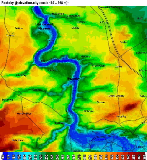
| Scale [m] | 170..335 m | 169..368 m | × |
| Scale [ft] | 558..1099 ft | 554..1207 ft | × |
| Average | 256 m = 840 ft | 268.2 m = 880 ft | × |
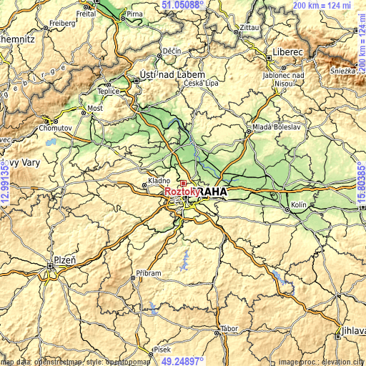
| Width | 6.26 km = 3.9 mi | 12.52 km = 7.8 mi | 200.4 km = 124.5 mi |
| Height | 6.26 km = 3.9 mi | 12.52 km = 7.8 mi | 200.3 km = 124.5 mi |
| ↑Max Latitude | 50.186556° | 50.214685° | 51.05088° |
| Latitude at center | 50.15841° | 50.15841° | 50.15841° |
| ↓Min Latitude | 50.130247° | 50.102068° | 49.24897° |
| ← Min Longitude | 14.353655° | 14.309709° | 12.99135° |
| Longitude center | 14.3976° | 14.3976° | 14.3976° |
| →Max Longitude | 14.441545° | 14.485491° | 15.80385° |
Nearby cities:
Cities around Roztoky sort by population:
• Prague elevation 202 m
8 km,  168°
168°
• Libeň 192 m
7.8 km,  135°
135°
• Střížkov 296 m
7.7 km,  117°
117°
• Karlín 190 m
8.1 km,  154°
154°
• Malá Strana 209 m
7.9 km,  176°
176°
• Libčice nad Vltavou 191 m
5 km,  331°
331°
• Horoměřice 321 m
5.1 km,  234°
234°
• Klecany 249 m
2.2 km,  26°
26°
• Zdiby 292 m
4 km,  74°
74°
• Líbeznice 233 m
7.8 km,  61°
61°
• Velké Přílepy 280 m
5.9 km,  272°
272°
• Řež 184 m
3.6 km,  306°
306°
Multilingual:
 En español:
Roztoky elevación 189 m.
 En France:
Roztoky élévation 189 m.
 Auf Deutsch:
Roztoky u Prahy höhe über dem Meeresspiegel ist 189 m.

Sources and notes:
- [note 1] Map square and city borders are not equal. Map elevation data is calculated only from area inside that square.
- [src 1] Elevation data from geonames database provided with same terms of usage.
- [src 2] The elevation map of Roztoky is generated using elevation data from NASA's 3 arcsec (90m) resolution SRTM data.
- [src 3] Base (background) map © OpenStreetMap contributors tiles are generated by Geofabrik and OpenTopoMap.
Copyright & License:
This Roztoky Elevation Map is licensed under CC BY-SA. You may reuse any part from this page, if you give a proper credit by linking to this URL:
 More info on terms of use page.