Karlín elevation
Karlín (Hlavní město Praha, Praha 8), Czech Republic elevation is 190 meters and Karlín elevation in feet is 623 ft above sea level [src 1]. Karlín is a section of populated place (feature code) with elevation that is 155 meters (509 ft) smaller than average city elevation in Czech Republic.
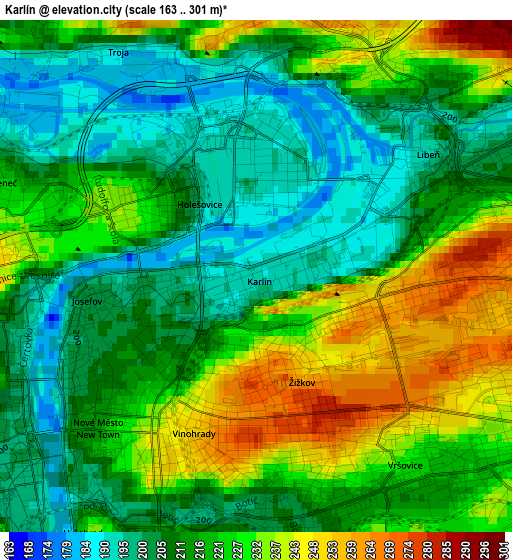
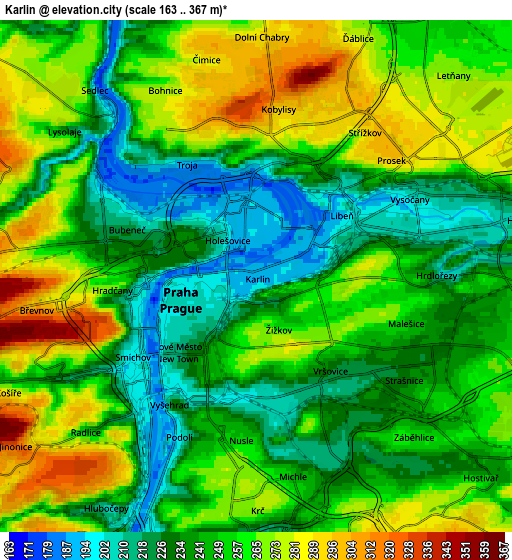
Below is the Elevation map of Karlín, which displays elevation range with different colors. Scale of the first map is from 163 to 301 m (535 to 988 ft) with average elevation of 218 meters (=715 ft) [note 1]
These maps also provides idea of topography and contour of this city, they are displayed at different zoom levels. More info about maps, scale and edge coordinates you can find below images.
| \ | Map #1 | Map #2 | Topo.Map |
| Scale [m] | 163..301 m | 163..367 m | × |
| Scale [ft] | 535..988 ft | 535..1204 ft | × |
| Average | 218 m = 715 ft | 250.6 m = 822 ft | × |
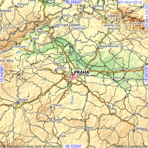
| Width | 6.27 km = 3.9 mi | 12.54 km = 7.8 mi | 200.6 km = 124.6 mi |
| Height | 6.27 km = 3.9 mi | 12.54 km = 7.8 mi | 200.6 km = 124.6 mi |
| ↑Max Latitude | 50.120905° | 50.149073° | 50.98642° |
| Latitude at center | 50.09272° | 50.09272° | 50.09272° |
| ↓Min Latitude | 50.064519° | 50.036301° | 49.18204° |
| ← Min Longitude | 14.403165° | 14.359219° | 13.04086° |
| Longitude center | 14.44711° | 14.44711° | 14.44711° |
| →Max Longitude | 14.491055° | 14.535001° | 15.85336° |
Nearby cities:
Cities around Karlín sort by population:
• Prague elevation 202 m
2 km,  254°
254°
• Libeň 192 m
2.6 km,  48°
48°
• Braník 201 m
6.8 km,  199°
199°
• Letňany 276 m
6.7 km, 47°
• Prosek 249 m
4.9 km,  59°
59°
• Střížkov 296 m
5 km,  41°
41°
• Vysočany 209 m
5.3 km,  69°
69°
• Staré Město 206 m
2 km, 251°
• Malá Strana 209 m
3.1 km,  259°
259°
• Hodkovičky 244 m
8.1 km, 196°
• Vysehrad 221 m
3.7 km,  214°
214°
• Hostavice 229 m
7.9 km,  89°
89°
Multilingual:
 En español:
Karlín elevación 190 m.
 En France:
Karlín élévation 190 m.


Sources and notes:
- [note 1] Map square and city borders are not equal. Map elevation data is calculated only from area inside that square.
- [src 1] Elevation data from geonames database provided with same terms of usage.
- [src 2] The elevation map of Karlín is generated using elevation data from NASA's 3 arcsec (90m) resolution SRTM data.
- [src 3] Base (background) map © OpenStreetMap contributors tiles are generated by Geofabrik and OpenTopoMap.
Copyright & License:
This Karlín Elevation Map is licensed under CC BY-SA. You may reuse any part from this page, if you give a proper credit by linking to this URL:
 More info on terms of use page.