Braník elevation
Braník (Hlavní město Praha, Praha 4), Czech Republic elevation is 201 meters and Braník elevation in feet is 659 ft above sea level [src 1]. Braník is a section of populated place (feature code) with elevation that is 144 meters (472 ft) smaller than average city elevation in Czech Republic.
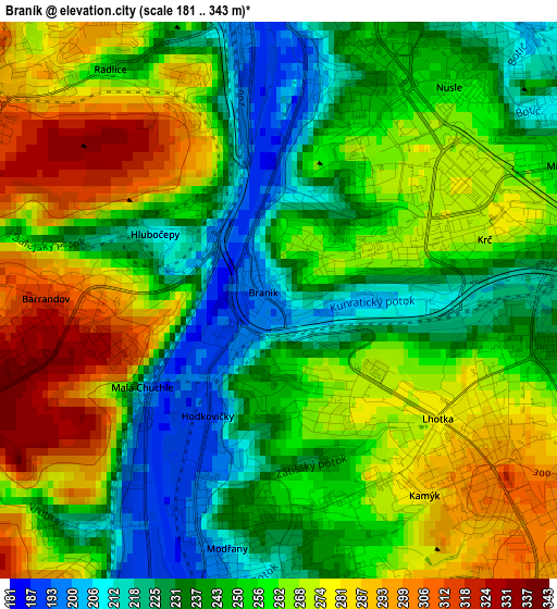
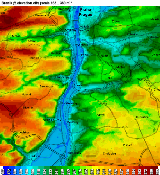
Below is the Elevation map of Braník, which displays elevation range with different colors. Scale of the first map is from 181 to 343 m (594 to 1125 ft) with average elevation of 255 meters (=837 ft) [note 1]
These maps also provides idea of topography and contour of this city, they are displayed at different zoom levels. More info about maps, scale and edge coordinates you can find below images.
| \ | Map #1 | Map #2 | Topo.Map |
| Scale [m] | 181..343 m | 163..389 m | × |
| Scale [ft] | 594..1125 ft | 535..1276 ft | × |
| Average | 255 m = 837 ft | 273 m = 896 ft | × |
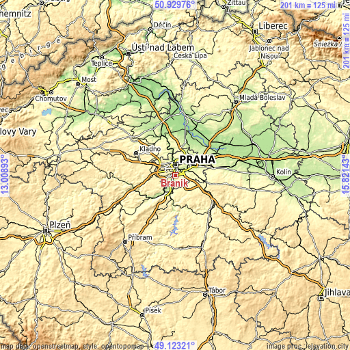
| Width | 6.28 km = 3.9 mi | 12.55 km = 7.8 mi | 200.9 km = 124.8 mi |
| Height | 6.28 km = 3.9 mi | 12.55 km = 7.8 mi | 200.9 km = 124.8 mi |
| ↑Max Latitude | 50.063199° | 50.091401° | 50.92976° |
| Latitude at center | 50.03498° | 50.03498° | 50.03498° |
| ↓Min Latitude | 50.006745° | 49.978493° | 49.12321° |
| ← Min Longitude | 14.371235° | 14.327289° | 13.00893° |
| Longitude center | 14.41518° | 14.41518° | 14.41518° |
| →Max Longitude | 14.459125° | 14.503071° | 15.82143° |
Nearby cities:
Cities around Braník sort by population:
• Prague elevation 202 m
5.9 km,  3°
3°
• Modřany 231 m
2.7 km,  188°
188°
• Libeň 192 m
9.2 km,  27°
27°
• Karlín 190 m
6.8 km,  19°
19°
• Staré Město 206 m
5.8 km, 3°
• Malá Strana 209 m
5.9 km,  352°
352°
• Hodkovičky 244 m
1.3 km,  183°
183°
• Jesenice 351 m
10.2 km,  136°
136°
• Průhonice 296 m
10.4 km,  112°
112°
• Vysehrad 221 m
3.4 km, 2°
• Dolní Břežany 334 m
8.6 km,  158°
158°
• Vestec 331 m
8.8 km,  133°
133°
Multilingual:
 En español:
Braník elevación 201 m.
 En France:
Braník élévation 201 m.


Sources and notes:
- [note 1] Map square and city borders are not equal. Map elevation data is calculated only from area inside that square.
- [src 1] Elevation data from geonames database provided with same terms of usage.
- [src 2] The elevation map of Braník is generated using elevation data from NASA's 3 arcsec (90m) resolution SRTM data.
- [src 3] Base (background) map © OpenStreetMap contributors tiles are generated by Geofabrik and OpenTopoMap.
Copyright & License:
This Braník Elevation Map is licensed under CC BY-SA. You may reuse any part from this page, if you give a proper credit by linking to this URL:
 More info on terms of use page.