Velké Přílepy elevation
Velké Přílepy (Central Bohemia, Okres Praha-západ), Czech Republic elevation is 280 meters and Velké Přílepy elevation in feet is 919 ft above sea level [src 1]. Velké Přílepy is a populated place (feature code) with elevation that is 65 meters (213 ft) smaller than average city elevation in Czech Republic.
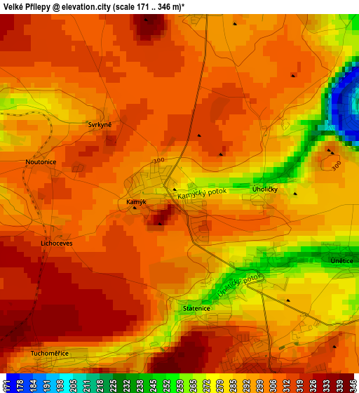
Below is the Elevation map of Velké Přílepy, which displays elevation range with different colors. Scale of the first map is from 171 to 346 m (561 to 1135 ft) with average elevation of 299.3 meters (=982 ft) [note 1]
These maps also provides idea of topography and contour of this city, they are displayed at different zoom levels. More info about maps, scale and edge coordinates you can find below images.
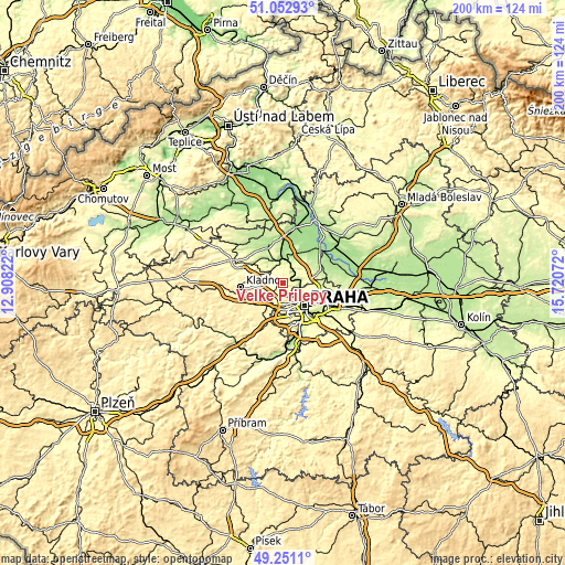
| \ | Map #1 | Topo.Map |
| Scale [m] | 171..346 m | × |
| Scale [ft] | 561..1135 ft | × |
| Average | 299.3 m = 982 ft | × |
| Width | 6.26 km = 3.9 mi | 200.3 km = 124.5 mi |
| Height | 6.26 km = 3.9 mi | 200.3 km = 124.5 mi |
| ↑Max Latitude | 50.188645° | 51.05293° |
| Latitude at center | 50.1605° | 50.1605° |
| ↓Min Latitude | 50.132339° | 49.2511° |
| ← Min Longitude | 14.270525° | 12.90822° |
| Longitude center | 14.31447° | 14.31447° |
| →Max Longitude | 14.358415° | 15.72072° |
Nearby cities:
Cities around Velké Přílepy sort by population:
• Kralupy nad Vltavou elevation 179 m
9 km,  358°
358°
• Malá Strana 209 m
10.3 km,  141°
141°
• Roztoky 189 m
5.9 km,  92°
92°
• Hostivice 344 m
9.6 km,  204°
204°
• Odolena Voda 247 m
10.6 km,  40°
40°
• Libčice nad Vltavou 191 m
5.4 km, 40°
• Buštěhrad 323 m
9 km,  266°
266°
• Horoměřice 321 m
3.6 km,  151°
151°
• Klecany 249 m
7.1 km,  76°
76°
• Zdiby 292 m
9.8 km, 85°
• Tuchoměřice 311 m
3.6 km,  219°
219°
• Řež 184 m
3.6 km,  58°
58°
Multilingual:
 En español:
Velké Přílepy elevación 280 m.
 En France:
Velké Přílepy élévation 280 m.
 Auf Deutsch:
Velké Přílepy höhe über dem Meeresspiegel ist 280 m.

Sources and notes:
- [note 1] Map square and city borders are not equal. Map elevation data is calculated only from area inside that square.
- [src 1] Elevation data from geonames database provided with same terms of usage.
- [src 2] The elevation map of Velké Přílepy is generated using elevation data from NASA's 3 arcsec (90m) resolution SRTM data.
- [src 3] Base (background) map © OpenStreetMap contributors tiles are generated by Geofabrik and OpenTopoMap.
Copyright & License:
This Velké Přílepy Elevation Map is licensed under CC BY-SA. You may reuse any part from this page, if you give a proper credit by linking to this URL:
 More info on terms of use page.