Slaný elevation
Slaný (Central Bohemia, Okres Kladno), Czech Republic elevation is 282 meters and Slaný elevation in feet is 925 ft above sea level [src 1]. Slaný is a populated place (feature code) with elevation that is 63 meters (207 ft) smaller than average city elevation in Czech Republic.
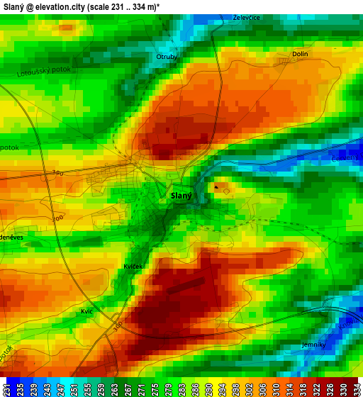
Below is the Elevation map of Slaný, which displays elevation range with different colors. Scale of the first map is from 231 to 334 m (758 to 1096 ft) with average elevation of 287 meters (=942 ft) [note 1]
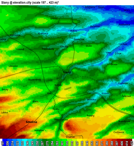
These maps also provides idea of topography and contour of this city, they are displayed at different zoom levels. More info about maps, scale and edge coordinates you can find below images.
| \ | Map #1 | Map #2 | Topo.Map |
| Scale [m] | 231..334 m | 197..423 m | × |
| Scale [ft] | 758..1096 ft | 646..1388 ft | × |
| Average | 287 m = 942 ft | 289.5 m = 950 ft | × |
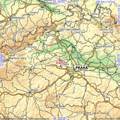
| Width | 6.25 km = 3.9 mi | 12.5 km = 7.8 mi | 200.1 km = 124.3 mi |
| Height | 6.25 km = 3.9 mi | 12.5 km = 7.8 mi | 200 km = 124.3 mi |
| ↑Max Latitude | 50.258564° | 50.286651° | 51.12157° |
| Latitude at center | 50.23046° | 50.23046° | 50.23046° |
| ↓Min Latitude | 50.20234° | 50.174203° | 49.32238° |
| ← Min Longitude | 14.042985° | 13.999039° | 12.68068° |
| Longitude center | 14.08693° | 14.08693° | 14.08693° |
| →Max Longitude | 14.130875° | 14.174821° | 15.49318° |
Nearby cities:
Cities around Slaný sort by population:
• Kladno elevation 390 m
9.3 km,  173°
173°
• Velvary 191 m
12 km,  61°
61°
• Libušín 318 m
7.3 km,  198°
198°
• Buštěhrad 323 m
11 km,  138°
138°
• Zlonice 224 m
6.4 km,  3°
3°
• Smečno 374 m
5.7 km,  215°
215°
• Pchery 302 m
4.6 km,  151°
151°
• Vinařice 353 m
6.1 km,  177°
177°
• Brandýsek 273 m
7 km,  130°
130°
• Hřebeč 352 m
11.9 km, 152°
• Kačice 401 m
10.3 km, 222°
• Klobuky 265 m
10 km,  314°
314°
Multilingual:
 En español:
Slaný elevación 282 m.
 En France:
Slaný élévation 282 m.


Sources and notes:
- [note 1] Map square and city borders are not equal. Map elevation data is calculated only from area inside that square.
- [src 1] Elevation data from geonames database provided with same terms of usage.
- [src 2] The elevation map of Slaný is generated using elevation data from NASA's 3 arcsec (90m) resolution SRTM data.
- [src 3] Base (background) map © OpenStreetMap contributors tiles are generated by Geofabrik and OpenTopoMap.
Copyright & License:
This Slaný Elevation Map is licensed under CC BY-SA. You may reuse any part from this page, if you give a proper credit by linking to this URL:
 More info on terms of use page.