Velvary elevation
Velvary (Central Bohemia, Okres Kladno), Czech Republic elevation is 191 meters and Velvary elevation in feet is 627 ft above sea level [src 1]. Velvary is a populated place (feature code) with elevation that is 154 meters (505 ft) smaller than average city elevation in Czech Republic.
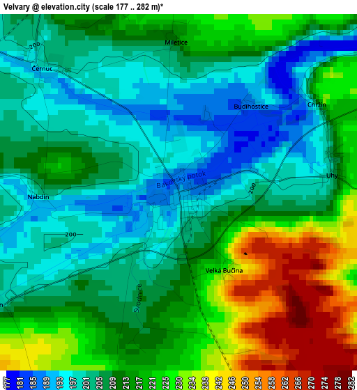
Below is the Elevation map of Velvary, which displays elevation range with different colors. Scale of the first map is from 177 to 282 m (581 to 925 ft) with average elevation of 212.6 meters (=698 ft) [note 1]
These maps also provides idea of topography and contour of this city, they are displayed at different zoom levels. More info about maps, scale and edge coordinates you can find below images.
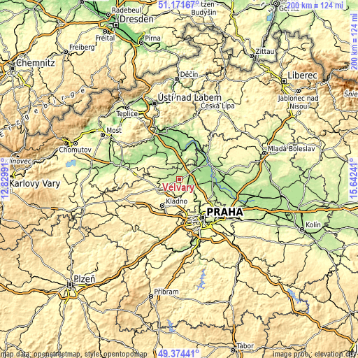
| \ | Map #1 | Topo.Map |
| Scale [m] | 177..282 m | × |
| Scale [ft] | 581..925 ft | × |
| Average | 212.6 m = 698 ft | × |
| Width | 6.24 km = 3.9 mi | 199.8 km = 124.1 mi |
| Height | 6.24 km = 3.9 mi | 199.8 km = 124.1 mi |
| ↑Max Latitude | 50.309593° | 51.17167° |
| Latitude at center | 50.28152° | 50.28152° |
| ↓Min Latitude | 50.25343° | 49.37441° |
| ← Min Longitude | 14.192215° | 12.82991° |
| Longitude center | 14.23616° | 14.23616° |
| →Max Longitude | 14.280105° | 15.64241° |
Nearby cities:
Cities around Velvary sort by population:
• Kralupy nad Vltavou elevation 179 m
7 km,  130°
130°
• Slaný 282 m
12 km,  241°
241°
• Odolena Voda 247 m
13.5 km,  113°
113°
• Libčice nad Vltavou 191 m
13 km,  135°
135°
• Buštěhrad 323 m
14.4 km,  193°
193°
• Zlonice 224 m
10.3 km,  273°
273°
• Pchery 302 m
12.9 km,  220°
220°
• Brandýsek 273 m
11.5 km,  207°
207°
• Veltrusy 176 m
6.7 km,  100°
100°
• Lužec nad Vltavou 169 m
12.5 km,  69°
69°
• Nelahozeves 190 m
5 km,  116°
116°
• Řež 184 m
14.4 km, 143°
Multilingual:
 En español:
Velvary elevación 191 m.
 En France:
Velvary élévation 191 m.


Sources and notes:
- [note 1] Map square and city borders are not equal. Map elevation data is calculated only from area inside that square.
- [src 1] Elevation data from geonames database provided with same terms of usage.
- [src 2] The elevation map of Velvary is generated using elevation data from NASA's 3 arcsec (90m) resolution SRTM data.
- [src 3] Base (background) map © OpenStreetMap contributors tiles are generated by Geofabrik and OpenTopoMap.
Copyright & License:
This Velvary Elevation Map is licensed under CC BY-SA. You may reuse any part from this page, if you give a proper credit by linking to this URL:
 More info on terms of use page.