Kladno elevation
Kladno (Central Bohemia, Okres Kladno), Czech Republic elevation is 390 meters and Kladno elevation in feet is 1280 ft above sea level [src 1]. Kladno is a populated place (feature code) with elevation that is 45 meters (148 ft) bigger than average city elevation in Czech Republic.
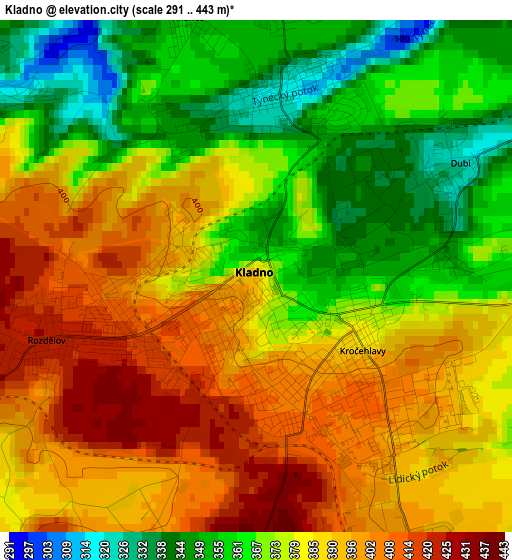
Below is the Elevation map of Kladno, which displays elevation range with different colors. Scale of the first map is from 291 to 443 m (955 to 1453 ft) with average elevation of 379.4 meters (=1245 ft) [note 1]
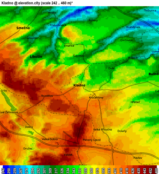
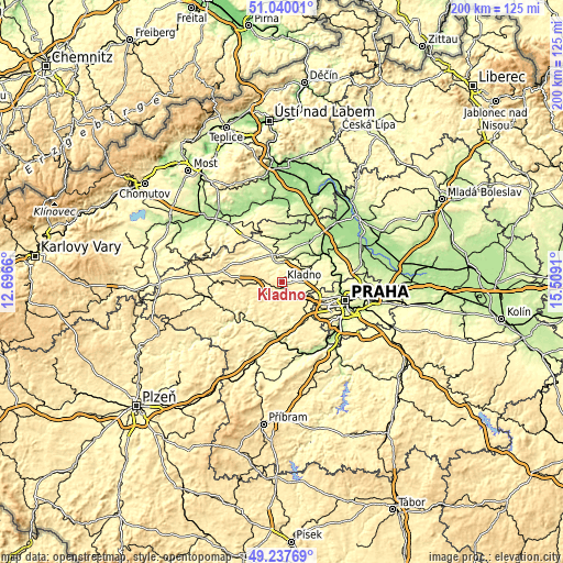
These maps also provides idea of topography and contour of this city, they are displayed at different zoom levels. More info about maps, scale and edge coordinates you can find below images.
| \ | Map #1 | Map #2 | Topo.Map |
| Scale [m] | 291..443 m | 242..460 m | × |
| Scale [ft] | 955..1453 ft | 794..1509 ft | × |
| Average | 379.4 m = 1245 ft | 369.2 m = 1211 ft | × |
| Width | 6.26 km = 3.9 mi | 12.52 km = 7.8 mi | 200.4 km = 124.5 mi |
| Height | 6.26 km = 3.9 mi | 12.52 km = 7.8 mi | 200.4 km = 124.5 mi |
| ↑Max Latitude | 50.175493° | 50.203629° | 51.04001° |
| Latitude at center | 50.14734° | 50.14734° | 50.14734° |
| ↓Min Latitude | 50.119171° | 50.090985° | 49.23769° |
| ← Min Longitude | 14.058905° | 14.014959° | 12.6966° |
| Longitude center | 14.10285° | 14.10285° | 14.10285° |
| →Max Longitude | 14.146795° | 14.190741° | 15.5091° |
Nearby cities:
Cities around Kladno sort by population:
• Unhošť elevation 389 m
7.2 km,  164°
164°
• Libušín 318 m
4.1 km,  303°
303°
• Buštěhrad 323 m
6.2 km,  81°
81°
• Tuchlovice 390 m
8 km,  262°
262°
• Smečno 374 m
6.4 km,  315°
315°
• Pchery 302 m
5.3 km,  11°
11°
• Vinařice 353 m
3.3 km,  345°
345°
• Brandýsek 273 m
6.3 km,  42°
42°
• Kamenné Žehrovice 403 m
6.5 km,  249°
249°
• Hřebeč 352 m
4.6 km,  106°
106°
• Velká Dobrá 405 m
4.8 km,  209°
209°
• Doksy 399 m
5 km,  231°
231°
Multilingual:
 En español:
Kladno elevación 390 m.
 En France:
Kladno élévation 390 m.


Sources and notes:
- [note 1] Map square and city borders are not equal. Map elevation data is calculated only from area inside that square.
- [src 1] Elevation data from geonames database provided with same terms of usage.
- [src 2] The elevation map of Kladno is generated using elevation data from NASA's 3 arcsec (90m) resolution SRTM data.
- [src 3] Base (background) map © OpenStreetMap contributors tiles are generated by Geofabrik and OpenTopoMap.
Copyright & License:
This Kladno Elevation Map is licensed under CC BY-SA. You may reuse any part from this page, if you give a proper credit by linking to this URL:
 More info on terms of use page.