Velká Bíteš elevation
Velká Bíteš (Vysočina, Okres Žďár nad Sázavou), Czech Republic elevation is 477 meters and Velká Bíteš elevation in feet is 1565 ft above sea level [src 1]. Velká Bíteš is a seat of a fourth-order administrative division (feature code) with elevation that is 132 meters (433 ft) bigger than average city elevation in Czech Republic.
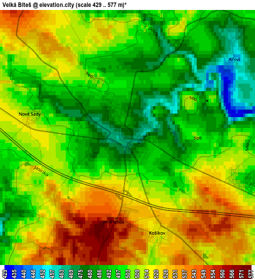
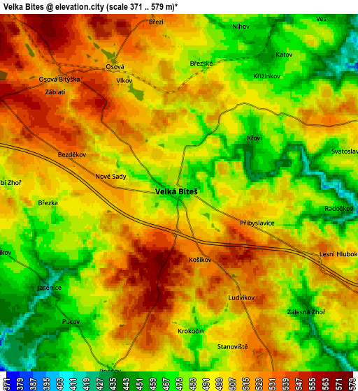
Below is the Elevation map of Velká Bíteš, which displays elevation range with different colors. Scale of the first map is from 429 to 577 m (1407 to 1893 ft) with average elevation of 505.5 meters (=1658 ft) [note 1]
These maps also provides idea of topography and contour of this city, they are displayed at different zoom levels. More info about maps, scale and edge coordinates you can find below images.
| \ | Map #1 | Map #2 | Topo.Map |
| Scale [m] | 429..577 m | 371..579 m | × |
| Scale [ft] | 1407..1893 ft | 1217..1900 ft | × |
| Average | 505.5 m = 1658 ft | 497 m = 1631 ft | × |
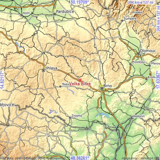
| Width | 6.37 km = 4 mi | 12.75 km = 7.9 mi | 204 km = 126.8 mi |
| Height | 6.37 km = 4 mi | 12.75 km = 7.9 mi | 204 km = 126.8 mi |
| ↑Max Latitude | 49.317035° | 49.345674° | 50.19709° |
| Latitude at center | 49.28838° | 49.28838° | 49.28838° |
| ↓Min Latitude | 49.259708° | 49.23102° | 48.36261° |
| ← Min Longitude | 16.183475° | 16.139529° | 14.82117° |
| Longitude center | 16.22742° | 16.22742° | 16.22742° |
| →Max Longitude | 16.271365° | 16.315311° | 17.63367° |
Nearby cities:
Cities around Velká Bíteš sort by population:
• Tišnov elevation 272 m
15.8 km,  64°
64°
• Rosice 339 m
16.6 km,  135°
135°
• Náměšť nad Oslavou 429 m
10.3 km,  209°
209°
• Zbýšov 351 m
17.3 km,  149°
149°
• Veverská Bítýška 235 m
15.3 km,  95°
95°
• Zastávka 319 m
14.9 km, 138°
• Křižanov 525 m
14 km,  322°
322°
• Říčany 349 m
14.6 km,  124°
124°
• Předklášteří 261 m
14.6 km, 60°
• Zbraslav 464 m
8.9 km, 146°
• Budišov 484 m
16.3 km,  263°
263°
• Dolní Loućky 280 m
12.5 km,  49°
49°
Multilingual:
 En español:
Velká Bíteš elevación 477 m.
 En France:
Velká Bíteš élévation 477 m.
 Auf Deutsch:
Velká Bíteš höhe über dem Meeresspiegel ist 477 m.

Sources and notes:
- [note 1] Map square and city borders are not equal. Map elevation data is calculated only from area inside that square.
- [src 1] Elevation data from geonames database provided with same terms of usage.
- [src 2] The elevation map of Velká Bíteš is generated using elevation data from NASA's 3 arcsec (90m) resolution SRTM data.
- [src 3] Base (background) map © OpenStreetMap contributors tiles are generated by Geofabrik and OpenTopoMap.
Copyright & License:
This Velká Bíteš Elevation Map is licensed under CC BY-SA. You may reuse any part from this page, if you give a proper credit by linking to this URL:
 More info on terms of use page.