Vítkov elevation
Vítkov (Moravskoslezský, Okres Opava), Czech Republic elevation is 470 meters and Vítkov elevation in feet is 1542 ft above sea level [src 1]. Vítkov is a populated place (feature code) with elevation that is 125 meters (410 ft) bigger than average city elevation in Czech Republic.
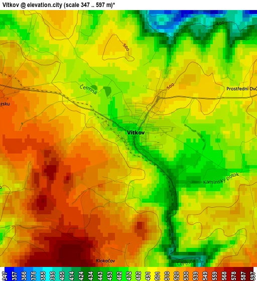
Below is the Elevation map of Vítkov, which displays elevation range with different colors. Scale of the first map is from 347 to 597 m (1138 to 1959 ft) with average elevation of 499.6 meters (=1639 ft) [note 1]
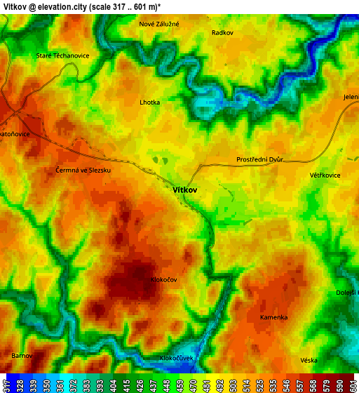
These maps also provides idea of topography and contour of this city, they are displayed at different zoom levels. More info about maps, scale and edge coordinates you can find below images.
| \ | Map #1 | Map #2 | Topo.Map |
| Scale [m] | 347..597 m | 317..601 m | × |
| Scale [ft] | 1138..1959 ft | 1040..1972 ft | × |
| Average | 499.6 m = 1639 ft | 485.2 m = 1592 ft | × |
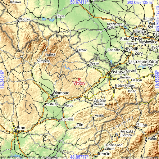
| Width | 6.31 km = 3.9 mi | 12.62 km = 7.8 mi | 202 km = 125.5 mi |
| Height | 6.31 km = 3.9 mi | 12.62 km = 7.8 mi | 201.9 km = 125.5 mi |
| ↑Max Latitude | 49.802821° | 49.831176° | 50.67411° |
| Latitude at center | 49.77445° | 49.77445° | 49.77445° |
| ↓Min Latitude | 49.746062° | 49.717657° | 48.85777° |
| ← Min Longitude | 17.705465° | 17.661519° | 16.34316° |
| Longitude center | 17.74941° | 17.74941° | 17.74941° |
| →Max Longitude | 17.793355° | 17.837301° | 19.15566° |
Nearby cities:
Cities around Vítkov sort by population:
• Odry elevation 305 m
13.8 km,  154°
154°
• Fulnek 290 m
13 km,  121°
121°
• Hradec nad Moravici 278 m
14.1 km,  40°
40°
• Budišov nad Budišovkou 510 m
8.9 km,  284°
284°
• Slavkov 296 m
17.5 km,  20°
20°
• Dvorce 553 m
15.9 km,  294°
294°
• Březová 518 m
8.6 km,  77°
77°
• Otice 262 m
18 km,  28°
28°
• Potštát 498 m
16.8 km,  204°
204°
• Město Libavá 544 m
17.5 km,  250°
250°
• Dolní Životice 304 m
13.8 km,  9°
9°
• Jakartovice 358 m
16.3 km,  343°
343°
Multilingual:
 En español:
Vítkov elevación 470 m.
 En France:
Vítkov élévation 470 m.


Sources and notes:
- [note 1] Map square and city borders are not equal. Map elevation data is calculated only from area inside that square.
- [src 1] Elevation data from geonames database provided with same terms of usage.
- [src 2] The elevation map of Vítkov is generated using elevation data from NASA's 3 arcsec (90m) resolution SRTM data.
- [src 3] Base (background) map © OpenStreetMap contributors tiles are generated by Geofabrik and OpenTopoMap.
Copyright & License:
This Vítkov Elevation Map is licensed under CC BY-SA. You may reuse any part from this page, if you give a proper credit by linking to this URL:
 More info on terms of use page.