Guisa elevation
Guisa (Granma), Cuba elevation is 201 meters and Guisa elevation in feet is 659 ft above sea level [src 1]. Guisa is a seat of a second-order administrative division (feature code) with elevation that is 132 meters (433 ft) bigger than average city elevation in Cuba.
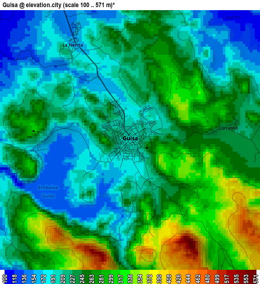
Below is the Elevation map of Guisa, which displays elevation range with different colors. Scale of the first map is from 100 to 571 m (328 to 1873 ft) with average elevation of 241.6 meters (=793 ft) [note 1]
These maps also provides idea of topography and contour of this city, they are displayed at different zoom levels. More info about maps, scale and edge coordinates you can find below images.
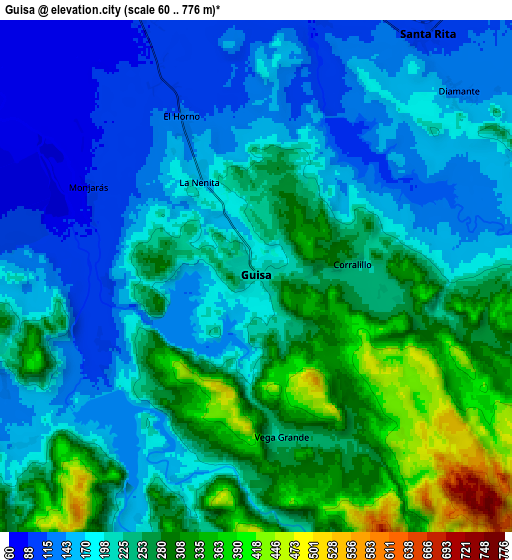
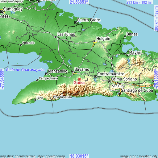
| \ | Map #1 | Map #2 | Topo.Map |
| Scale [m] | 100..571 m | 60..776 m | × |
| Scale [ft] | 328..1873 ft | 197..2546 ft | × |
| Average | 241.6 m = 793 ft | 221.4 m = 726 ft | × |
| Width | 9.17 km = 5.7 mi | 18.34 km = 11.4 mi | 293.4 km = 182.3 mi |
| Height | 9.17 km = 5.7 mi | 18.34 km = 11.4 mi | 293.4 km = 182.3 mi |
| ↑Max Latitude | 20.296162° | 20.337374° | 21.56853° |
| Latitude at center | 20.25494° | 20.25494° | 20.25494° |
| ↓Min Latitude | 20.213707° | 20.172463° | 18.93015° |
| ← Min Longitude | -76.583245° | -76.627191° | -77.94555° |
| Longitude center | -76.5393° | -76.5393° | -76.5393° |
| →Max Longitude | -76.495355° | -76.451409° | -75.13305° |
Nearby cities:
Cities around Guisa sort by population:
• Bayamo elevation 58 m
17.1 km,  320°
320°
• Manzanillo 32 m
61.5 km,  279°
279°
• Palma Soriano 152 m
57.1 km,  94°
94°
• Contramaestre 114 m
31.1 km,  80°
80°
• Bartolomé Masó 65 m
43.3 km,  256°
256°
• San Germán 98 m
57.1 km,  47°
47°
• Cacocum 74 m
58.1 km,  22°
22°
• Jiguaní 122 m
17.1 km,  42°
42°
• Yara 30 m
43 km,  272°
272°
• Río Cauto 12 m
51.9 km,  310°
310°
• Cauto Cristo 51 m
34.3 km,  11°
11°
• Buey Arriba 136 m
24.5 km,  247°
247°
Multilingual:
 En español:
Guisa elevación 201 m.
 En France:
Guisa élévation 201 m.


Sources and notes:
- [note 1] Map square and city borders are not equal. Map elevation data is calculated only from area inside that square.
- [src 1] Elevation data from geonames database provided with same terms of usage.
- [src 2] The elevation map of Guisa is generated using elevation data from NASA's 3 arcsec (90m) resolution SRTM data.
- [src 3] Base (background) map © OpenStreetMap contributors tiles are generated by Geofabrik and OpenTopoMap.
Copyright & License:
This Guisa Elevation Map is licensed under CC BY-SA. You may reuse any part from this page, if you give a proper credit by linking to this URL:
 More info on terms of use page.