Mariel elevation
Mariel (Artemisa), Cuba elevation is 16 meters and Mariel elevation in feet is 52 ft above sea level [src 1]. Mariel is a seat of a second-order administrative division (feature code) with elevation that is 53 meters (174 ft) smaller than average city elevation in Cuba.
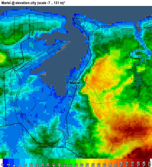
Below is the Elevation map of Mariel, which displays elevation range with different colors. Scale of the first map is from -7 to 131 m (-23 to 430 ft) with average elevation of 37 meters (=121 ft) [note 1]
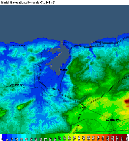
These maps also provides idea of topography and contour of this city, they are displayed at different zoom levels. More info about maps, scale and edge coordinates you can find below images.
| \ | Map #1 | Map #2 | Topo.Map |
| Scale [m] | -7..131 m | -7..241 m | × |
| Scale [ft] | -23..430 ft | -23..791 ft | × |
| Average | 37 m = 121 ft | 54.3 m = 178 ft | × |
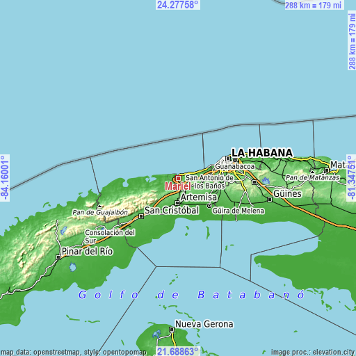
| Width | 9 km = 5.6 mi | 17.99 km = 11.2 mi | 287.9 km = 178.9 mi |
| Height | 9 km = 5.6 mi | 17.99 km = 11.2 mi | 287.9 km = 178.9 mi |
| ↑Max Latitude | 23.029759° | 23.070196° | 24.27758° |
| Latitude at center | 22.98931° | 22.98931° | 22.98931° |
| ↓Min Latitude | 22.948849° | 22.908376° | 21.68863° |
| ← Min Longitude | -82.797705° | -82.841651° | -84.16001° |
| Longitude center | -82.75376° | -82.75376° | -82.75376° |
| →Max Longitude | -82.709815° | -82.665869° | -81.34751° |
Nearby cities:
Cities around Mariel sort by population:
• Boyeros elevation 66 m
36.1 km,  86°
86°
• Güira de Melena 21 m
33.2 km,  130°
130°
• Artemisa 54 m
19.2 km,  181°
181°
• Bauta 70 m
21.2 km, 92°
• San Antonio de los Baños 60 m
28.1 km,  113°
113°
• La Salud 62 m
36.3 km, 111°
• Guanajay 109 m
9.7 km,  135°
135°
• Alquízar 21 m
26.9 km, 139°
• Candelaria 59 m
34.8 km,  217°
217°
• Soroa 226 m
34.2 km,  231°
231°
• Cabañas 7 m
17.3 km,  266°
266°
• Caimito 74 m
16.9 km,  104°
104°
Multilingual:
 En español:
Mariel elevación 16 m.
 En France:
Mariel élévation 16 m.


Sources and notes:
- [note 1] Map square and city borders are not equal. Map elevation data is calculated only from area inside that square.
- [src 1] Elevation data from geonames database provided with same terms of usage.
- [src 2] The elevation map of Mariel is generated using elevation data from NASA's 3 arcsec (90m) resolution SRTM data.
- [src 3] Base (background) map © OpenStreetMap contributors tiles are generated by Geofabrik and OpenTopoMap.
Copyright & License:
This Mariel Elevation Map is licensed under CC BY-SA. You may reuse any part from this page, if you give a proper credit by linking to this URL:
 More info on terms of use page.