Güira de Melena elevation
Güira de Melena (Artemisa), Cuba elevation is 21 meters and Güira de Melena elevation in feet is 69 ft above sea level [src 1]. Güira de Melena is a seat of a second-order administrative division (feature code) with elevation that is 48 meters (157 ft) smaller than average city elevation in Cuba.
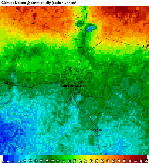
Below is the Elevation map of Güira de Melena, which displays elevation range with different colors. Scale of the first map is from 4 to 44 m (13 to 144 ft) with average elevation of 19.9 meters (=65 ft) [note 1]
These maps also provides idea of topography and contour of this city, they are displayed at different zoom levels. More info about maps, scale and edge coordinates you can find below images.
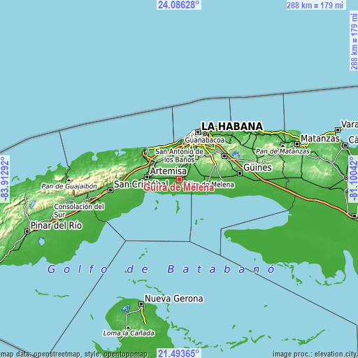
| \ | Map #1 | Map #2 | Topo.Map |
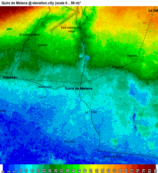
| Scale [m] | 4..44 m | 0..86 m | × |
| Scale [ft] | 13..144 ft | 0..282 ft | × |
| Average | 19.9 m = 65 ft | 24.4 m = 80 ft | × |
| Width | 9.01 km = 5.6 mi | 18.02 km = 11.2 mi | 288.3 km = 179.1 mi |
| Height | 9.01 km = 5.6 mi | 18.02 km = 11.2 mi | 288.3 km = 179.1 mi |
| ↑Max Latitude | 22.836637° | 22.877131° | 24.08628° |
| Latitude at center | 22.79613° | 22.79613° | 22.79613° |
| ↓Min Latitude | 22.755611° | 22.715081° | 21.49365° |
| ← Min Longitude | -82.550615° | -82.594561° | -83.91292° |
| Longitude center | -82.50667° | -82.50667° | -82.50667° |
| →Max Longitude | -82.462725° | -82.418779° | -81.10042° |
Nearby cities:
Cities around Güira de Melena sort by population:
• Boyeros elevation 66 m
25.8 km,  24°
24°
• Artemisa 54 m
26 km,  275°
275°
• Bauta 70 m
21.1 km,  348°
348°
• San Antonio de los Baños 60 m
10.5 km,  3°
3°
• Santiago de las Vegas 95 m
22.9 km,  32°
32°
• La Salud 62 m
12 km,  45°
45°
• Guanajay 109 m
23.5 km,  308°
308°
• Bejucal 110 m
19.1 km,  39°
39°
• Alquízar 21 m
8 km, 277°
• Batabanó 10 m
23.9 km,  111°
111°
• Quivicán 51 m
15.8 km,  79°
79°
• Caimito 74 m
19.4 km,  332°
332°
Multilingual:
 En español:
Güira de Melena elevación 21 m.
 En France:
Güira de Melena élévation 21 m.
 Auf Deutsch:
Güira de Melena höhe über dem Meeresspiegel ist 21 m.

Sources and notes:
- [note 1] Map square and city borders are not equal. Map elevation data is calculated only from area inside that square.
- [src 1] Elevation data from geonames database provided with same terms of usage.
- [src 2] The elevation map of Güira de Melena is generated using elevation data from NASA's 3 arcsec (90m) resolution SRTM data.
- [src 3] Base (background) map © OpenStreetMap contributors tiles are generated by Geofabrik and OpenTopoMap.
Copyright & License:
This Güira de Melena Elevation Map is licensed under CC BY-SA. You may reuse any part from this page, if you give a proper credit by linking to this URL:
 More info on terms of use page.