Anaime elevation
Anaime (Tolima, Cajamarca), Colombia elevation is 1818 meters and Anaime elevation in feet is 5965 ft above sea level [src 1]. Anaime is a populated place (feature code) with elevation that is 669 meters (2195 ft) bigger than average city elevation in Colombia.
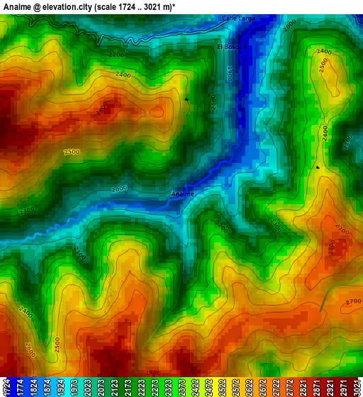
Below is the Elevation map of Anaime, which displays elevation range with different colors. Scale of the first map is from 1724 to 3021 m (5656 to 9911 ft) with average elevation of 2358.2 meters (=7737 ft) [note 1]
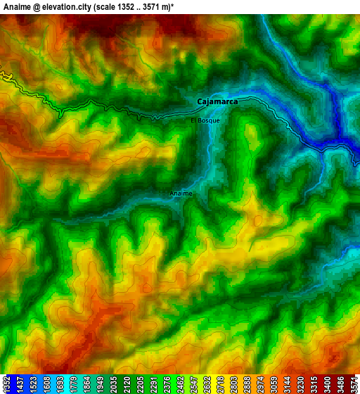
These maps also provides idea of topography and contour of this city, they are displayed at different zoom levels. More info about maps, scale and edge coordinates you can find below images.
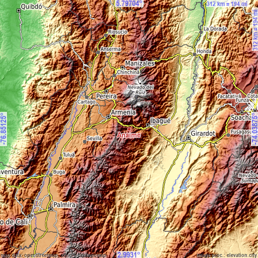
| \ | Map #1 | Map #2 | Topo.Map |
| Scale [m] | 1724..3021 m | 1352..3571 m | × |
| Scale [ft] | 5656..9911 ft | 4436..11716 ft | × |
| Average | 2358.2 m = 7737 ft | 2454.2 m = 8052 ft | × |
| Width | 9.74 km = 6.1 mi | 19.49 km = 12.1 mi | 311.8 km = 193.7 mi |
| Height | 9.74 km = 6.1 mi | 19.49 km = 12.1 mi | 311.8 km = 193.7 mi |
| ↑Max Latitude | 4.440205° | 4.484017° | 5.79704° |
| Latitude at center | 4.39639° | 4.39639° | 4.39639° |
| ↓Min Latitude | 4.352573° | 4.308753° | 2.9931° |
| ← Min Longitude | -75.488945° | -75.532891° | -76.85125° |
| Longitude center | -75.445° | -75.445° | -75.445° |
| →Max Longitude | -75.401055° | -75.357109° | -74.03875° |
Nearby cities:
Cities around Anaime sort by population:
• Ibagué elevation 1229 m
24.1 km,  78°
78°
• Armenia 1480 m
30.3 km,  300°
300°
• Calarcá 1537 m
26.3 km, 304°
• Circasia 1772 m
32.5 km,  319°
319°
• Coello 1303 m
16.7 km,  87°
87°
• Cajamarca 1818 m
5.4 km,  19°
19°
• Rovira 867 m
28.7 km,  127°
127°
• Pijao 2010 m
29.6 km,  256°
256°
• Salento 1995 m
30.2 km,  332°
332°
• Córdoba 1771 m
26.9 km,  268°
268°
• Buenavista 1514 m
32.8 km, 262°
• Laureles 1724 m
20.4 km,  138°
138°
Multilingual:
 En español:
Anaime elevación 1818 m.
 En France:
Anaime élévation 1818 m.


Sources and notes:
- [note 1] Map square and city borders are not equal. Map elevation data is calculated only from area inside that square.
- [src 1] Elevation data from geonames database provided with same terms of usage.
- [src 2] The elevation map of Anaime is generated using elevation data from NASA's 3 arcsec (90m) resolution SRTM data.
- [src 3] Base (background) map © OpenStreetMap contributors tiles are generated by Geofabrik and OpenTopoMap.
Copyright & License:
This Anaime Elevation Map is licensed under CC BY-SA. You may reuse any part from this page, if you give a proper credit by linking to this URL:
 More info on terms of use page.