Arenal elevation
Arenal (Bolívar), Colombia elevation is 44 meters and Arenal elevation in feet is 144 ft above sea level [src 1]. Arenal is a seat of a second-order administrative division (feature code) with elevation that is 1105 meters (3625 ft) smaller than average city elevation in Colombia.
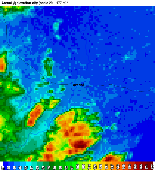
Below is the Elevation map of Arenal, which displays elevation range with different colors. Scale of the first map is from 29 to 177 m (95 to 581 ft) with average elevation of 54.5 meters (=179 ft) [note 1]
These maps also provides idea of topography and contour of this city, they are displayed at different zoom levels. More info about maps, scale and edge coordinates you can find below images.
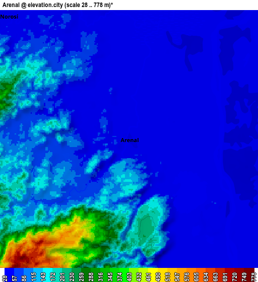
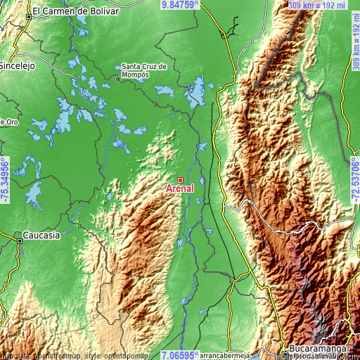
| \ | Map #1 | Map #2 | Topo.Map |
| Scale [m] | 29..177 m | 28..778 m | × |
| Scale [ft] | 95..581 ft | 92..2552 ft | × |
| Average | 54.5 m = 179 ft | 96.8 m = 318 ft | × |
| Width | 9.67 km = 6 mi | 19.33 km = 12 mi | 309.3 km = 192.2 mi |
| Height | 9.67 km = 6 mi | 19.33 km = 12 mi | 309.3 km = 192.2 mi |
| ↑Max Latitude | 8.502745° | 8.546205° | 9.84759° |
| Latitude at center | 8.45928° | 8.45928° | 8.45928° |
| ↓Min Latitude | 8.41581° | 8.372336° | 7.06595° |
| ← Min Longitude | -73.987255° | -74.031201° | -75.34956° |
| Longitude center | -73.94331° | -73.94331° | -73.94331° |
| →Max Longitude | -73.899365° | -73.855419° | -72.53706° |
Nearby cities:
Cities around Arenal sort by population:
• Aguachica elevation 164 m
39.7 km,  115°
115°
• Morales 42 m
22 km,  158°
158°
• Pelaya 73 m
39.8 km,  50°
50°
• Gamarra 42 m
26.8 km, 124°
• Río Viejo 37 m
18.3 km,  38°
38°
• La Gloria 36 m
23.5 km, 41°
• Altos del Rosario 22 m
44.3 km,  326°
326°
• Tamalameque 31 m
46 km,  18°
18°
• Tiquisio 48 m
36.8 km,  287°
287°
• Regidor 36 m
26.6 km,  30°
30°
• San Martín de Loba 32 m
54.1 km,  348°
348°
• Norosí 50 m
12.8 km,  306°
306°
Multilingual:
 En español:
Arenal elevación 44 m.
 En France:
Arenal élévation 44 m.


Sources and notes:
- [note 1] Map square and city borders are not equal. Map elevation data is calculated only from area inside that square.
- [src 1] Elevation data from geonames database provided with same terms of usage.
- [src 2] The elevation map of Arenal is generated using elevation data from NASA's 3 arcsec (90m) resolution SRTM data.
- [src 3] Base (background) map © OpenStreetMap contributors tiles are generated by Geofabrik and OpenTopoMap.
Copyright & License:
This Arenal Elevation Map is licensed under CC BY-SA. You may reuse any part from this page, if you give a proper credit by linking to this URL:
 More info on terms of use page.