Girón elevation
Girón (Santander), Colombia elevation is 706 meters and Girón elevation in feet is 2316 ft above sea level [src 1]. Girón is a seat of a second-order administrative division (feature code) with elevation that is 443 meters (1453 ft) smaller than average city elevation in Colombia.
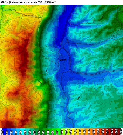
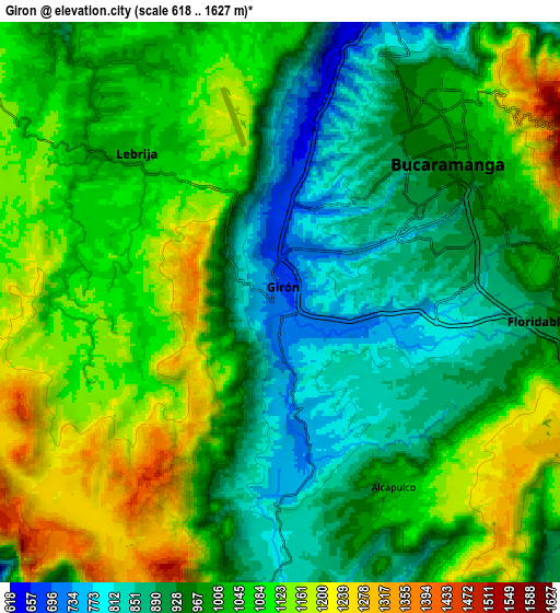
Below is the Elevation map of Girón, which displays elevation range with different colors. Scale of the first map is from 655 to 1396 m (2149 to 4580 ft) with average elevation of 916 meters (=3005 ft) [note 1]
These maps also provides idea of topography and contour of this city, they are displayed at different zoom levels. More info about maps, scale and edge coordinates you can find below images.
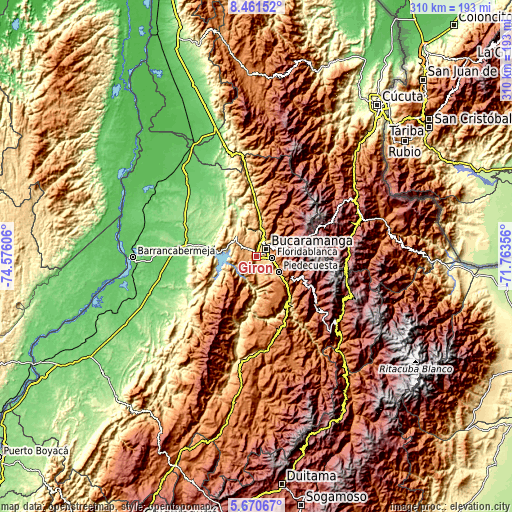
| \ | Map #1 | Map #2 | Topo.Map |
| Scale [m] | 655..1396 m | 618..1627 m | × |
| Scale [ft] | 2149..4580 ft | 2028..5338 ft | × |
| Average | 916 m = 3005 ft | 1015.2 m = 3331 ft | × |
| Width | 9.7 km = 6 mi | 19.4 km = 12.1 mi | 310.3 km = 192.8 mi |
| Height | 9.7 km = 6 mi | 19.4 km = 12.1 mi | 310.3 km = 192.8 mi |
| ↑Max Latitude | 7.111809° | 7.155414° | 8.46152° |
| Latitude at center | 7.0682° | 7.0682° | 7.0682° |
| ↓Min Latitude | 7.024587° | 6.980969° | 5.67067° |
| ← Min Longitude | -73.213755° | -73.257701° | -74.57606° |
| Longitude center | -73.16981° | -73.16981° | -73.16981° |
| →Max Longitude | -73.125865° | -73.081919° | -71.76356° |
Nearby cities:
Cities around Girón sort by population:
• Bucaramanga elevation 993 m
8.4 km,  40°
40°
• Floridablanca 928 m
9.2 km,  94°
94°
• Piedecuesta 1014 m
16 km,  123°
123°
• Lebrija 1016 m
7.3 km,  313°
313°
• Zapatoca 1696 m
30.1 km,  201°
201°
• Betulia 1823 m
22.5 km,  213°
213°
• Matanza 1588 m
33 km,  31°
31°
• Los Santos 1062 m
14.1 km, 36°
• Charta 2000 m
32.4 km, 43°
• Tona 1893 m
27.1 km,  56°
56°
• Santa Bárbara 1913 m
30.3 km,  106°
106°
• Rionegro 664 m
21.9 km,  5°
5°
Multilingual:
 En español:
Girón elevación 706 m.
 En France:
Girón élévation 706 m.


Sources and notes:
- [note 1] Map square and city borders are not equal. Map elevation data is calculated only from area inside that square.
- [src 1] Elevation data from geonames database provided with same terms of usage.
- [src 2] The elevation map of Girón is generated using elevation data from NASA's 3 arcsec (90m) resolution SRTM data.
- [src 3] Base (background) map © OpenStreetMap contributors tiles are generated by Geofabrik and OpenTopoMap.
Copyright & License:
This Girón Elevation Map is licensed under CC BY-SA. You may reuse any part from this page, if you give a proper credit by linking to this URL:
 More info on terms of use page.