Aykol elevation
Aykol (Xinjiang), China elevation is 1075 meters and Aykol elevation in feet is 3527 ft above sea level [src 1]. Aykol is a populated place (feature code) with elevation that is 517 meters (1696 ft) bigger than average city elevation in China.
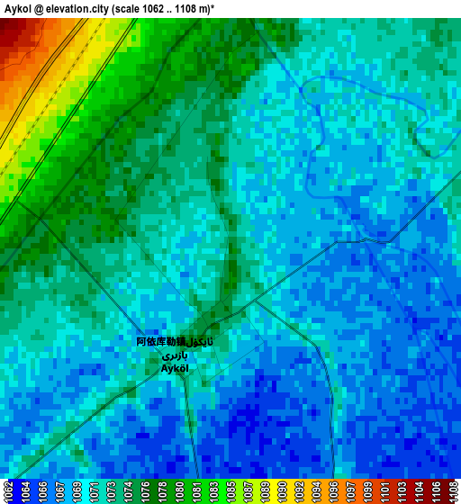
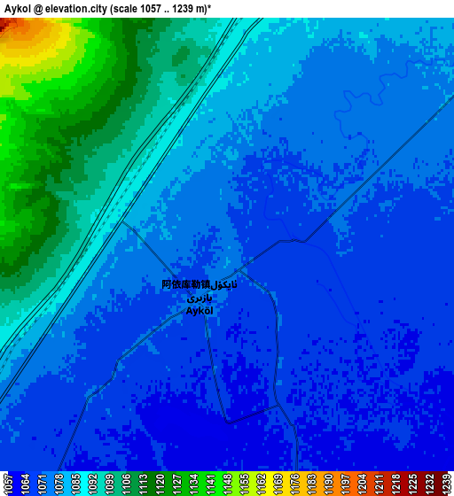
Below is the Elevation map of Aykol, which displays elevation range with different colors. Scale of the first map is from 1062 to 1108 m (3484 to 3635 ft) with average elevation of 1072 meters (=3517 ft) [note 1]
These maps also provides idea of topography and contour of this city, they are displayed at different zoom levels. More info about maps, scale and edge coordinates you can find below images.
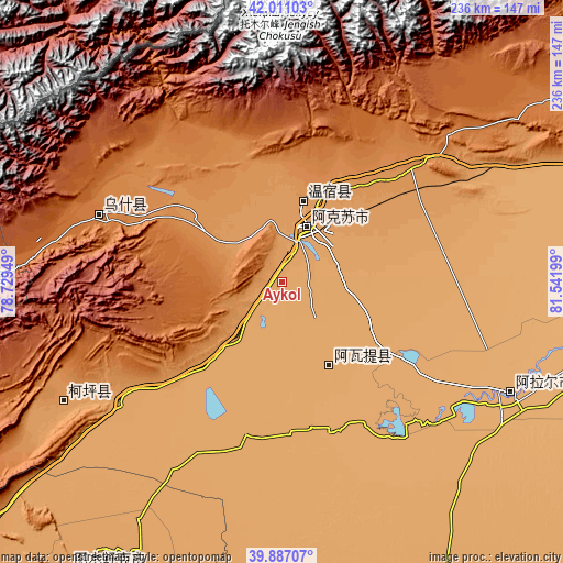
| \ | Map #1 | Map #2 | Topo.Map |
| Scale [m] | 1062..1108 m | 1057..1239 m | × |
| Scale [ft] | 3484..3635 ft | 3468..4065 ft | × |
| Average | 1072 m = 3517 ft | 1080.4 m = 3545 ft | × |
| Width | 7.38 km = 4.6 mi | 14.76 km = 9.2 mi | 236.2 km = 146.8 mi |
| Height | 7.38 km = 4.6 mi | 14.76 km = 9.2 mi | 236.2 km = 146.8 mi |
| ↑Max Latitude | 40.990769° | 41.023931° | 42.01103° |
| Latitude at center | 40.95759° | 40.95759° | 40.95759° |
| ↓Min Latitude | 40.924394° | 40.891182° | 39.88707° |
| ← Min Longitude | 80.091795° | 80.047849° | 78.72949° |
| Longitude center | 80.13574° | 80.13574° | 80.13574° |
| →Max Longitude | 80.179685° | 80.223631° | 81.54199° |
Nearby cities:
Cities around Aykol sort by population:
• Aksu elevation 1119 m
27.9 km,  25°
25°
• Aral 1014 m
105.8 km,  115°
115°
• Kuqa 1054 m
248.1 km,  70°
70°
• Xayar 983 m
225.8 km,  82°
82°
• Xinhe 1014 m
217.6 km, 72°
• Baicheng 1220 m
170.7 km,  57°
57°
• Tumxuk 1086 m
151.3 km,  216°
216°
• Akqi 1986 m
142.1 km,  269°
269°
• Kalpin 1152 m
102 km,  242°
242°
• Wushi 1619 m
79.4 km,  285°
285°
• Awat 1047 m
41 km,  149°
149°
• Wensu 1127 m
36 km,  14°
14°
Multilingual:
 En español:
Aykol elevación 1075 m.
 En France:
Aykol élévation 1075 m.


Sources and notes:
- [note 1] Map square and city borders are not equal. Map elevation data is calculated only from area inside that square.
- [src 1] Elevation data from geonames database provided with same terms of usage.
- [src 2] The elevation map of Aykol is generated using elevation data from NASA's 3 arcsec (90m) resolution SRTM data.
- [src 3] Base (background) map © OpenStreetMap contributors tiles are generated by Geofabrik and OpenTopoMap.
Copyright & License:
This Aykol Elevation Map is licensed under CC BY-SA. You may reuse any part from this page, if you give a proper credit by linking to this URL:
 More info on terms of use page.