Kuqa elevation
Kuqa (Xinjiang), China elevation is 1054 meters and Kuqa elevation in feet is 3458 ft above sea level [src 1]. Kuqa is a seat of a third-order administrative division (feature code) with elevation that is 496 meters (1627 ft) bigger than average city elevation in China.
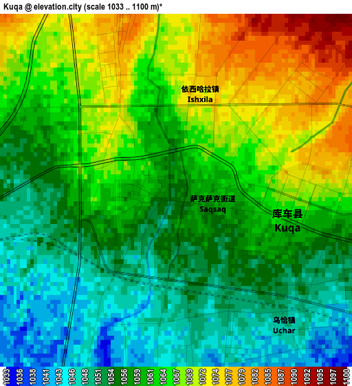
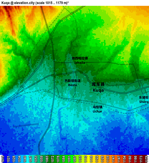
Below is the Elevation map of Kuqa, which displays elevation range with different colors. Scale of the first map is from 1033 to 1100 m (3389 to 3609 ft) with average elevation of 1060.7 meters (=3480 ft) [note 1]
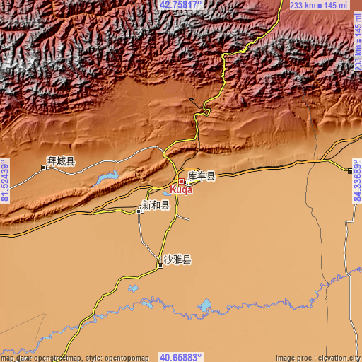
These maps also provides idea of topography and contour of this city, they are displayed at different zoom levels. More info about maps, scale and edge coordinates you can find below images.
| \ | Map #1 | Map #2 | Topo.Map |
| Scale [m] | 1033..1100 m | 1015..1179 m | × |
| Scale [ft] | 3389..3609 ft | 3330..3868 ft | × |
| Average | 1060.7 m = 3480 ft | 1066.2 m = 3498 ft | × |
| Width | 7.29 km = 4.5 mi | 14.59 km = 9.1 mi | 233.4 km = 145 mi |
| Height | 7.29 km = 4.5 mi | 14.59 km = 9.1 mi | 233.4 km = 145 mi |
| ↑Max Latitude | 41.749864° | 41.782642° | 42.75817° |
| Latitude at center | 41.71707° | 41.71707° | 41.71707° |
| ↓Min Latitude | 41.684259° | 41.651431° | 40.65883° |
| ← Min Longitude | 82.886695° | 82.842749° | 81.52439° |
| Longitude center | 82.93064° | 82.93064° | 82.93064° |
| →Max Longitude | 82.974585° | 83.018531° | 84.33689° |
Nearby cities:
Cities around Kuqa sort by population:
• Aksu elevation 1119 m
228.8 km,  254°
254°
• Xinyuan 953 m
191.9 km,  7°
7°
• Aral 1014 m
191.1 km,  226°
226°
• Nilka 1091 m
233.1 km,  351°
351°
• Wensu 1127 m
229.4 km,  257°
257°
• Zhaosu 1797 m
218.2 km,  315°
315°
• Tokkuztara 788 m
204.8 km,  341°
341°
• Tekes 1204 m
189.2 km,  331°
331°
• Luntai 972 m
109.2 km,  86°
86°
• Baicheng 1220 m
88.3 km,  274°
274°
• Xayar 983 m
55.1 km,  190°
190°
• Xinhe 1014 m
32 km, 234°
Multilingual:
 En español:
Kuqa elevación 1054 m.
 En France:
Koutcha élévation 1054 m.


Sources and notes:
- [note 1] Map square and city borders are not equal. Map elevation data is calculated only from area inside that square.
- [src 1] Elevation data from geonames database provided with same terms of usage.
- [src 2] The elevation map of Kuqa is generated using elevation data from NASA's 3 arcsec (90m) resolution SRTM data.
- [src 3] Base (background) map © OpenStreetMap contributors tiles are generated by Geofabrik and OpenTopoMap.
Copyright & License:
This Kuqa Elevation Map is licensed under CC BY-SA. You may reuse any part from this page, if you give a proper credit by linking to this URL:
 More info on terms of use page.