Qapqal elevation
Qapqal (Xinjiang, Ili Kazak Zizhizhou), China elevation is 638 meters and Qapqal elevation in feet is 2093 ft above sea level [src 1]. Qapqal is a seat of a third-order administrative division (feature code) with elevation that is 80 meters (262 ft) bigger than average city elevation in China.
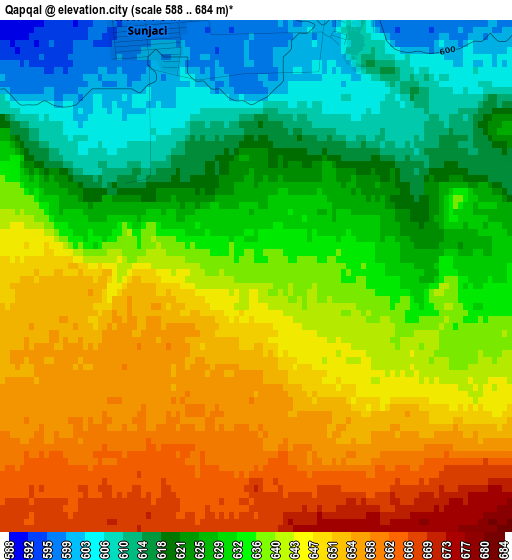
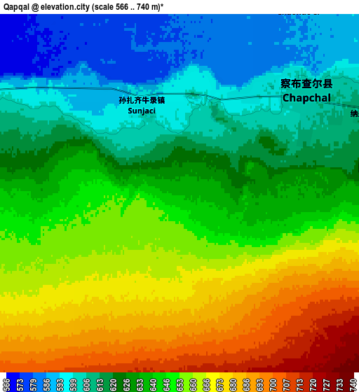
Below is the Elevation map of Qapqal, which displays elevation range with different colors. Scale of the first map is from 588 to 684 m (1929 to 2244 ft) with average elevation of 635.5 meters (=2085 ft) [note 1]
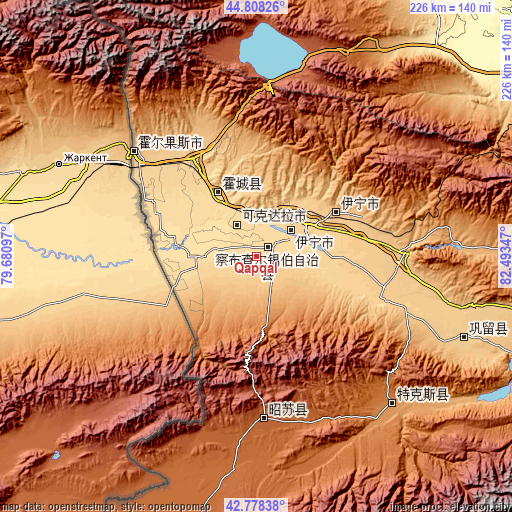
These maps also provides idea of topography and contour of this city, they are displayed at different zoom levels. More info about maps, scale and edge coordinates you can find below images.
| \ | Map #1 | Map #2 | Topo.Map |
| Scale [m] | 588..684 m | 566..740 m | × |
| Scale [ft] | 1929..2244 ft | 1857..2428 ft | × |
| Average | 635.5 m = 2085 ft | 638.3 m = 2094 ft | × |
| Width | 7.05 km = 4.4 mi | 14.11 km = 8.8 mi | 225.7 km = 140.2 mi |
| Height | 7.05 km = 4.4 mi | 14.11 km = 8.8 mi | 225.7 km = 140.2 mi |
| ↑Max Latitude | 43.833649° | 43.86534° | 44.80826° |
| Latitude at center | 43.80194° | 43.80194° | 43.80194° |
| ↓Min Latitude | 43.770215° | 43.738472° | 42.77838° |
| ← Min Longitude | 81.043275° | 80.999329° | 79.68097° |
| Longitude center | 81.08722° | 81.08722° | 81.08722° |
| →Max Longitude | 81.131165° | 81.175111° | 82.49347° |
Nearby cities:
Cities around Qapqal sort by population:
• Huocheng elevation 639 m
32.8 km,  328°
328°
• Xinyuan 953 m
179 km,  103°
103°
• Kuqa 1054 m
276.4 km,  147°
147°
• Xinhe 1014 m
279.8 km, 153°
• Baicheng 1220 m
234.3 km,  164°
164°
• Nilka 1091 m
113.1 km,  90°
90°
• Tokkuztara 788 m
93.2 km,  113°
113°
• Tekes 1204 m
89 km,  136°
136°
• Zhaosu 1797 m
75.5 km,  180°
180°
• Yining 792 m
39.7 km,  60°
60°
• Yili 645 m
23.7 km, 62°
• Ailan Mubage 643 m
23 km, 58°
Multilingual:
 En español:
Qapqal elevación 638 m.
 En France:
Qapqal élévation 638 m.


Sources and notes:
- [note 1] Map square and city borders are not equal. Map elevation data is calculated only from area inside that square.
- [src 1] Elevation data from geonames database provided with same terms of usage.
- [src 2] The elevation map of Qapqal is generated using elevation data from NASA's 3 arcsec (90m) resolution SRTM data.
- [src 3] Base (background) map © OpenStreetMap contributors tiles are generated by Geofabrik and OpenTopoMap.
Copyright & License:
This Qapqal Elevation Map is licensed under CC BY-SA. You may reuse any part from this page, if you give a proper credit by linking to this URL:
 More info on terms of use page.