Jianshelu elevation
Jianshelu (Henan), China elevation is 119 meters and Jianshelu elevation in feet is 390 ft above sea level [src 1]. Jianshelu is a seat of a third-order administrative division (feature code) with elevation that is 439 meters (1440 ft) smaller than average city elevation in China.
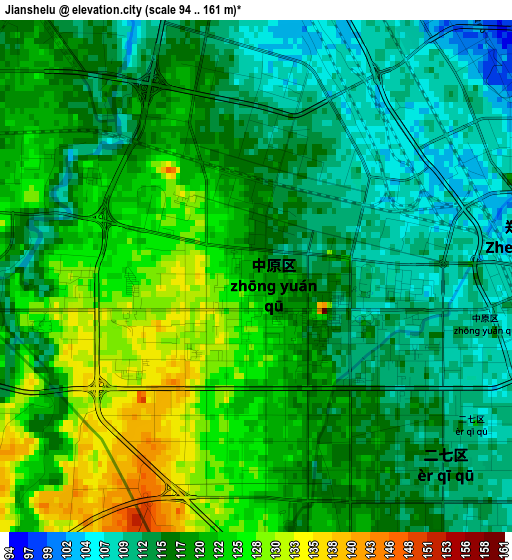
Below is the Elevation map of Jianshelu, which displays elevation range with different colors. Scale of the first map is from 94 to 161 m (308 to 528 ft) with average elevation of 118 meters (=387 ft) [note 1]
These maps also provides idea of topography and contour of this city, they are displayed at different zoom levels. More info about maps, scale and edge coordinates you can find below images.
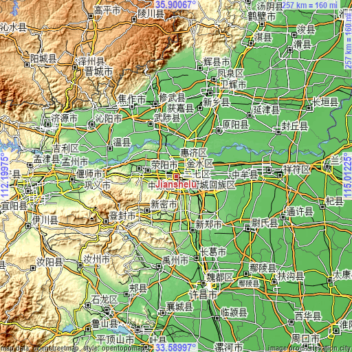
| \ | Map #1 | Topo.Map |
| Scale [m] | 94..161 m | × |
| Scale [ft] | 308..528 ft | × |
| Average | 118 m = 387 ft | × |
| Width | 8.03 km = 5 mi | 256.9 km = 159.6 mi |
| Height | 8.03 km = 5 mi | 256.9 km = 159.6 mi |
| ↑Max Latitude | 34.789498° | 35.90067° |
| Latitude at center | 34.7534° | 34.7534° |
| ↓Min Latitude | 34.717286° | 33.58997° |
| ← Min Longitude | 113.562055° | 112.19975° |
| Longitude center | 113.606° | 113.606° |
| →Max Longitude | 113.649945° | 115.01225° |
Nearby cities:
Cities around Jianshelu sort by population:
• Zhengzhou elevation 104 m
3.9 km,  82°
82°
• Xinxiang 82 m
51.7 km,  20°
20°
• Xiuwu Chengguanzhen 87 m
55.3 km,  343°
343°
• Wenquan 112 m
52.6 km,  292°
292°
• Yuanyang Chengguanzhen 80 m
46.6 km,  44°
44°
• Mucheng 96 m
42.8 km,  332°
332°
• Xinhualu 117 m
41.2 km,  164°
164°
• Zhongmu Chengguanzhen 79 m
33.2 km,  98°
98°
• Qingping 305 m
32 km,  221°
221°
• Jiyuanlu 149 m
31.9 km,  283°
283°
• Suohe 152 m
23 km, 279°
• Huaihelu 112 m
5.2 km,  141°
141°
Multilingual:
 En español:
Jianshelu elevación 119 m.
 En France:
Jianshelu élévation 119 m.
 Auf Deutsch:
Jianshelu höhe über dem Meeresspiegel ist 119 m.

Sources and notes:
- [note 1] Map square and city borders are not equal. Map elevation data is calculated only from area inside that square.
- [src 1] Elevation data from geonames database provided with same terms of usage.
- [src 2] The elevation map of Jianshelu is generated using elevation data from NASA's 3 arcsec (90m) resolution SRTM data.
- [src 3] Base (background) map © OpenStreetMap contributors tiles are generated by Geofabrik and OpenTopoMap.
Copyright & License:
This Jianshelu Elevation Map is licensed under CC BY-SA. You may reuse any part from this page, if you give a proper credit by linking to this URL:
 More info on terms of use page.