Panshi elevation
Panshi (Jilin), China elevation is 323 meters and Panshi elevation in feet is 1060 ft above sea level [src 1]. Panshi is a populated place (feature code) with elevation that is 235 meters (771 ft) smaller than average city elevation in China.
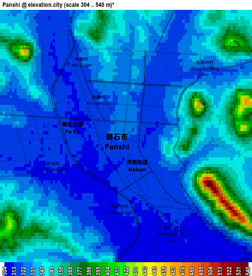
Below is the Elevation map of Panshi, which displays elevation range with different colors. Scale of the first map is from 304 to 540 m (997 to 1772 ft) with average elevation of 334.3 meters (=1097 ft) [note 1]
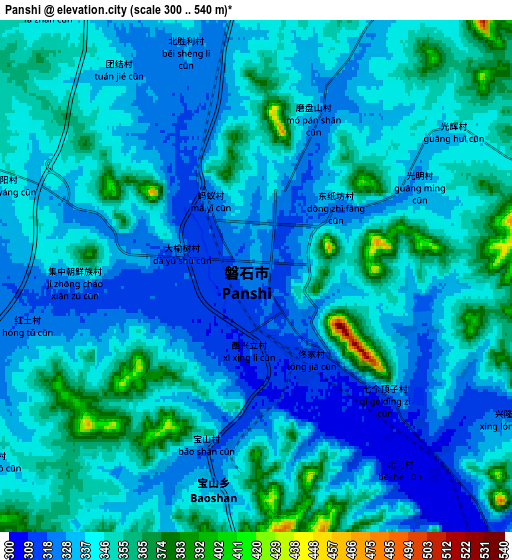
These maps also provides idea of topography and contour of this city, they are displayed at different zoom levels. More info about maps, scale and edge coordinates you can find below images.
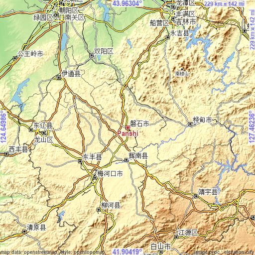
| \ | Map #1 | Map #2 | Topo.Map |
| Scale [m] | 304..540 m | 300..540 m | × |
| Scale [ft] | 997..1772 ft | 984..1772 ft | × |
| Average | 334.3 m = 1097 ft | 340.5 m = 1117 ft | × |
| Width | 7.15 km = 4.4 mi | 14.31 km = 8.9 mi | 228.9 km = 142.2 mi |
| Height | 7.15 km = 4.4 mi | 14.31 km = 8.9 mi | 228.9 km = 142.2 mi |
| ↑Max Latitude | 42.974381° | 43.006526° | 43.96304° |
| Latitude at center | 42.94222° | 42.94222° | 42.94222° |
| ↓Min Latitude | 42.910042° | 42.877847° | 41.90419° |
| ← Min Longitude | 126.012165° | 125.968219° | 124.64986° |
| Longitude center | 126.05611° | 126.05611° | 126.05611° |
| →Max Longitude | 126.100055° | 126.144001° | 127.46236° |
Nearby cities:
Cities around Panshi sort by population:
• Liaoyuan elevation 263 m
75.1 km,  266°
266°
• Huadian 268 m
56.3 km,  87°
87°
• Meihekou 329 m
55.6 km,  213°
213°
• Chaoyang 297 m
31.2 km,  184°
184°
• Dongfeng 350 m
55.7 km,  232°
232°
• Liuhe 399 m
82.9 km,  199°
199°
• Huinan 315 m
39.3 km,  154°
154°
• Shuangyang 210 m
71.7 km,  334°
334°
• Yantongshan 250 m
39.1 km,  354°
354°
• Jingyu 549 m
87.9 km,  136°
136°
• Kouqian 240 m
84 km,  22°
22°
• Yitong 249 m
74.9 km,  304°
304°
Multilingual:
 En español:
Panshi elevación 323 m.
 En France:
Panshi élévation 323 m.


Sources and notes:
- [note 1] Map square and city borders are not equal. Map elevation data is calculated only from area inside that square.
- [src 1] Elevation data from geonames database provided with same terms of usage.
- [src 2] The elevation map of Panshi is generated using elevation data from NASA's 3 arcsec (90m) resolution SRTM data.
- [src 3] Base (background) map © OpenStreetMap contributors tiles are generated by Geofabrik and OpenTopoMap.
Copyright & License:
This Panshi Elevation Map is licensed under CC BY-SA. You may reuse any part from this page, if you give a proper credit by linking to this URL:
 More info on terms of use page.