Anren Chengguanzhen elevation
Anren Chengguanzhen (Hunan), China elevation is 110 meters and Anren Chengguanzhen elevation in feet is 361 ft above sea level [src 1]. Anren Chengguanzhen is a seat of a third-order administrative division (feature code) with elevation that is 448 meters (1470 ft) smaller than average city elevation in China.
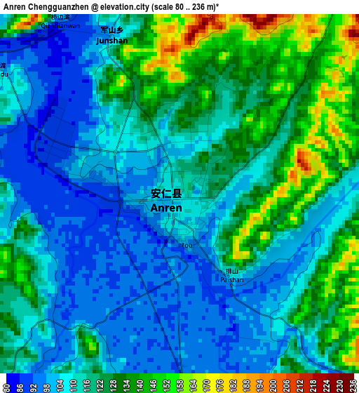
Below is the Elevation map of Anren Chengguanzhen, which displays elevation range with different colors. Scale of the first map is from 80 to 236 m (262 to 774 ft) with average elevation of 116.8 meters (=383 ft) [note 1]
These maps also provides idea of topography and contour of this city, they are displayed at different zoom levels. More info about maps, scale and edge coordinates you can find below images.
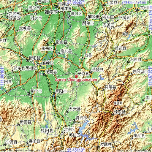
| \ | Map #1 | Topo.Map |
| Scale [m] | 80..236 m | × |
| Scale [ft] | 262..774 ft | × |
| Average | 116.8 m = 383 ft | × |
| Width | 8.73 km = 5.4 mi | 279.3 km = 173.5 mi |
| Height | 8.73 km = 5.4 mi | 279.3 km = 173.5 mi |
| ↑Max Latitude | 26.753378° | 27.96327° |
| Latitude at center | 26.71413° | 26.71413° |
| ↓Min Latitude | 26.674869° | 25.45113° |
| ← Min Longitude | 113.223315° | 111.86101° |
| Longitude center | 113.26726° | 113.26726° |
| →Max Longitude | 113.311205° | 114.67351° |
Nearby cities:
Cities around Anren Chengguanzhen sort by population:
• Hengyang elevation 66 m
67.2 km,  286°
286°
• Leiyang 69 m
53.4 km,  229°
229°
• Xidu 67 m
93.2 km, 286°
• Qinting 170 m
81.5 km,  56°
56°
• Tangdong 131 m
79.2 km,  180°
180°
• Kaiyun 55 m
68.9 km,  323°
323°
• Yongxing Chengguanzhen 127 m
67 km,  191°
191°
• Yunji 79 m
59.6 km,  267°
267°
• Xiayang 217 m
55.7 km,  116°
116°
• Hengdong Chengguanzhen 68 m
51.7 km, 322°
• Youxian Chengguanzhen 84 m
32.2 km,  16°
16°
• Chaling Chengguanzhen 133 m
28.4 km,  72°
72°
Multilingual:
 En español:
Anren Chengguanzhen elevación 110 m.
 En France:
Anren Chengguanzhen élévation 110 m.
 Auf Deutsch:
Anren Chengguanzhen höhe über dem Meeresspiegel ist 110 m.
 На русском:
Anren Chengguanzhen высота над уровнем моря 110 м
Sources and notes:
- [note 1] Map square and city borders are not equal. Map elevation data is calculated only from area inside that square.
- [src 1] Elevation data from geonames database provided with same terms of usage.
- [src 2] The elevation map of Anren Chengguanzhen is generated using elevation data from NASA's 3 arcsec (90m) resolution SRTM data.
- [src 3] Base (background) map © OpenStreetMap contributors tiles are generated by Geofabrik and OpenTopoMap.
Copyright & License:
This Anren Chengguanzhen Elevation Map is licensed under CC BY-SA. You may reuse any part from this page, if you give a proper credit by linking to this URL:
 More info on terms of use page.